Potoče - Novi grad (Pusti grad)
Starting point: Potoče (520 m)
| Latitude/Longitude: | 46,30580°N 14,43200°E |
| |
Walking time: 25 min
Difficulty: easy marked way
Elevation gain: 110 m
Elevation difference along the route: 125 m
Map: Karavanke - osrednji del 1:50.000
Recommended equipment (summer):
Recommended equipment (winter):
Views: 1.957
 | 2 people like this post |
Access to starting point:
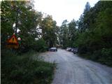
A) From highway Ljubljana - Jesenice we go to the exit Kranj - east, and then we continue driving in the direction of Jezersko. When we get to Preddvor we leave the main road and we continue driving left, and after some 10 meters, opposite the company Jelovica we continue right in the direction of village Potoče, St. Jakob and Potoška gora and lake Črnava. Further, the road leads through the settlement Hrib, above which we get to a crossroad, where we continue straight (left Hotel Bor and lake Črnava, right Senior Citizens' Home Preddvor). Next follows a good 100 meters of a light ascent to the chapel, where the road turns right, and we are driving there past a few more houses, and then before Senior Citizens' Home we turn left on a larger macadam parking lot.
B) From highway Jesenice - Ljubljana we go to the exit Kranj - west and at the first crossroad, we continue left. Further, we drive through the underpass below the highway, and then we get to a roundabout, from where we continue driving in the direction of Golnik. The path ahead leads us through the settlement Mlaka pri Kranju, and at the end of the settlement, we continue right in the direction of the settlement Srakovlje. Next follows driving through Srakovlje, Spodnja Bela, Srednja Bela to Zgornja Bela, where we continue right towards Preddvor. At the end of Preddvor, only some 10 meters before the road joins main road Zgornje Jezersko - Kranj, we continue left in the direction of village Potoče, St. Jakob and Potoška gora and lake Črnava. Further, the road leads through the settlement Hrib, above which we get to a crossroad, where we continue straight (left Hotel Bor and lake Črnava, right Senior Citizens' Home Preddvor). Next follows a good 100 meters of a light ascent to the chapel, where the road turns right, and we are driving there past a few more houses, and then before Senior Citizens' Home we turn left on a larger macadam parking lot.
Route description:
A few steps before the beginning of the parking lot, by the fence of Senior Citizens' Home Preddvor, we will notice hiking signposts, and we go on the path in the direction of Senčnica Josipine Turnograjske. The path starts by the already mentioned fence, and then continues through the forest. Through the forest, we ascend relatively steeply for a few minutes, and then the path flattens and brings us to Senčnica Josipine Turnograjske, where there is also a registration box with a registration book.
From the top follows a short descent on a forest path, and then we reach the forest road which we follow to the left, and there we lightly descend for a short time. We soon reach the other wider road (road which leads from the parking lot near Senior Citizens' Home Preddvor and which bypasses Senčnica Josipine Turnograjske), which we cross slightly towards the left, where by the entrance into the forest, we notice red hiking signposts (also possible via the previously mentioned road to here).
We continue in the direction of ruins of Novi grad (Pusti grad) and footpath towards sv. Jakob and Potoška gora. The path ahead moderately ascends through a forested valley, and then splits into two parts.
We choose the left path, named Juhantova pot, which leads towards sv. Jakob (slightly right the usual marked path towards sv. Jakob, Potoška gora, Javorov vrh...), which already after a minute or two again splits.
In direction straight continues marked, but further unmarked path towards sv. Jakob, and we continue left on still marked path in the direction of Novi grad. Next follows a short ascent and we reach a smaller saddle, where we continue left on a wider mountain path. Forest path then ascends diagonally and gradually turns to the right. A little further, the path turns even more to the right and brings us to the ruins of Novi grad.
From the top, we can descend on a marked circular path, which returns to the above described path at a smaller saddle right below the summit.

Photos:
 1
1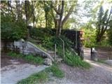 2
2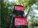 3
3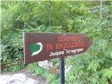 4
4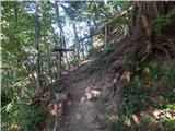 5
5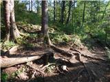 6
6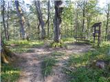 7
7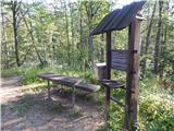 8
8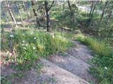 9
9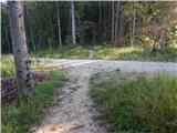 10
10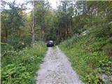 11
11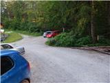 12
12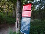 13
13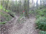 14
14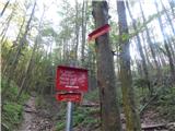 15
15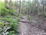 16
16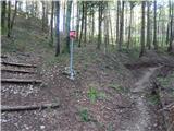 17
17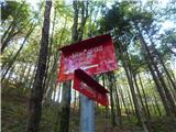 18
18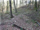 19
19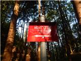 20
20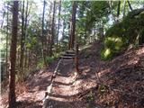 21
21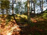 22
22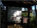 23
23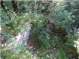 24
24 25
25
Discussion about the trip Potoče - Novi grad (Pusti grad)
To post a comment you must log in:
If you do not yet have a username, you must first
register.