Starting point: Povir (399 m)
| Latitude/Longitude: | 45,70100°N 13,93530°E |
| |
Walking time: 35 min
Difficulty: easy unmarked way
Elevation gain: 111 m
Elevation difference along the route: 115 m
Map: Primorje in Kras 1:50.000
Recommended equipment (summer):
Recommended equipment (winter):
Views: 2.730
 | 6 people like this post |
Access to starting point:
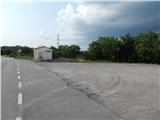
A) We leave the Primorska highway at the Divača exit, and then we follow the signs for Divača and Sežana. When we get to the settlement Povir, before the crossroad where a road branches off to the right towards the settlement Brestovica pri Povirju, we turn right onto a macadam parking lot, which is situated by the bus stop.
B) We drive to Sežana, and then we continue driving on the old road towards Divača. When we get to the settlement Povir, after the crossroad where a road branches off to the left towards the settlement Brestovica pri Povirju, we turn left onto a macadam parking lot, which is situated by the bus stop.
Route description:
From the starting point, we walk to a crossroad, then we go left into the village Povir. We continue walking among houses, at crossroads we first go straight, then we follow the signs for Gostilna pri Hribu Povir. After crossing the railway track Sežana - Divača we go right (left the mentioned inn and the marked path to Stari tabor) and then we also walk past the railway station Povir. We quickly arrive at a larger chapel, past which we go left onto a poor road, from the poor road before its end we go left onto a cart track. The cart track first ascends gently through sparse shrubbery, then passes into the forest and becomes slightly steeper. There follows some diagonal ascent to the right, then we reach a road junction.
We cross the road to the right and continue in the direction of Gura. The path ahead leads us along a wide cart track, from which a forest path branches off slightly to the left, along which we continue (we arrive at the summit even if we continue along the wide cart track). There follow a few minutes of moderate ascent, then the path turns right and quickly brings us to Gura, where there stands the church of the Assumption of Mary.
We descend along the same path or along the cart track mentioned in the description.
Description and pictures refer to the condition in 2018 (July).

Photos:
 1
1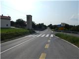 2
2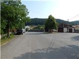 3
3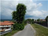 4
4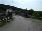 5
5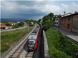 6
6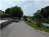 7
7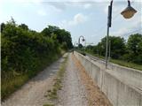 8
8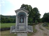 9
9 10
10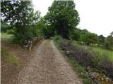 11
11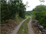 12
12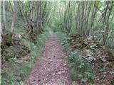 13
13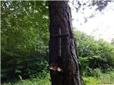 14
14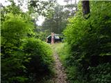 15
15 16
16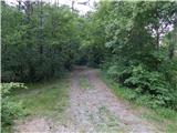 17
17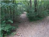 18
18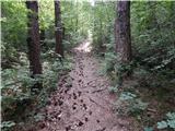 19
19 20
20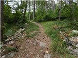 21
21 22
22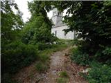 23
23 24
24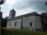 25
25 26
26
Discussion about the trip Povir - Gura
|
| Lisica27. 04. 2020 |
Today I walked it, wonderful path. From the chapel, there's now a Way of the Cross carved into the rocks. When you reach the junction take the second path to the right ahead to the church on top.
Back I went below on the asphalt which runs parallel to the one I came on directly to the village.
There right before the wall to the right on the path past the horses and to the path to Stari tabor.
|
|
|
To post a comment you must log in:
If you do not yet have a username, you must first
register.