Starting point: Povlje (710 m)
| Latitude/Longitude: | 46,32960°N 14,37680°E |
| |
Walking time: 2 h 5 min
Difficulty: easy unmarked way
Elevation gain: 769 m
Elevation difference along the route: 775 m
Map: Karavanke - osrednji del 1:50.000
Recommended equipment (summer):
Recommended equipment (winter): ice axe, crampons
Views: 3.832
 | 1 person like this post |
Access to starting point:
a) From the Ljubljana - Jesenice motorway, take the Brnik exit, then when reaching the Mengeš - Kranj road, continue left towards Kranj. Drive along the main road towards Kranj to the first roundabout, from where take the first right exit towards Šenčur. Continue through Šenčur on the main road, then when reaching the Kranj - Zgornje Jezersko road, turn right towards Jezersko. When arriving in Preddvor, leave the main road and continue left towards the centre of the mentioned town, from there follow the signs to the Bašelj settlement. Just after the Bašelj settlement, the road descends to the Milka stream and crosses it over a bridge. Here, a road first branches right to the villages Babni, Vrt, and about 100 m further to the village Povlje. Continue on the ascending road towards Povlje, and park on a small parking lot above the village. At the starting point, there is a small intersection, several hiking signposts, and a large information board for the Trstenik educational trail "path under Storžič".
b) From the Jesenice - Ljubljana motorway, take the Kranj west exit, then continue driving towards Golnik. When arriving in Tenetiše, leave the main road towards Golnik and continue right towards Trstenik. Approximately 1 km after the Trstenik settlement, arrive at a small intersection, where continue left towards the village Povlje. Continue on the ascending road towards Povlje, and park on a small parking lot above the village. At the starting point, there is a small intersection, several hiking signposts, and a large information board for the Trstenik educational trail "path under Storžič".
Route description:
From the parking lot, head onto the left road towards Velika and Mala Poljana (the path between the two roads leads to Planina Javornik, also Dolenčeva pot to Velika Poljana). The road soon turns left, leading past a water tank and a quarry. A bit further, the road turns into a cart track, which temporarily ascends more steeply. Just after the cart track levels out and turns right into the forest, a marked footpath branches off even further right from it, on which we continue the ascent. For a short time, we continue ascending along the torrent, then the path turns left and ascends transversely, in the last part over a somewhat collapsed gully. At the top of the gully, we step onto a kind of ridge between two streams, where the path from the villages Goriče and Zalog joins us from the left. A short ascent follows along the scenic ridge, then we arrive at a marked junction, from where we continue right towards Velika Poljana (slightly left Mala Poljana and Tolsti vrh).
The path ahead leads past a viewpoint, where there used to be a small bench, but today only a stand remains. After enjoying the views over Gorenjska, we return to the path, which enters the forest, through which it occasionally ascends quite steeply. The path continues ascending the slope for a few minutes, then returns to the forested ridge, where Andrejeva bench stands. Here the path temporarily levels out, then becomes steeper again. A bit further, the path turns right and ascends along a moderately steep ridge to the point where we join the Dolenčeva pot and the cart track path.
We continue along the initially gentle cart track, which leads past the "second refreshment point". After the refreshment point, the cart track continues straight ahead, but we continue slightly right from the cart track onto a parallel path that ascends a bit above the cart track. Higher up, we cross the cart track and some kind of pasture fence, then gradually move from the forest onto grassy slopes. A little further, we step back onto the cart track, and ahead we can already see the hut on Velika Poljana, separated from us by only a short, increasingly scenic ascent.
From the shepherd's hut, continue transversely to the left (straight to Dom pod Storžičem, Mala Poljana and Storžič, sharply right to Planina Javornik), where in less than 5 minutes we arrive at the Koča na Grebencu, from which a nice view opens further to the west to southwest.
Behind the hut, a poorer path branches slightly to the right, which crosses the fence and leads further towards the summit of Grebenc. The path ahead is not well trodden, but it can be followed relatively easily, as most of the time it runs along or beside the scenic ridge. Higher up, the path crosses some belts of forest, all the time sticking to the main ridge, avoiding difficult spots mostly on the right side. During the ascent, the path ascends quite steeply several times, occasionally crossing slippery exposed slopes, but in dry conditions the path does not pose a major danger, as we can always detour the difficult parts to the right into the forest and then return to the ridge. After about 15 minutes of ascent from the Koča na Grebencu, we reach a fairly scenic summit.
Starting point - Gmajna 0:25, Gmajna - second refreshment point 0:50, second refreshment point - Velika Poljana 0:30, Velika Poljana - Grebenc 0:20.
Description and photos refer to the condition in 2015 (January).

Along the route: Gmajna (840m), Andrejeva klopca (977m), Druga okrepčevalnica (1198m),
Velika Poljana (1385m), Koča na Grebencu (1401m)
Photos:
 1
1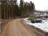 2
2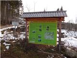 3
3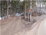 4
4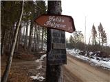 5
5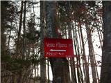 6
6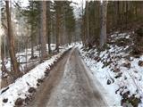 7
7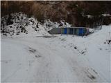 8
8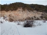 9
9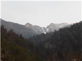 10
10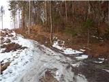 11
11 12
12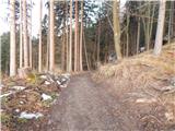 13
13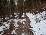 14
14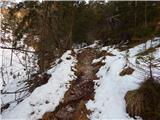 15
15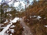 16
16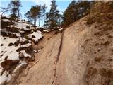 17
17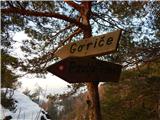 18
18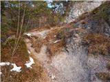 19
19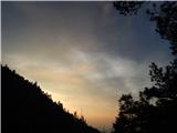 20
20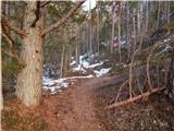 21
21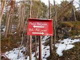 22
22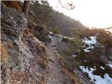 23
23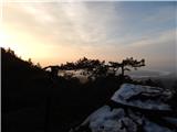 24
24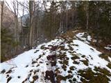 25
25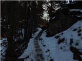 26
26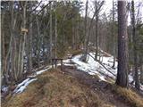 27
27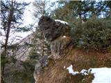 28
28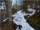 29
29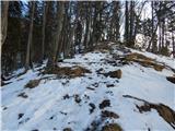 30
30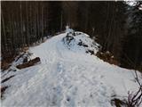 31
31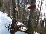 32
32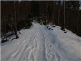 33
33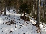 34
34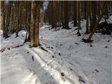 35
35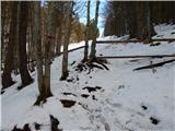 36
36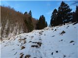 37
37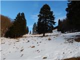 38
38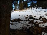 39
39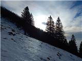 40
40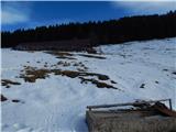 41
41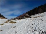 42
42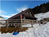 43
43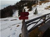 44
44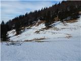 45
45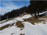 46
46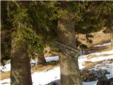 47
47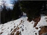 48
48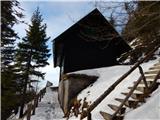 49
49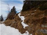 50
50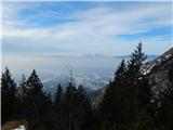 51
51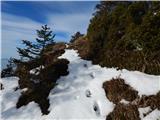 52
52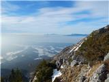 53
53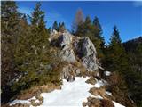 54
54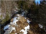 55
55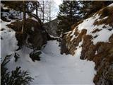 56
56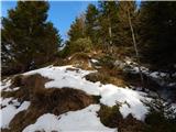 57
57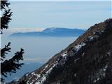 58
58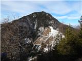 59
59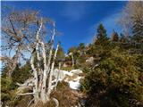 60
60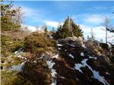 61
61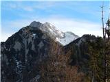 62
62 63
63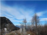 64
64 65
65
Discussion about the trip Povlje - Grebenc
|
| ločanka9. 04. 2024 07:29:50 |
Wonderful peak, visited yesterday, but observed for many years. Situated between Tolsti vrh and Storžič, characteristic small triangle in between, well visible from Kranj area and from afar. Many years ago, a geography teacher presented it with the name Srna. I don't know if there's any truth to that. Worth a visit in any case!
|
|
|
To post a comment you must log in:
If you do not yet have a username, you must first
register.