Praproče - Polhograjska Gora (Sveti Lovrenc) (gentle path)
Starting point: Praproče (549 m)
| Latitude/Longitude: | 46,06140°N 14,29230°E |
| |
Route name: gentle path
Walking time: 50 min
Difficulty: easy marked way
Elevation gain: 275 m
Elevation difference along the route: 280 m
Map: Ljubljana - okolica 1:50.000
Recommended equipment (summer):
Recommended equipment (winter):
Views: 18.596
 | 3 people like this post |
Access to starting point:
First, we drive to Polhov Gradec (to here from Horjul or Dobrova), and then we continue driving towards Gorenja vas. In the village Briše we continue right in the direction of Praproče and we continue driving on a narrower and relatively steep road. Soon after the chapel, which we notice on the left side of the road, we will get to a bigger hayrack by which we notice mountain signposts for Polhograjska Gora. At the starting point, there are no arranged parking spots.
Route description:
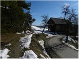
On and by the hayrack, we notice signs for Gora, which point us to the right on a wide and at first moderately steep cart track. The cart track or worse road soon entirely flattens and brings us to a smaller crossroads, where we continue right in the direction of Sveti Lovrenc. The cart track then narrows a little more and then brings us to grassy slopes, where it gradually starts turning more and more to the right. After a short ascent, we step into the forest, where we join the path from a slightly lower starting point. We continue straight on the marked path - cart track, which a little higher joins the forest road.
We continue in the direction of Sveti Lovrenc (left downwards Praproče on the road, left upwards Sveti Lovrenc "demanding path") on the road, across which there is a gate. The road then starts to ascend more steeply and after a few minutes of further walking brings us to a larger rocky section (mainly after rain or at the end of winter there is a danger of falling rocks). Here the road flattens for a short time, then passes into the forest, where it starts to ascend steeply. The steepness eases at Logar, where the road also ends. Here a beautiful view opens up towards part of the Karawanks, and we continue slightly left and continue the ascent past the chapel on the path that goes into the forest. There follows a moderate ascent through the forest and the path brings us to the ridge, from which a nice view opens up towards the west. Here we continue left and after a few steps of further walking we step onto the summit of Polhograjska Gora.

Photos:
 1
1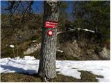 2
2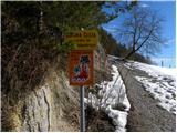 3
3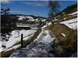 4
4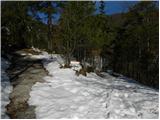 5
5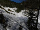 6
6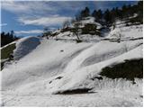 7
7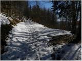 8
8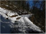 9
9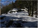 10
10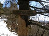 11
11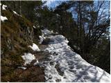 12
12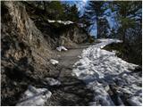 13
13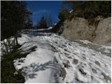 14
14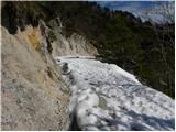 15
15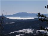 16
16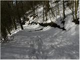 17
17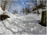 18
18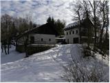 19
19 20
20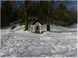 21
21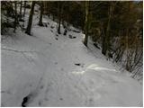 22
22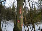 23
23 24
24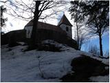 25
25 26
26 27
27
Discussion about the trip Praproče - Polhograjska Gora (Sveti Lovrenc) (gentle path)
|
| Gost3. 12. 2007 |
MT-I recommend a trip to P. Gora (Lovrenc) from P. Grad past the beekeeping home and the monument to the Saxon king along the excellently marked trail. Elevation gain ca. +400m, walking time ca. 1h. Beautiful views from the top towards Lj.
|
|
|
|
| BananaBronson24. 01. 2018 |
We visited Polhograjska Gora as a family, via the shortest possible variant. The trail is entirely snow-free.
|
|
|
To post a comment you must log in:
If you do not yet have a username, you must first
register.