Praproče - Polhograjska Gora (Sveti Lovrenc) (steep path)
Starting point: Praproče (549 m)
| Latitude/Longitude: | 46,06140°N 14,29230°E |
| |
Route name: steep path
Walking time: 45 min
Difficulty: partly demanding marked way
Elevation gain: 275 m
Elevation difference along the route: 280 m
Map: Ljubljana - okolica 1:50.000
Recommended equipment (summer):
Recommended equipment (winter): ice axe, crampons
Views: 9.124
 | 3 people like this post |
Access to starting point:
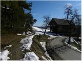
First, we drive to Polhov Gradec (to here from Horjul or Dobrova), and then we continue driving towards Gorenja vas. In the village Briše we continue right in the direction of Praproče and we continue driving on a narrower and relatively steep road. Soon after the chapel, which we notice on the left side of the road, we will get to a bigger hayrack by which we notice mountain signposts for Polhograjska Gora. At the starting point, there are no arranged parking spots.
Route description:
At and by the hayrack, we notice signs for Gora, which point us to the right on a wide and at first moderately steep cart track. The cart track or a worse road soon entirely flattens and brings us to a smaller crossroad, where we continue right in the direction of Sveti Lovrenc. The cart track then narrows a little more and then brings us to grassy slopes, where it gradually starts turning more and more to the right. After a short ascent, we step into the forest, where we join the path from a little lower starting point. We continue straight on the marked path - cart track, which a little higher joins the forest road.
We continue left in the direction of the demanding path (left downwards Praproče on the road, straight Sveti Lovrenc easier approach) and we continue the ascent on an increasingly steep path. The path, which mostly runs through a pine forest, higher ascends even more steeply and crosses a short exposed slope (mainly when wet, great risk of slipping). Higher, the path slightly flattens and passes onto the ridge of Polhograjska Gora. Further ahead the path passes out of the forest and after a shorter further ascent brings us to the wall of the church of St. Lovrenc. Here with the help of a few footholds and holds, we climb over the mentioned wall and step onto the panoramic peak.

Photos:
 1
1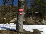 2
2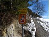 3
3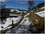 4
4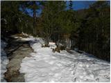 5
5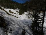 6
6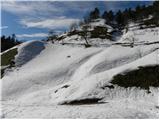 7
7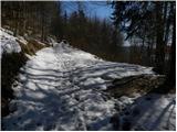 8
8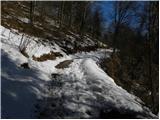 9
9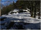 10
10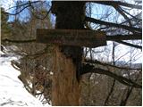 11
11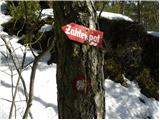 12
12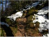 13
13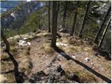 14
14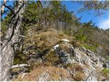 15
15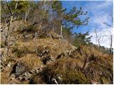 16
16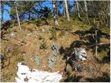 17
17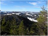 18
18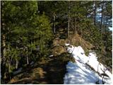 19
19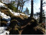 20
20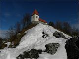 21
21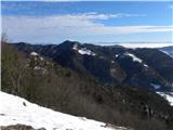 22
22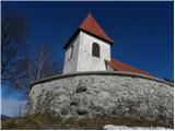 23
23 24
24
Discussion about the trip Praproče - Polhograjska Gora (Sveti Lovrenc) (steep path)
|
| VanSims12. 05. 2012 |
From the main road (about 4 km after Polhov Gradec) turn LEFT then continue on the steep and narrow path past the chapel.
|
|
|
|
| ljubitelj gora13. 05. 2012 |
When driving towards Praproče you will see a signpost at one bend before the village there is space to park because in the village it is almost impossible to park.
|
|
|
|
| VanSims13. 05. 2012 |
@LG: and then we reach that junction (where the 'demanding' path branches off) via that path which in the description is 'left downhill Praproče by road'? In this case the essential part of the path is not damaged.
Otherwise the path barely deserves the label 'partly-demanding'. You just need to be careful there at the exposed spot or push the rock a couple of times that's all. The path is certainly easier than e.g. Westrova on Šmarna gora which is also labeled as 'partly-demanding' on these pages
|
|
|
|
| Holcar223. 03. 2013 |
Today to Lovrenc via the "partly difficult" path. No views due to the weather today, nor many hikers or snow. The latter is mostly on the northern slopes, up to 10 cm, but new snow will fall tomorrow. The path is not for the vertiginous, but it's a convenient workout and training for more demanding paths, right near the capital. There were some kids on this path today, almost toddlers, which I think is unwise of the parents. Anyway, the path is shorter in time and more interesting than the one on the macadam road, and I recommend it to all those whom current conditions don't allow to go higher. In dry conditions, of course.
|
|
|
To post a comment you must log in:
If you do not yet have a username, you must first
register.