Prebukovje - Ravna Gora (Zvonareva pot)
Starting point: Prebukovje (260 m)
| Latitude/Longitude: | 46,25388°N 15,98111°E |
| |
Route name: Zvonareva pot
Walking time: 1 h 15 min
Difficulty: partly demanding marked way
Elevation gain: 434 m
Elevation difference along the route: 434 m
Map:
Recommended equipment (summer):
Recommended equipment (winter):
Views: 39
 | 1 person like this post |
Access to starting point:
We reach Croatia via the Gruškovje-Macelj border crossing. We immediately leave the motorway in the direction of Ivanec or Varaždin. We drive through the settlements Trakošćan, Pleš and Purga Bednjanska and arrive at the town of Bednja. When in Bednja we see the cemetery in the distance on the hill, we come to a junction where we turn left (at the junction there is a tourist signpost for the Church of the Blessed Virgin Mary). At the next junction we turn right in the direction of Prebukovje or Kameničko Podgorje. We then follow this road for another three kilometres. When we arrive at the Šprem farm, where there is also a bus stop, we are at the starting point of the trail. Next to the farm there are a few parking spaces where we can leave the vehicle.
Route description:
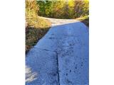
From the Šprem farm we continue to the village of Prebukovje along a narrow asphalt road. The trail ascends gently to moderately. We arrive at a junction where we turn left in the direction of Meljan. Along the way we pass the interesting Flegar farm. In this section the markings are somewhat sparser.
After the Flegar farm we arrive at a junction with a cross, we turn right and continue very steeply uphill. The trail leads us past some abandoned farms and a water supply facility. At the next junction we turn right again, and along the way we notice another cross. We arrive at the Vuk farm (here we can get water at the tap) and continue right into the forest.
In the forest we ascend quickly and steeply to the Oreški farm. Here we turn left through an orchard and re-enter the forest.
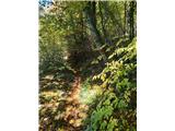
Upon entering the forest the trail is marked with non-standard red dots. At the first forest junction we turn right. Along the trail there is a bench for resting, after which follows another junction where a very steep unofficial shortcut to the climbing area by the Filićev dom branches off to the right. We continue straight in a gentle ascent.
After a few minutes we arrive at a junction where we cross the trail that the Varaždin hikers call Bob steza. We continue straight.
In this section the markings are again somewhat sparser, but from the junction onwards the trail is very well trodden (many hikers use only this part of the trail). A gentle ascent leads us under the rocky area, where the ground becomes more stony. Along the way we encounter two technically somewhat more demanding sections. Experienced hikers will manage them without using their hands, but it is easier to use them. The trail then leads us to a sharp right turn, where a shorter, steep and technically more demanding section of the trail begins.
We ascend through the rocky area. Here too it is possible without using hands, but it is easier to help with them. The most difficult part of the trail can be bypassed. When we reach the Zvonar rock, the more demanding section ends.
This is followed by a few more minutes of steep but undemanding ascent, which leads us to a junction by the church of sv. Treh kraljev. To the right it goes towards Filićev dom, to the left towards Pusti duh hut, but we continue to the church.
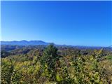
At the church we turn right towards the south and after two minutes of quite steep ascent we step under the viewpoint pyramid, from which an exceptional view opens in all directions.
Just a few metres from the pyramid there is a rock that represents the highest peak of Ravna Gora. A stamp is also placed by the rock, but there is no summit register here (it is located in Filićev dom).
• Prebukovje–entrance to the forest: 30 min
• Entrance to the forest–junction with Bob steza: 10 min
• Junction–more demanding section: 20 min
• In the more demanding section of the trail: 5 min
• Exit from the more demanding section–summit: 10 min

Photos:
 1
 2
 3
 4
 5
 6
 7
 8
 9
 10
 11
 12
 13
 14
 15
 16
 17
 18
 19
 20
 21
 22
 23
 24
 25
 26
 27
 28
 29
 30
 31
 32
 33
 34
 35
 36
 37
 38
 39
 40
 41
 42
 43
 44
 45
 46
 47
 48
Discussion about the trip Prebukovje - Ravna Gora (Zvonareva pot)
To post a comment you must log in:
If you do not yet have a username, you must first
register.