Starting point: Pred Belo (571 m)
| Latitude/Longitude: | 46,31880°N 14,60050°E |
| |
Walking time: 3 h 45 min
Difficulty: difficult marked way
Elevation gain: 1232 m
Elevation difference along the route: 1232 m
Map: Kamniške in Savinjske Alpe 1:50.000
Recommended equipment (summer): helmet, self belay set
Recommended equipment (winter): helmet, self belay set, ice axe, crampons
Views: 58.064
 | 3 people like this post |
Access to starting point:
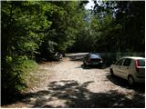
We drive to Kamnik and follow the road ahead towards the valley of Kamniška Bistrica. Approximately 2 km after the bottom station of the cable car to Velika Planina, we will notice on the right side of the road a parking lot and mountain signposts for Presedljaj, Konj and Korošica (the parking lot is located after the bridge).
Route description:
From the parking lot, we head onto the path in the direction of Presedljaj, Korošica, Konj and Ojstrica. Already after a few meters the path turns to the right, where at first it ascends barely noticeably, then it starts to descend and after a few minutes joins a wide cart track. We continue the ascent on the gentle cart track, which soon crosses a torrent, then gently to moderately ascends towards the head of the valley Kamniška Bela.
After a good 30 minutes of walking from the starting point, we arrive at a marked junction, where we continue right on the marked path (left to waterfall Orglice and Korošica via Šraj pesek). The cart track soon after the junction changes into an increasingly steep footpath, which leads us further through dense forest. Higher, the path turns slightly to the left and crosses a torrent gully. A little further, the path via Najnar štant branches off to the left almost unnoticeably (demanding and exposed path that leads to Korošica, higher it joins the path via Šraj pesek), while we continue straight on the marked path, which starts to ascend in numerous switchbacks. Higher, the path steeply ascends for a short time and brings us to a nice viewpoint with a table and bench.
The path ahead slightly descends, crosses a steep slope and brings us to a torrent gully. Here the path turns to the left side of the slope, first ascends with the aid of some pegs and higher cable handrails, then returns to the forest, where it steeply ascends for some time. Higher, the path temporarily flattens, then steeply ascends again and brings us to the saddle Presedljaj in a few minutes of further walking, where there is a marked junction.
On Presedljaj there is a junction, where we turn right following the signs for Konj. The path then runs slightly to the right across somewhat steeper scree-covered slopes and then turns to the left. Here the path ascends somewhat more steeply for a short time, aided by some pegs. We continue across the slope covered with dwarf pines, which brings us to the ridge. The path then runs along the right side of the ridge and becomes somewhat more demanding and somewhat more exposed. Next comes probably the hardest part of the path, where we ascend quite steeply along pegs and cable handrails back towards the ridge. When we reach the ridge again, we have only a few meters to the forepeak, on which the registration box is placed. From here we then have a short ascent along the cable handrail to the summit of Konj.
Pred Belo - Presedljaj 3:00, Presedljaj - Konj 45 minutes.

Along the route: Presedljaj (1613m)
Photos:
 1
1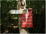 2
2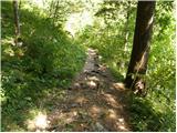 3
3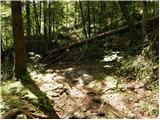 4
4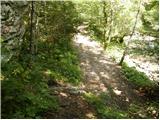 5
5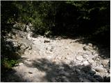 6
6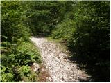 7
7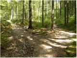 8
8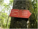 9
9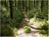 10
10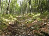 11
11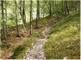 12
12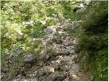 13
13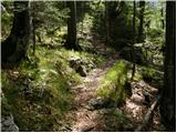 14
14 15
15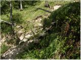 16
16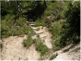 17
17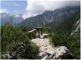 18
18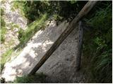 19
19 20
20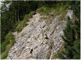 21
21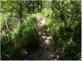 22
22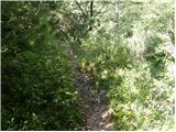 23
23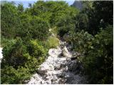 24
24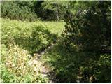 25
25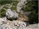 26
26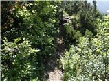 27
27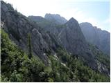 28
28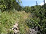 29
29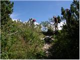 30
30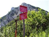 31
31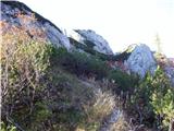 32
32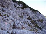 33
33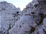 34
34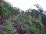 35
35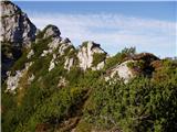 36
36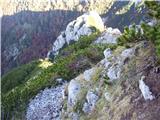 37
37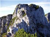 38
38 39
39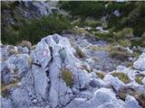 40
40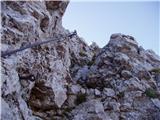 41
41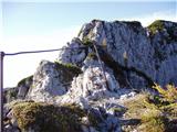 42
42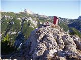 43
43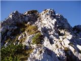 44
44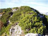 45
45
Discussion about the trip Pred Belo - Konj
Show older messages
|
| klavdipo29. 10. 2009 |
Is the path to Konj snowy at all?
|
|
|
|
| aonuk130. 10. 2009 |
Was on Konj on Wednesday 28.10.09 at 11 o'clock, very nice sunny weather, no wind.
Below the saddle in the morning it was wet, no trace of snow even higher up, a bit whitish.
|
|
|
|
| petruša3. 05. 2010 |
Is there still any snow on Konj at this time, because we would like to go with children, or would it be better to wait? If someone has been there recently, please let me know. lp
|
|
|
|
| Saten5. 05. 2010 |
I went to Konj via Presedljaj last Thursday. Already before Presedljaj there are snowfields, and even after Presedljaj there are quite a few snowfields that are very steep (at least some), so they can be dangerous, especially for children. I personally didn't need crampons because the snow was soft enough, but great caution was needed. For now, I would advise against this path. No problems on the path from Kamniška Bistrica via planina Dol and planina Rzenik. There, even with snow in some places, children can go too.
Safe steps.
|
|
|
|
| rakec25. 07. 2010 |
Was on Konj on 24.7.2010 via Presedljaj. The path to Presedljaj is a bit demanding, it climbs steadily and doesn't give you a break. You need some fitness. From Presedljaj to Konj the path goes along the ridge, there are lots of cables and pegs on and off the ridge. I definitely advise against this path for children, it's much easier from planina Dol. One cable is also damaged, the peg is pulled out.
|
|
|
|
| petruša25. 07. 2010 |
We did this path to Konj at the end of May. Since we were two families, there were children with us. The youngest was 7 years old, the oldest 11. The path wasn't hard or too demanding for us, nor for the children. But the children had self-belaying. I don't see this path as too hard, because some paths are harder and more demanding and are marked as easy. But if you don't have fitness and if you're afraid of heights, then I really advise against it. lp
|
|
|
|
| petra28. 03. 2012 |
hey, has anyone been to Konj this March yet??? I'm wondering if there's still any snow up there??
|
|
|
|
| redbull28. 03. 2012 |
I was there in February, and even then there was almost no snow anymore, just not much, no crampons needed, now I can definitely tell you it's snow-free!!!! maybe a patch here and there, no need to wear gaiters up there
|
|
|
|
| HMatjaž2. 05. 2012 |
Was at Konj on 30.04 via Presedljaj. The path is newly arranged. The stamp box is also new and moved to the very top.
|
|
|
|
| nincokl7. 05. 2013 |
I'm interested if I can climb to Konj from (Pred Belo) to the top, and then return via Rzenik and the pastures down to the starting point and how much time would it take with moderate hiking for this tour??
If anyone knows, I would be grateful for an answer, and also some info on snow depth.
|
|
|
|
| nincokl7. 05. 2013 |
Sorry, I meant to descend to Kraljev hrib and not to Planina Dol!
|
|
|
|
| ejti7. 05. 2013 |
If you return via Rzenik, you descend to Planina Dol anyway, then through Dolski graben to Kraljev hrib or directly to Kopiščica (a bit less asphalt back to the car). Moderate pace for about 6-7 hours, I'd say, with longer breaks even more.
|
|
|
|
| Rokovnjacica9. 05. 2013 |
You can descend from Planina Dol to Kopiščica also via Martin stena
|
|
|
|
| keti110. 05. 2013 |
And who knows if there's still any snow on Martinj stezi?
|
|
|
|
| Janiel747. 06. 2013 |
Is the starting point easy to find? Thanks
|
|
|
|
| jax7. 06. 2013 |
If they haven't done any renovations in the meantime, then there's really just one poorly visible sign at the junction, so you might miss the starting point. But - after all, the parking is right by the main road, so you really can't get lost.
|
|
|
|
| rasto_r8. 06. 2013 |
Along Bela over Presedljaj to the summit count 3.5 to 4 hours, via planina Rzenik, Dol to the road and back to the car approx. less than 3 hours. No snow on this path. The starting point for the tour is about 100 m after the bridge over Bela (about 1 or 2 km before Dom v Kamniški Bistrici). It's more of a side branch into the forest where you can park. There are no markers there, but some 50m further in the forest along the trail.
|
|
|
|
| Janiel749. 06. 2013 |
Thanks. I went, but not much further than Presedljaj, because it started raining and it was dark... too dangerous on the fixed cables... I didn't see the first sign mentioned in the description anywhere...
|
|
|
|
| ostrorogi10. 08. 2014 |
Today on Konj. The whole way up I didn't meet a living soul. If you don't like crowds, I recommend it!
|
|
|
|
| VidicM10. 10. 2014 |
Is the path too steep to take a dog along?
|
|
|
|
| martinkarpan10. 10. 2014 |
As far as I know the last part is quite exposed and I doubt it's suitable for a dog
|
|
|
|
| Macesna10. 10. 2014 |
I agree with martinomkrpan. It would be possible with a dog if going to Konj from Velika planina or via pl. Dol past Rzenik. This variant has no cables.
|
|
|
|
| squash12328. 10. 2014 |
Today my wife and I climbed to Konj. On the path to Konj and then to Planina Rzenik and Planina Dol we didn't meet a single mountaineer. Apparently Konj is quite unpopular, despite offering very nice views in all directions.
|
|
|
|
| janez zorman6. 02. 2015 |
Konj is very visited in all seasons. Rzenik, which is 30m higher and more interesting, is really neglected. And this mainly because the path is poorly marked. Last autumn, from Planina Rzenik (meadow) to the top, the path through the scrub has been cleared - cut pine branches - you walk like through a tunnel.
|
|
|
|
| ločanka7. 02. 2015 |
Thanks Janez for warning us! It was really all overgrown, simply too much to decide to access the summit.
|
|
|
|
| Barentoter12. 03. 2015 |
On Saturday I'm going the circular route via Presedljaj to Konj and via Dolina Dol back to the lower cable car station. Does anyone know the conditions these days? I'm more worried about the ridge if there's wind-blown snow. We'll manage through those pines on Rzenik.
|
|
|
|
| _sandra_13. 03. 2015 |
On Tuesday from the lower cable car to Planina Dol through the forest it was a bit icy, on Planina Dol snow is being cleared diligently, higher towards Konj it's up to the knees, but there's a track.. I don't know about the ridge and the path via Presedljaj..
|
|
|
|
| Barentoter16. 03. 2015 |
On Saturday we went over Presedljaj to Konj. Through the forest the path is quite nice, some fallen trees still on the path, otherwise you need to be careful not to miss the path because the marks are quite poorly visible. On the ridge (from the junction with Korošica) there was a lot of drifted snow. The first fixed rope is torn and a couple of pegs are under the snow. Since my wife and I had only "small" crampons, we decided midway on the ridge to descend back to the valley. I currently recommend approach from Planina Dol for less experienced hikers.
|
|
|
|
| _sandra_16. 03. 2015 |
if you two were at least approximately experienced, you would have all winter gear with you, so regarding the comment below that you recommend approach from planina Dol for less experienced hikers, it's not appropriate.. I went from there too with full winter gear, because you never know what awaits you on the path.. and I don't count myself among more or less experienced, winter in mountains is the same for everyone, where who goes is another debate..
|
|
|
|
| redbull16. 03. 2015 |
sandra excellent comment. Small crampons mean almost like having nothing.
|
|
|
|
| Barentoter16. 03. 2015 |
I absolutely agree regarding the equipment. I just wanted to describe the path over Presedljaj in the current conditions. And I still firmly stand by the fact that the winter ascent is not for everyone who goes to Šmarna on Sunday.
|
|
|
|
| _sandra_16. 03. 2015 |
Maybe it's not fair to complain about people who go to Šmarna on Sunday, I think it's incorrect that someone who hikes to the mountains with incomplete winter equipment then judges who should go where..when you next reach the summit with proper crampons then I'll also refrain from further comments..until then good luck wherever, even if "only" to Šmarna..
|
|
|
|
| andrej7816. 03. 2015 |
Sandra don't get upset for no reason...best
|
|
|
|
| redbull17. 03. 2015 |
to cut it short. Did you see Barentoter, if there was anything trodden or tracks towards Korošica from Presedljaj?
thanks
best
Dejan
|
|
|
|
| Barentoter17. 03. 2015 |
Towards Korošica there were a couple of tracks. Didn't see or meet anyone though. The tracks were also a bit melted at the edges and maybe a day old.
|
|
|
|
| veja520. 06. 2015 |
Hi,
tomorrow we'd go to Konj via this path. What's the condition of the path?
Thanks for the info and best regards to all-
|
|
|
|
| lanževica20. 06. 2015 |
the trail is by no means bp either, as the gully from picture 19 is right after the bench, about three meters long, quite collapsed. There's no trail at all and nothing to hold onto.
The secured trail to Konj is in good condition, quite a bit of scree loaded on the rocks. That was the condition on this trail last Sunday.
|
|
|
|
| dprapr21. 06. 2015 |
I thought similarly about that bp, but I usually don't interfere with the condition of marked trails.
|
|
|
|
| smatjaz21. 06. 2015 |
me too rarely, but based on what I saw last Sunday when descending from Konj, whoever is bothered by the section in picture 19 will hardly manage the section from the saddle to Konj, so I think that whoever finds section 19 dangerous should turn back at the saddle or go the other way (I don't know the trail towards Korošica). This wasn't meant as criticism or lecturing, but as a fact that this is a less dangerous section than the one higher up.....
|
|
|
|
| dprapr21. 06. 2015 |
The question was about the condition of the trail, not the difficulty of the trail!
|
|
|
|
| smatjaz21. 06. 2015 |
you are right about that...
|
|
|
|
| veja521. 06. 2015 |
Due to the poor weather forecast, we didn't go on this trail. Thanks for the information provided. When/if we hike the trail, I'll report on the condition regarding crossing the gully.
Best regards to all.
|
|
|
|
| smatjaz21. 06. 2015 |
veja5 just boldly nothing to fear it's not as bad as we're arguing up here, anyway if you follow us regularly you'll notice that there's always someone arguing, pardon two, because if it's just one it's already a bit strange....
|
|
|
|
| veja511. 07. 2015 |
Yesterday my wife and I walked this path. In that section where a few meters of path are missing, steps have already been made. So it no longer causes major difficulties when crossing. The final ridge section of the path is scenic and worth every drop of sweat. Nice transitions between secured and unsecured sections. Interesting Konj.
Best regards to all.
|
|
|
|
| Stane72. 12. 2015 |
Has anyone walked this path recently? How much snow is there on the ridge?
|
|
|
|
| Pelca9. 10. 2017 |
Good day, is it difficult or very dangerous to get from Konj summit to the stamp location?
|
|
|
|
| Enka9. 10. 2017 |
The stamp is now at the summit
|
|
|
|
| garmont9. 10. 2017 |
If coming from Planina Rzenik to Konj summit, stamp accessible without issues.
If from Presedljaj though, that's a different story.
|
|
|
|
| Pelca10. 10. 2017 |
I'm coming from Rzenik, that's why I asked, because it says that for the stamp you have to climb a bit in the direction of Presedljaj; apparently they've moved it now. Thanks everyone for the info!
|
|
|
|
| smatjaz10. 10. 2017 |
The path from Pelca over planina Rzenik to Konj is entirely a hiking trail without any special features, so just go boldly, the stamp is at the top of Konj, and if you feel like "a bit of bushwhacking" through the brush then it's worth visiting the summit of Rzenik whose junction is nicely marked about 10 min before the top of Konj to the left.
|
|
|
|
| Pelca11. 10. 2017 |
smatjaz thank you very much! I was already figuring out how to also get to Rzenik at the same time, thanks!
|
|
|
|
| pohodnik3816. 06. 2020 |
On Saturday 13.6 to Konj from the Kamniška Bela valley via the climbing path, then also to Rzenik which is very close, and back to the valley to the starting point via Martinj path. From the upper direction, the Martinj path is harder to find as a large part of the forest has been cut down. It is recommended to have some GPS track to lead you to the start of the Martinj path.
VIDEO of the completed path
Regards, Tone
|
|
|
|
| green15. 10. 2021 11:25:57 |
Is this path over Presedljaj still closed? What are the current conditions on Konj?
|
|
|
|
| grega_z_brega15. 10. 2021 12:35:43 |
The path is newly and interestingly arranged.
As for the conditions on Konj, I don't know, probably some snow.
|
|
|
|
| 5Xum15. 10. 2021 15:51:56 |
|
|
|
|
| smatjaz16. 10. 2021 11:44:28 |
Yes, really, that first little news isn't quite accurate; it was possible to bypass the landslide and unofficially continue on the current route, but the trail is officially open from September, so now it's safely routed around the landslide. However, one must be aware that Rzenik hasn't had the last word yet and that more will come down from it in the future, probably not on such a scale, so it's good to avoid the landslide area. The other hazard is that the landslide debris is still completely unstable and doesn't move downward, but collapses into itself, because under the huge amount of rocks, tree trunks are piled like mikado, and areas sink and collapse from time to time. Therefore, walking on the debris is discouraged. If you sink in the debris, probably no one will find you for the next few thousand years.........
|
|
|
|
| Hribovc911. 11. 2021 17:42:53 |
Part of the new path is really nicely laid out. At one spot it's slightly uncomfortable, as the path goes under avalanche terrain. I would also remind that it's a very demanding marked path.
|
|
|
|
| ljubitelj gora24. 04. 2022 22:44:03 |
Hiked 24.4.2022, winter gear no longer needed, fixed protections look okay. Descended via Martinj steza and road back to Bela.
|
|
|
|
| seinfeld9. 10. 2022 12:36:17 |
Markings to Konj from Presedljaj have faded, at the beginning you easily miss the direction. If the paths to Peč and Raduha are very difficult, this one could also be categorized the same. Really short, but more demanding and very exposed.
|
|
|
|
| bo_zl2. 07. 2023 15:35:46 |
The path is excellently marked up to Presedlaj, almost fresh markings, but further on they are really very poorly visible. The safety gear on the path is all fine.
|
|
|
|
| trdi12. 09. 2023 21:41:56 |
The path from Presedljaj to Konj is definitely very demanding. At two points you climb vertically along the cable over the abyss. However, the safety gear at these points is ok, so no problems, but it's not just a demanding path as stated in the description...
|
|
|
|
| plaNinaPirsMajcen18. 08. 2025 17:47:48 |
Hi,
I've wanted to hike the ridge section of this path for some time, i.e. the secured climbing part from Konj to Presedljaj. The idea came from two path markers last year, a couple I talked to at the top of Konj. Many thanks for the repair!
We started the path from planina Dol, ascended to Konj, along the ridge to sedlo Presedljaj and back to the top of Konj. On the return to planina Dol we also visited neighbor Rzenik.
We didn't use SVK, just the helmet. The ridge path is nicely secured and marked all the way, only a young viper on the path scared us 🐍.
Sharing a video so someone can better visualize the secured section:
https://youtu.be/mtWs_ZdvGHc?si=gPdC1muP69qVdQO7
It was a pleasure for us 🙂
Best, Nina
|
|
|
To post a comment you must log in:
If you do not yet have a username, you must first
register.