Starting point: Pred Belo (571 m)
| Latitude/Longitude: | 46,31880°N 14,60050°E |
| |
Walking time: 6 h 45 min
Difficulty: difficult marked way
Elevation gain: 1779 m
Elevation difference along the route: 1870 m
Map: Grintovci 1 : 25.000
Recommended equipment (summer): helmet
Recommended equipment (winter): helmet, ice axe, crampons
Views: 9.701
 | 1 person like this post |
Access to starting point:
On 25.08.2008, I set off from Kamniška Bistrica through Presedljaj and Korošica to Ojstrica. I went from Ljubljana by car, but it’s important that you drive to Kamnik. Drive on the bypass road through Kamnik and turn left at the end of Kamnik over the bridge in the direction of Velika Planina, Kamniška Bistrica. After a few hundred meters, there is a roundabout in which you must turn right for Velika Planina. Then you arrive at the village of Stahovica (approximately 4 km from Kamnik), and at the beginning of this village, you turn left in the direction of Velika Planina. When you reach the parking lot below the lower station of the cableway to Velika Planina, continue the path for another 1.7 km, and you will come to the bridge over the stream Kamniška Bela; drive another 10 meters, and at the end of the right turn, you will see a parking lot for approximately 10 vehicles. Here, park and start the hike.
Route description:
At 08:45, I began the journey, following the stream Kamniška Bela upwards. The path is quite gentle at the start, which means it will then begin to ascend steeply. At 09:10, I reached a path junction; there is no signpost for the left path, but I believe it branches off to the waterfall Orglice and the Partisan hospital. Thus, criticism is due to whoever is responsible for placing signposts to the waterfall Orglice and the Partisan hospital, if it still exists there. There is a mountain sign pointing to the right, directing us along our path. For a few minutes, the path remains quite gentle, then it starts to ascend steeply through the forest. At 09:55, I reach a bench from where beautiful views open up. Looking at the map, I assume this point is called Počivalo. I continue the path and reach Presedljaj at 10:45. For this part of the path, I needed 2 hours.
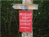
At Presedljaj, there is a crossroad; you can go right towards the peak Konj and Velika planina. The passage over Konj is very challenging. To the left, a sign directs us towards Korošica, indicating two more hours ahead. The path from Presedljaj to Korošica mostly passes through low pine bushes and is almost flat. On the path, you can see many Bodeče Neže, which you should not pick. I reach Kocbekov dom na Korošici at 11:45, needing only 1 hour. A few hundred meters before the hut, just after the wire fence for sheep, a beautiful view opens towards the hollow where Kocbekov dom is located.
At Kocbekov dom, I treat myself to goulash, bread, and beer, paying 8 EUR. After a few minutes of sunbathing, I continue the path to Ojstrica at 12:25. The path to the summit is quite steep and rocky. I reach Ojstrica at 13:20, where I meet two Germans and a hunting dog. For this path, I needed just under an hour.
At the summit, I enjoy a beer from my backpack, lie down, and even doze off a bit in the sun. The views from Ojstrica are stunning, especially towards Logarska dolina. The waterfall you see northwest in the basin is the waterfall Rinka. At the summit, I also found some snow that fell a few days ago. At 14:15, I continue the path eastward towards Mala Ojstrica, arriving by 15:05. At the summit, I’m surprised by a miniature replica of the Aljaž turret, set up by the Slovenian mountaineering club SKALA.
I don’t linger here, so I descend the hill along the path and head south towards Presedljaj, passing Kocbekov dom on the eastern side. At 15:20, I reach a crossroad above the hollow Korošica, where I “tie the sausage” and head towards Presedljaj, arriving by 16:15. Thus, the descent from Ojstrica via Mala Ojstrica to Presedljaj took 2 hours.
The descent to the starting point takes an additional 1 hour and 30 minutes, and I reach the vehicle by 17:45. To be honest, the path was quite exhausting, so less prepared hikers might find it better to split it into two days.
The path is suitable for children up to Kocbekov dom na Korošici, but it is very steep.
Good luck.

Photos:
 1
1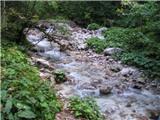 2
2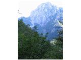 3
3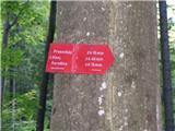 4
4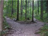 5
5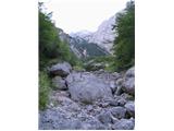 6
6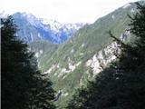 7
7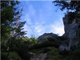 8
8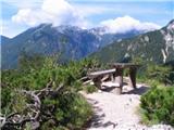 9
9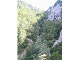 10
10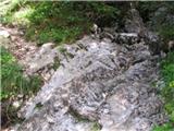 11
11 12
12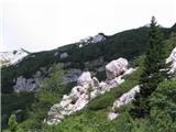 13
13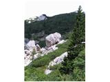 14
14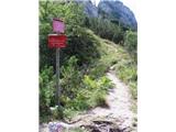 15
15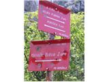 16
16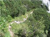 17
17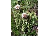 18
18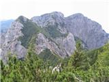 19
19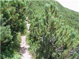 20
20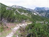 21
21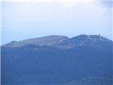 22
22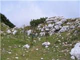 23
23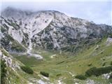 24
24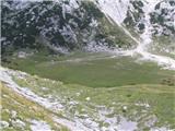 25
25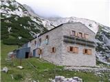 26
26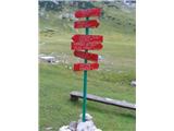 27
27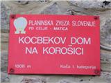 28
28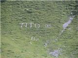 29
29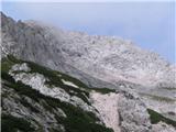 30
30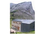 31
31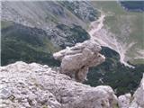 32
32 33
33 34
34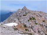 35
35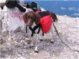 36
36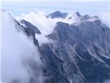 37
37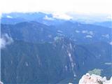 38
38 39
39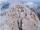 40
40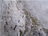 41
41 42
42 43
43 44
44 45
45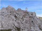 46
46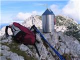 47
47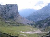 48
48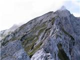 49
49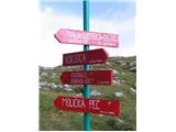 50
50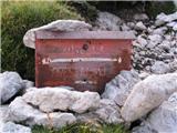 51
51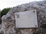 52
52 53
53
Discussion about the trip Pred Belo - Ojstrica
To post a comment you must log in:
If you do not yet have a username, you must first
register.