Preddvor - Štefanja gora (on footpath)
Starting point: Preddvor (459 m)
| Latitude/Longitude: | 46,30010°N 14,42810°E |
| |
Route name: on footpath
Walking time: 1 h 20 min
Difficulty: easy unmarked way
Elevation gain: 289 m
Elevation difference along the route: 340 m
Map: Karavanke - osrednji del 1:50.000
Recommended equipment (summer):
Recommended equipment (winter): crampons
Views: 3.200
 | 1 person like this post |
Access to starting point:
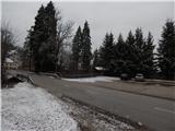
From the Gorenjska highway, exit Kranj east (Kranj or Šenčur), we drive towards Jezersko. When we get to the settlement Tupaliče, we leave the main road and continue driving left towards Preddvor. After crossing the river Kokra, Tupaliče ends and we get to Preddvor, where we park on a larger macadam parking lot in front of the company Jelovica hiše d.o.o.
Route description:
From the parking lot through the river Kokra we return back to Tupaliče, and when we reach the main road we continue right towards Kranj. Along the main road we walk to the bakery Jaka, where we go slightly left onto a somewhat narrower road. When we ascend along the road above the gas station Logo, at the junction we continue left in the direction of Možjanca. The path ahead leads us past a few more houses, then before the last house, which is located before the sign, we leave the road which leads towards Možjanca and continue left among the houses. Behind the house on the right we notice the beginning of the cart track which transitions into the forest and further ascends for some time parallel to the asphalt road. Higher the cart track turns slightly to the left and brings us along the power line into the valley between Vrtičnik (682 m) on the left and hill Vrhe (689 m) on the right, where a little higher we arrive at a junction where the path from Potoč joins.
Here we continue right, at the next junction we choose the left cart track. The path ahead continues along the edge of the forest, higher it brings us to the settlement Možjanca, where first we arrive at the Okrepčevalnica Rožmarin, a little further, if at the junction we continue left, also to the church of St. Nicholas.
From Možjanca we continue in the direction of Štefanja gora, where the road leads us past a few more houses, then we arrive at the place where to the right downhill branches off the road towards the nearby houses. Here we continue straight, to the right downhill we continue behind the houses which we see under the road. There follows some transverse descent, then we arrive in the smaller valley between Veliki vrh (785 m) on the left and Apnišče (739 m) on the right.
When we reach the mentioned valley we continue left (right Bethlehem and Olševek) and ascend easily along it. The cart track on which we walk changes higher into a forest path, which splits into two parts.
We continue straight in the direction of Štefanja gora (right Apnišče), a little higher when we reach the cart track we go sharply right. Along the cart track in a gentle ascent we quickly reach the saddle between Štefanja gora on the left and Apnišče on the right.
Here we continue slightly left in the direction of Štefanja gora (straight downhill Olševek, right Apnišče). The path ahead quickly splits, we choose the right path (straight tourist farm Pr Mežnarju), which a little ahead brings us onto the pasture, along the edge of which we then ascend to the church of St. Stephen on Štefanja gora.
Preddvor - Možjanca 40 minutes, Možjanca - Štefanja gora 40 minutes.
Description and pictures refer to the condition in 2018 (January).

Photos:
 1
1 2
2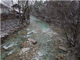 3
3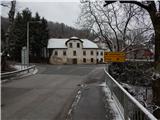 4
4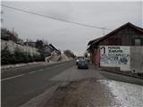 5
5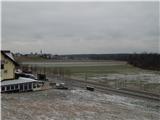 6
6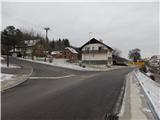 7
7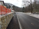 8
8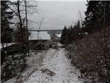 9
9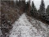 10
10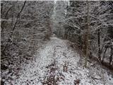 11
11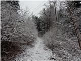 12
12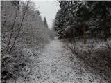 13
13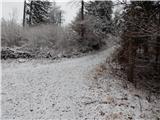 14
14 15
15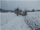 16
16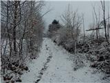 17
17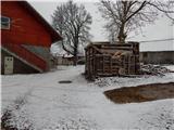 18
18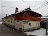 19
19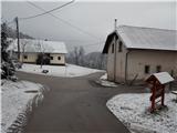 20
20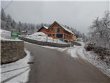 21
21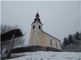 22
22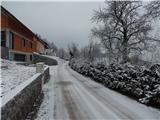 23
23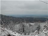 24
24 25
25 26
26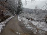 27
27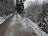 28
28 29
29 30
30 31
31 32
32 33
33 34
34 35
35 36
36 37
37 38
38 39
39 40
40 41
41 42
42 43
43 44
44
Discussion about the trip Preddvor - Štefanja gora (on footpath)
To post a comment you must log in:
If you do not yet have a username, you must first
register.