Preddvor - Sveti Nikolaj (Možjanca) (by road)
Starting point: Preddvor (459 m)
| Latitude/Longitude: | 46,30010°N 14,42810°E |
| |
Route name: by road
Walking time: 45 min
Difficulty: easy unmarked way
Elevation gain: 230 m
Elevation difference along the route: 230 m
Map: Karavanke - osrednji del 1:50.000
Recommended equipment (summer):
Recommended equipment (winter):
Views: 1.940
 | 1 person like this post |
Access to starting point:
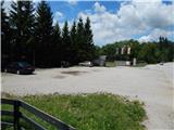
From the Gorenjska highway, exit Kranj east (Kranj or Šenčur), we drive towards Jezersko. When we get to the settlement Tupaliče, we leave the main road and continue driving left towards Preddvor. After crossing the river Kokra, Tupaliče ends and we get to Preddvor, where we park on a larger macadam parking lot in front of the company Jelovica hiše d.o.o.
Route description:
From the parking lot over the river Kokra we return to Tupaliče, and when we reach the main road we continue right towards Kranj. Along the main road we walk to bakery Jaka, where we go slightly left onto a somewhat narrower road. When we ascend on the road above gas station Logo, at the crossroad we continue left in the direction of Možjanca. The path ahead leads us past a few more houses, and then it passes into the forest through which we start to ascend more steeply. There follows a little less than 30 minutes of ascent and the road brings us to Možjanca, where we can walk to snack bar Rožmarin or church of St. Nikolaj.
Description and pictures refer to the condition in the year 2017 (July).
Along the route: Tupaliče (455m)
Photos:
 1
1 2
2 3
3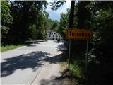 4
4 5
5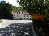 6
6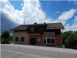 7
7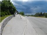 8
8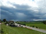 9
9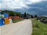 10
10 11
11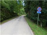 12
12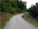 13
13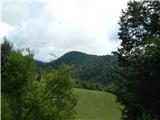 14
14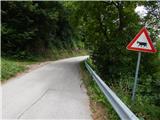 15
15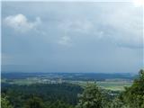 16
16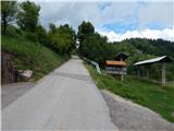 17
17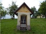 18
18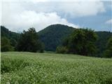 19
19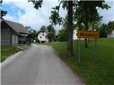 20
20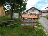 21
21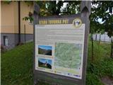 22
22 23
23 24
24 25
25
Discussion about the trip Preddvor - Sveti Nikolaj (Možjanca) (by road)
|
| Gost21. 07. 2017 |
Just a note. The described path runs entirely on asphalt. But if at the last house in Tupaliče at the sign in the forest you turn left (so as not to go through the yard of that house) after a few meters you reach a forest path that ends at the refreshment point. A little above the weekend houses above Možjanca there is a nice viewpoint with a view of the Kokra river valley and the peaks. The excursion can be extended along the marked footpath to Štefanja gora to the Mežnar farm tourism.
|
|
|
To post a comment you must log in:
If you do not yet have a username, you must first
register.