Predgozd - Sveti Lenart (Krvava Peč)
Starting point: Predgozd (815 m)
| Latitude/Longitude: | 45,83610°N 14,53180°E |
| |
Walking time: 1 h
Difficulty: easy marked way
Elevation gain: -10 m
Elevation difference along the route: 50 m
Map: Snežnik 1:50.000
Recommended equipment (summer):
Recommended equipment (winter):
Views: 3.580
 | 1 person like this post |
Access to starting point:
A) First, we drive to Ig, and from there we continue driving towards Kurešček. Further on, we drive along an ascending road which flattens at the turn-off for Kurešček, and then starts descending towards the village Rob. From the village Rob we continue in the direction of Sela, Rup, Vrha and other settlements of Rutarska planota, and on a winding road we drive to some sort of triangular crossroad, where we continue right towards the hamlet Predgozd (if we continue slightly left we will quickly come to settlements of Rutarska planota). Further, we drive past a few more houses, and then we turn left towards the forestry cottage, where on a parking lot in its vicinity we also park.
B) From Ljubljana, we drive towards Kočevje, then at settlement Rašica we turn right (from the direction Kočevje left) in the direction of village Rob. From the village Rob we continue in the direction of Sela, Rup, Vrha and other settlements of Rutarska planota, and on a winding road we drive to some sort of triangular crossroad, where we continue right towards the hamlet Predgozd (if we continue slightly left we will quickly come to settlements of Rutarska planota). Further, we drive past a few more houses, and then we turn left towards the forestry cottage, where on a parking lot in its vicinity we also park.
C) We drive to Nova vas, from there we continue driving towards Velike Lašče. After approximately 6.5 km from the center of Nova vas we leave the main road towards Velike Lašče and we continue left towards the settlements Lužarji, Naredi, Boštetje, Mohorje, Rupe and Selo pri Robu. Above the village Selo we arrive at some sort of triangular crossroad, where we continue left towards the hamlet Predgozd. Further, we drive past a few more houses, and then we turn left towards the forestry cottage, where on a parking lot in its vicinity we also park.
Route description:
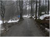
From the forestry cottage, by which there are some information boards, on the European footpath E6 we ascend to the nearby road (we ascend to the road which we left when we turned left towards the forestry cottage). When we step onto the road we continue straight, and it leads us past one residential house. Immediately after the house, the European footpath E6 branches off to the right from the road, and we continue on the macadam road in the direction of Krvava peč. The road which runs through the forest initially continues without major changes in altitude, then starts to descend more noticeably. While the road descends, we will notice a cross on the left side, somewhat off the path, and we continue on the road which flattens, then leads us across some meadows. A little further we arrive at a marked crossroad, where we continue left in the direction of Bukovec, church of St. Lenart, Krvava pečina and cave Kevdrc (straight downwards village Krvava peč).
Further on, we gently ascend to the next crossroad, where we continue right (left Bukovec). The path ahead still leads on the macadam road which ascends along an indistinct ridge high above the valley of the river Iška, whose roaring we can hear all the way to our path. The relatively gentle road leads us past some weekend cottages, then we arrive at the church of St. Lenart.

Photos:
 1
1 2
2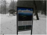 3
3 4
4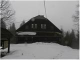 5
5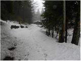 6
6 7
7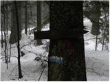 8
8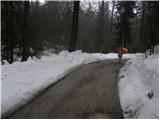 9
9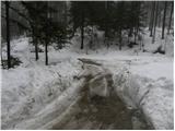 10
10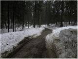 11
11 12
12 13
13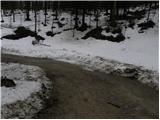 14
14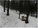 15
15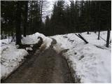 16
16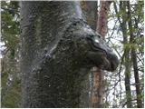 17
17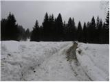 18
18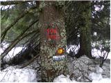 19
19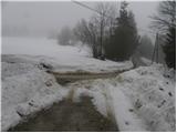 20
20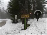 21
21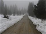 22
22 23
23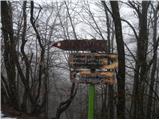 24
24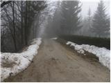 25
25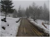 26
26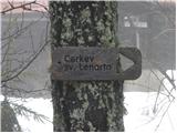 27
27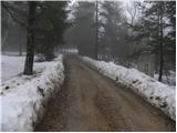 28
28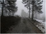 29
29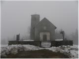 30
30
Discussion about the trip Predgozd - Sveti Lenart (Krvava Peč)
To post a comment you must log in:
If you do not yet have a username, you must first
register.