Predmeja (Gorjanka) - Koča Edmunda Čibeja v Tihi dolini
Starting point: Predmeja (Gorjanka) (887 m)
| Latitude/Longitude: | 45,94376°N 13,87631°E |
| |
Walking time: 25 min
Difficulty: easy marked way
Elevation gain: 63 m
Elevation difference along the route: 65 m
Map:
Recommended equipment (summer):
Recommended equipment (winter):
Views: 320
 | 1 person like this post |
Access to starting point:
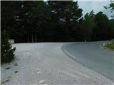
a) Drive to Col, then follow the road towards Otlice and Predmeja. This is followed by driving across the Gora plateau, where the road leads us through several villages; when we arrive in Predmeja, pay attention not to miss the parking lot located at the beginning of the right bend. Next to the parking lot is a small landscaped park with the Slovenian flag, and by the parking lot there are also trash bins and mountaineering signposts.
b) Drive to Ajdovščina, then follow the signs to Lokavec and Predmeja. This is followed by a fairly steep ascent along the road to Predmeja, where we continue right towards Otlica and Col. A little further on, at the end of the left bend, turn right onto the gravel parking lot located next to the landscaped park with the Slovenian flag and mountaineering signposts.
Route description:
From the parking lot we briefly continue along the road towards Otlice and Col, then turn left onto a side road along which the markings continue and there are signs for the Tiha dolina sports park. There follow several smaller intersections where we follow the markings, and we initially ascend easily past individual houses. After Štemčev kal we begin to ascend somewhat more noticeably, but the paths still lead us past a few individual houses, at the intersections we follow the markings or signs for the mountain hut. The fairly panoramic asphalt road then quickly brings us to Koča Edmunda Čibeja v Tihi dolini.
Description and photos refer to the condition in July 2025.
Along the route: Štemčev kal (910m)
Photos:
 1
1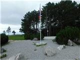 2
2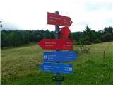 3
3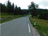 4
4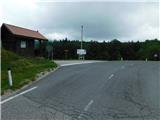 5
5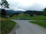 6
6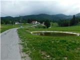 7
7 8
8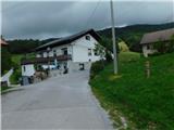 9
9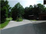 10
10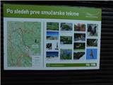 11
11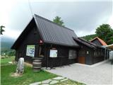 12
12
Discussion about the trip Predmeja (Gorjanka) - Koča Edmunda Čibeja v Tihi dolini
To post a comment you must log in:
If you do not yet have a username, you must first
register.