Predmeja (tuneli) - Kucelj (on Čaven) (via Koča na Čavnu)
Starting point: Predmeja (tuneli) (800 m)
| Latitude/Longitude: | 45,93770°N 13,86920°E |
| |
Route name: via Koča na Čavnu
Walking time: 2 h 15 min
Difficulty: easy marked way
Elevation gain: 437 m
Elevation difference along the route: 550 m
Map: Goriška 1:50.000
Recommended equipment (summer):
Recommended equipment (winter): ice axe, crampons
Views: 9.637
 | 1 person like this post |
Access to starting point:
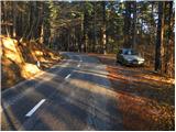
From the expressway Razdrto - Nova Gorica we head to the exit Ajdovščina and follow the road ahead towards the village Lokavec (to Lokavec we come from the center of Ajdovščina, or from the old road Ajdovščina - Nova Gorica, where at the settlement Cesta we turn right). From Lokavec we continue driving on the ascending winding road in the direction of Predmeja. We follow the mentioned road to the hiking signposts for Čaven, Veliki rob and Kucelj (signposts are located between the quarry and tunnels, road marking approx. 10 km). We park several tens of meters lower on the parking lot beside the road.
To the starting point we can also come from Godovič, over Črni vrh and Col to Predmeja. In this case from Predmeja we descend towards Ajdovščina and then soon after the third tunnel we park.
Route description:
From the parking lot we first walk to the signposts, then we head onto the Srednječavenska pot. The path, which goes immediately into the forest, first moderately ascends and then continues crossing the slopes towards the south. Wide and well-made mountain path, soon passes onto steep slopes (danger of falling rocks) and gradually turns more and more towards the right. A little further beautiful views open up from the path onto Nanos and Vipava valley, the path gradually passes into more rocky terrain. A little further the path again passes into dense forest, where it starts to descend gently. After a shorter gentle descent we come to a marked junction, where we continue right steeply upwards in the direction of Čavna (left downwards Lokavec, straight the Srednječavenska pot continues).
We continue the ascent on the "lokavška" path, which ascends quite steeply. After some time the path, which for most of the time ran through the forest, again crosses some panoramic slopes. A little further the path brings us to the ridge, where we have two options for continuing. The left path runs a little below the ridge and is less panoramic than the one along the ridge, but it is more sheltered in case of strong bora. After 10 minutes both paths join and bring us to the uncultivated grassy slopes east of Mala gora.
Here the steepness eases and the path continues across nice meadows, where in spring and summer we notice a lot of mountain flowers. Higher up the path from Stomaž joins from the left, we continue straight on the path, which brings us to the Koča na Čavnu in a few minutes of further walking.
Behind the hut the signs for Kucelj direct us slightly left onto a footpath, which starts to descend diagonally. The path ahead crosses a short strip of forest, then turns right, where it continues to descend gently. The path then gradually enters the forest and from the left the path from the village Kamnje joins (there are two turn-offs for Kamnje). We continue in the direction of Kuclj on the path, which gradually passes to the right side of the "Čavna" ridge. The path continues across a larger clearing, from which a view opens onto the surrounding hills, then returns to the forest. A little further we leave the gentle cart track and continue the ascent left, ascending further through dense forest. The steepness soon eases and the path brings us from the forest onto increasingly panoramic grassy slopes. A few minutes of easy walking follow, then the path brings us below the summit of Kuclj itself, where it steeply ascends again. We follow this path, which offers increasingly beautiful views, all the way to the summit of Kuclj, which we reach after a few minutes of further walking.

Photos:
 1
1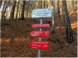 2
2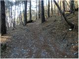 3
3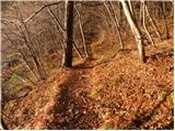 4
4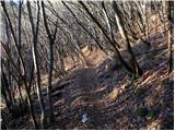 5
5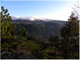 6
6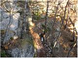 7
7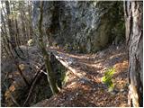 8
8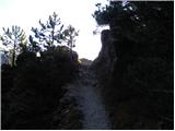 9
9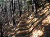 10
10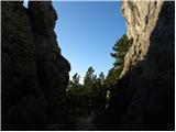 11
11 12
12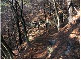 13
13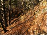 14
14 15
15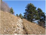 16
16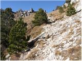 17
17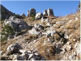 18
18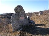 19
19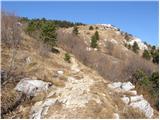 20
20 21
21 22
22 23
23 24
24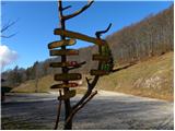 25
25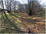 26
26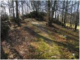 27
27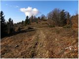 28
28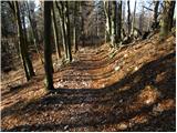 29
29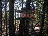 30
30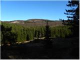 31
31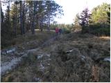 32
32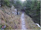 33
33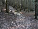 34
34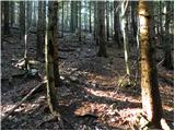 35
35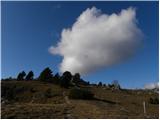 36
36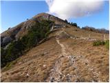 37
37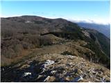 38
38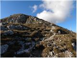 39
39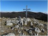 40
40 41
41
Discussion about the trip Predmeja (tuneli) - Kucelj (on Čaven) (via Koča na Čavnu)
To post a comment you must log in:
If you do not yet have a username, you must first
register.