Predmeja (tuneli) - Veliki Rob (Srednječavenska pot)
Starting point: Predmeja (tuneli) (800 m)
| Latitude/Longitude: | 45,93770°N 13,86920°E |
| |
Route name: Srednječavenska pot
Walking time: 3 h
Difficulty: partly demanding marked way
Elevation gain: 437 m
Elevation difference along the route: 620 m
Map: Goriška 1:50.000
Recommended equipment (summer): helmet
Recommended equipment (winter): helmet, ice axe, crampons
Views: 5.470
 | 2 people like this post |
Access to starting point:
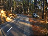
A) From the expressway Razdrto - Nova Gorica, we take the exit Ajdovščina and follow the road ahead towards the village Lokavec (to Lokavec we come from the center of Ajdovščina, or from the old road Ajdovščina - Nova Gorica, where at the place Cesta we turn right). From Lokavec we continue driving on the ascending winding road in the direction of Predmeja. We follow the mentioned road to the hiking signposts for Čaven, Veliki Rob and Kucelj (signposts are located between the quarry and the tunnels, road marker approx. 10 km). We park a few tens of meters lower on the parking lot by the road.
B) To the starting point, we can also come from Godovič, via Črni Vrh and Cola to Predmeja. In this case we descend from Predmeja towards Ajdovščina and then soon after the third tunnel we park.
Route description:
From the parking lot, we first walk to the signposts, then head onto the Srednječavenska pot. The path, which goes immediately into the forest, first rises moderately and then continues crossing the slopes towards the south. Wide and well-made mountain path, soon passes onto steep slopes (danger of falling rocks) and gradually turns more and more to the right. A little further, beautiful views open up from the path onto Nanos and Vipava valley, and the path gradually transitions into more rocky terrain. A little further still, the path again enters dense forest, where it begins to descend lightly. After a short gentle descent we come to a junction, where we continue straight (left down to Lokavec, right up to Koča na Čavnu) along the path which, although running at about 900 m altitude, takes on the appearance of a real high mountain path. The path then brings us from mostly pine forest onto scree, from which a nice view opens onto the valley, and on the right side we see steep rocky cliffs. At the end of the scree the path transitions into the ridges of the eastern forepeak of Mala gora, where with the aid of steel cable we cross a wide and also partly exposed ledge. At the end of the ledge a nice view opens onto the landslide Slano blato above Lokavec, and we continue along the Srednječavenska pot, which turns even more to the right, where it begins to descend gently through a belt of bushes. After a short descent the path levels out, and beside it we notice a large rocky ridge and next to it a pleasant bench for a short or long rest. The path, continuing through the forest, quickly brings us to the next junction.
This time we continue right in the direction of Mala gora and Čaven (left down to Stomaž, straight ahead the Srednječavenska pot continues) along the path which begins to ascend more steeply. After a few minutes of steep ascent the steepness eases and the path brings us onto unvegetated grassy slopes of Mala gora, where we also reach the next junction.
Here we continue left (straight up to Koča na Čavnu) along the path which mostly crosses the slopes to the west. After approximately 10 minutes of walking from the junction the path descends and brings us in a few steps to the Koča na Mali gori.
From the Koča na Mali gori we continue in the direction of Kucelj and Čaven. A few steps ahead, a cart track joins from the left, coming from the nearby hunting hut. We continue ahead along the cart track, from which soon a path branches right to the Koča na Čavnu.
We continue straight ahead along the cart track, which then brings us to the path from Koča na Čavnu to Kucelj. Here we continue left along the path which first runs almost horizontally, then begins to ascend. This path soon brings us out of the forest, where we already see Kucelj ahead of us, separated by another 10 minutes of panoramic ascent.
From Kucelj we descend in the direction of Vrtovina, along the path which after a short descent brings us to a marked junction.
We continue right in the direction of Veliki Rob along a pleasant trail which gently descends over panoramic grassy slopes. Lower down the path enters a belt of bushes, then joins the old road or cart track connection between Vipava valley and Trnovski gozd. We follow the mentioned cart track to the right, then after a few minutes the signs for Veliki Rob direct us left onto a footpath which gradually begins to ascend the southern slopes of Trnovski gozd. Occasionally quite panoramic, the path higher up moves a bit to the right of the ridge and for a short time enters dense forest, where the path from Krnica joins from the right. After a short descent the path begins to ascend again, bringing us out of the forest into a belt of dwarf pines, where it continues on and beside the occasionally quite steep ridge. We follow this path, from which beautiful views open up, all the way to Veliki Rob, from which a nice view opens up.
Predmeja (tunnels) - Mala gora 1:30, Mala gora - Kucelj 0:30, Kucelj - Veliki Rob 1:00.

Along the route: Mala gora (1034m), Kucelj na Čavnu (1237m)
Photos:
 1
1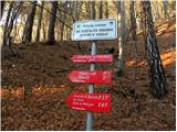 2
2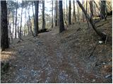 3
3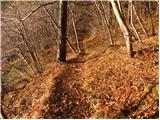 4
4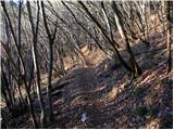 5
5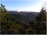 6
6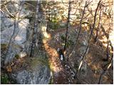 7
7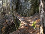 8
8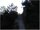 9
9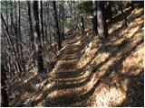 10
10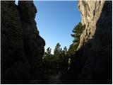 11
11 12
12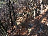 13
13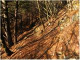 14
14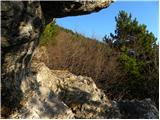 15
15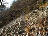 16
16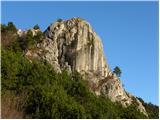 17
17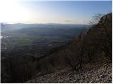 18
18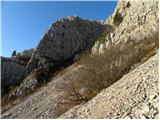 19
19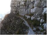 20
20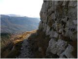 21
21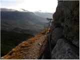 22
22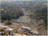 23
23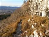 24
24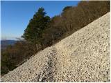 25
25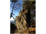 26
26 27
27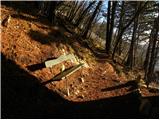 28
28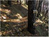 29
29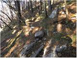 30
30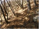 31
31 32
32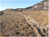 33
33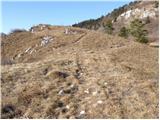 34
34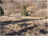 35
35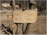 36
36 37
37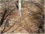 38
38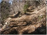 39
39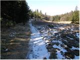 40
40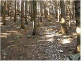 41
41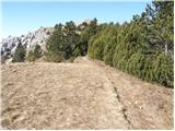 42
42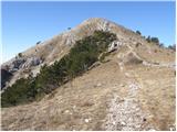 43
43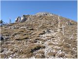 44
44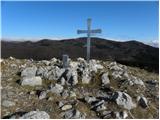 45
45 46
46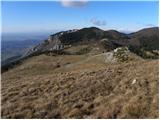 47
47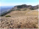 48
48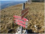 49
49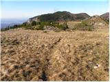 50
50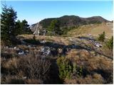 51
51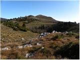 52
52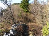 53
53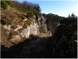 54
54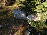 55
55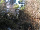 56
56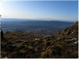 57
57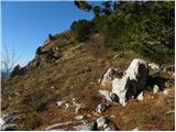 58
58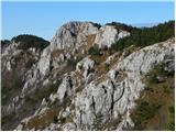 59
59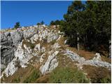 60
60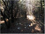 61
61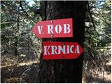 62
62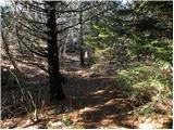 63
63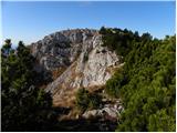 64
64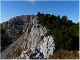 65
65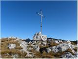 66
66 67
67
Discussion about the trip Predmeja (tuneli) - Veliki Rob (Srednječavenska pot)
|
| darinka46. 12. 2020 |
The Srednječavenska path is beautiful and generally interesting. Long, if you walk the whole thing. But it's worth hiking in spring when it's full of flowers there.
|
|
|
|
| mirank6. 12. 2020 |
That's right; however, the mentioned path does not lead to M mountain. Already on picture 29 it just crosses the path from Stomaž and continues in a nice gentle crossing of the southern slopes of Kuclje and V roba. At the rock barrier it turns right and leads to the saddle 5 min west of V roba - i.e. Strma pot.
|
|
|
|
| garmont31. 05. 2021 19:47:50 |
From the last junction to Kucelj onwards, there are older, quite faded markings along the path. You can see that most hikers turn to this nearby, same-height summit.
The benches are unfortunately also typical for these parts.
|
|
|
|
| garmont23. 03. 2026 05:46:42 |
If we skip the turn-off to Mala gora and continue along the Srednječavenska pot to the end, as described above by @mirank, our walking time to the summit of Veliki Rob will extend by almost an hour. It's worth considering, because the return to the tunnels is also quite long.
|
|
|
|
| mirank23. 03. 2026 18:41:46 |
That's true, but for the return I would recommend, after descending from Kuclje, turning down to M gora and returning along the path along the edge. This path avoids the hut at Čavnu, which isn't really a landmark, but the mentioned path is more interesting. All in all, about 5-6 hours should suffice
|
|
|
To post a comment you must log in:
If you do not yet have a username, you must first
register.