Predmeja - Veliki Modrasovec
Starting point: Predmeja (875 m)
| Latitude/Longitude: | 45,94660°N 13,87020°E |
| |
Walking time: 1 h 40 min
Difficulty: easy marked way
Elevation gain: 478 m
Elevation difference along the route: 500 m
Map: Goriška - izletniška karta 1:50.000
Recommended equipment (summer):
Recommended equipment (winter): crampons
Views: 12.088
 | 1 person like this post |
Access to starting point:
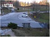
From the expressway Razdrto - Nova Gorica we take the exit Ajdovščina and follow the road ahead towards the village Lokavec (to Lokavec we come from the center of Ajdovščina, or from the old road Ajdovščina - Nova Gorica, where at the settlement Cesta we turn right). From Lokavec we continue driving on the ascending winding road in the direction of Predmeja. We follow the mentioned road to the crossroads, where the road branches off to the right towards Col. We park on the parking lot right next to the crossroads.
To the starting point we can also come from Godovič, over Črni vrh and Col to Predmeja. In this case, we drive to the crossroads, where just after the sign "end of Predmeja" the road branches off left downwards towards Ajdovščina. We park on the parking lot right next to the crossroads.
Route description:
From the parking lot by the crossroads we head onto the footpath in the direction of the mountain hut Koča na Čavnu. The path first ascends past the memorial plaque to Josef Ressel, then passes into the forest, where it starts first moderately, then steeply ascending. Higher, the path brings us to a smaller vantage point (view of Predmeja) next to which we notice a bench and a thermometer.
At the bench we also join a wide cart track, which a little higher turns into a footpath that soon starts steeply ascending again. The relatively steep path, alongside which we notice numerous larger cairns, then brings us higher to a macadam road, which we follow to the left. We continue the ascent along the mentioned road, which for a short time gets asphalt surfacing. Higher, the road flattens and brings us out of the forest onto panoramic slopes from which a nice view opens up onto Golaki, Nanos and Vipava valley, later also the Adriatic Sea. We follow this road, which slowly turns to the right and in the last part even descends slightly, all the way to the mountain hut Koča na Čavnu.
Behind the hut, the signs for Modrasovec and Golaki direct us right onto a meadow, across which we ascend diagonally into the forest. Once we enter the forest, we quickly cross the indistinct ridge of Mali Modrasovec (here an unmarked path to Mali Modrasovec branches off to the right, 5 minutes), but we continue straight on the cart track, which descends slightly and turns somewhat to the right. A little further on we reach a marked junction, where we continue straight in the direction of Modrasovec (slightly right to Golaki). We continue the ascent along a wider but quite overgrown path, which gradually shifts to the right side of the ridge. From the wide path or poorer cart track, a marked footpath soon branches off to the left, along which in a few minutes of further walking we ascend to the summit of Veliki Modrasovec.

Photos:
 1
1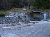 2
2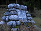 3
3 4
4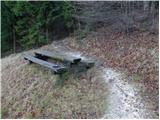 5
5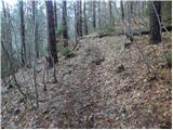 6
6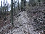 7
7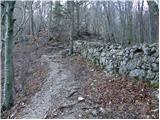 8
8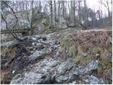 9
9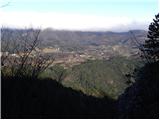 10
10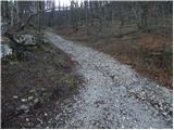 11
11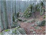 12
12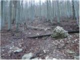 13
13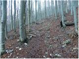 14
14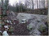 15
15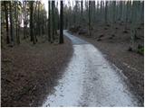 16
16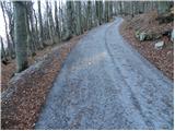 17
17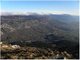 18
18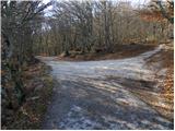 19
19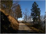 20
20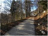 21
21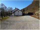 22
22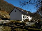 23
23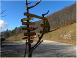 24
24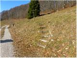 25
25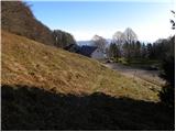 26
26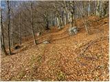 27
27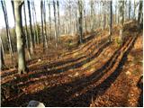 28
28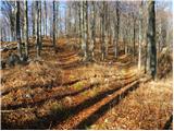 29
29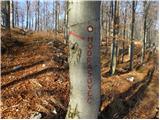 30
30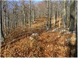 31
31 32
32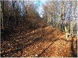 33
33 34
34 35
35
Discussion about the trip Predmeja - Veliki Modrasovec
To post a comment you must log in:
If you do not yet have a username, you must first
register.