Prelaz Vrhe - Donačka gora (eastern peak)
Starting point: Prelaz Vrhe (426 m)
| Latitude/Longitude: | 46,25830°N 15,75860°E |
| |
Walking time: 1 h 15 min
Difficulty: difficult marked way
Elevation gain: 457 m
Elevation difference along the route: 460 m
Map: Rogaška Slatina z Bočem in Donačko goro 1:25.000
Recommended equipment (summer): helmet
Recommended equipment (winter): helmet, ice axe, crampons
Views: 184
 | 1 person like this post |
Access to starting point:
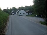
From the motorway Ljubljana - Maribor, we take the Dramlje exit and follow the road ahead in the direction of Šentjur, Rogaška Slatina and Rogatec. In Rogatec, signs for Donačka gora direct us left onto a somewhat narrower road, which we then follow towards the settlement Žetale. On a smaller pass, right at the spot where the municipality of Rogatec ends, we will notice on the right side a somewhat larger parking lot, where we park.
Route description:
From the parking lot, we first walk to the pass, where we continue on the left ascending road in the direction of Donačka gora. After a short ascent, only a few meters behind the house with thatched roof, signs for Donačka gora direct us right onto a gently sloping cart track, which after a few steps enters a short stretch of forest.
The cart track quickly emerges from the forest and then continues across a panoramic hayfield. Higher up, the path brings us to a lonely homestead, past which the marked path leads. Just a little above the mentioned farm, we join a somewhat wider cart track, which we follow to the right (left to Sveti Jurij and the church of St. Donat). The cart track, which ascends diagonally farther on, mostly through the forest, brings us to the next junction, where we continue left in the direction of Donačka gora (straight to Rudijev dom, right to Žetale).
After a short ascent on an excellently maintained path, the path from Rudijev dom joins from the right. Here we continue straight in the direction of Donačka gora on the path, which then ascends quite steeply. When the steepness eases, a traverse of steep slopes follows. The path ahead then brings us below the steep summit slope of the eastern peak of Donačka gora. A very steep ascent follows on a well-secured path to the ridge.
Here we go left (right to the western peak of Donačka gora, 20 minutes) and quickly arrive at the precipitous eastern peak of Donačka gora.

Photos:
 1
1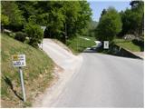 2
2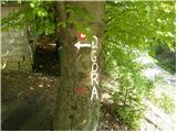 3
3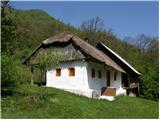 4
4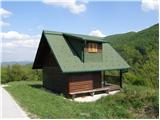 5
5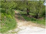 6
6 7
7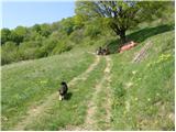 8
8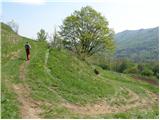 9
9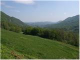 10
10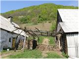 11
11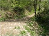 12
12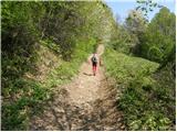 13
13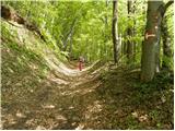 14
14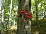 15
15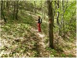 16
16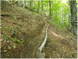 17
17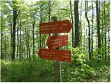 18
18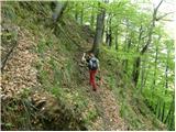 19
19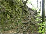 20
20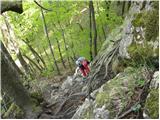 21
21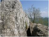 22
22
Discussion about the trip Prelaz Vrhe - Donačka gora (eastern peak)
To post a comment you must log in:
If you do not yet have a username, you must first
register.