Prelaz Vrhe - Maceljska gora (via source of Sotla)
Starting point: Prelaz Vrhe (426 m)
| Latitude/Longitude: | 46,25830°N 15,75860°E |
| |
Route name: via source of Sotla
Walking time: 1 h 50 min
Difficulty: easy marked way
Elevation gain: 292 m
Elevation difference along the route: 395 m
Map:
Recommended equipment (summer):
Recommended equipment (winter): ice axe, crampons
Views: 537
 | 1 person like this post |
Access to starting point:
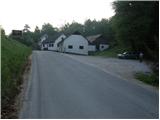
A) We leave the Štajerska motorway at the Dramlje or Slovenska Bistrica south exit, then follow the signs for Rogaška Slatina. When approaching Rogaška Slatina, we do not drive towards the settlement, but continue in the direction of Rogatec. From Rogatec we head onto the road towards Ptuj, which we follow to Vrhe Pass, where on the right side, opposite the sign marking the end of the Rogatec municipality, we notice a parking lot where we park.
B) We leave the Podravska motorway at the Zakl exit, then follow the signs for Žetale and Rogatec. When we arrive at Vrhe Saddle, at the sign marking the start of the Rogatec municipality, we turn left and park in the parking lot by the main road.
Route description:
From the parking lot past a few houses we continue in the direction towards Žetale, after a short descent, at the beginning of the settlement Čermožiše we go right onto a side road, by which there are signs for the Sotla spring, which we walk for only a few tens of meters. Here we will notice a marked cart track which turns right from the gravel road and starts to ascend moderately through the forest. We continue the ascent along the well-marked cart track, which higher up brings us to a forest road, which we follow to the left; it quickly brings us to the hunting cottage (Koserjeva koča).
Immediately behind the cottage we leave the gravel road, as the blazes direct us left onto a footpath which starts to ascend more steeply through dense forest. The path soon brings us to the wide ridge of Macelj, where it flattens out, then continues with a few shorter ascents and descents. When a nice view opens up towards Donačka gora, we leave the ridge and continue slightly to the right along a cart track which starts to descend. After a few minutes of descent we reach the next junction, where we continue sharply left (slightly right to Trlično and Lipovec). Ahead we ascend gently along the grassy cart track, then the signs for the Sotla spring direct us right onto a path, along which in one minute of further walking we descend to the spring.
From the spring we return to the cart track, along it we continue right and ascend to the state border. When the cart track reaches the state border, along the state border in two minutes we ascend to the ridge of Macelj, which we reach at a smaller saddle, by which there is a bench.
Here we go right (straight down to Žetale) and continue along the pathless ridge and along the state border. In a few minutes of further walking we arrive at the western subpeak of Maceljska gora, and a few minutes further to Maceljska gora.
Prelaz Vrhe - Sotla spring 1:30, Sotla spring - Maceljska gora 0:20.

Photos:
 1
1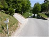 2
2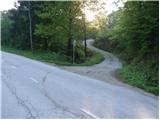 3
3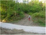 4
4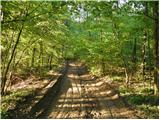 5
5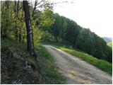 6
6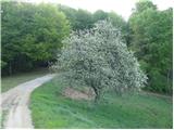 7
7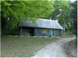 8
8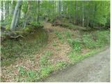 9
9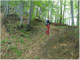 10
10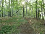 11
11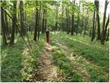 12
12 13
13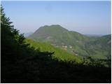 14
14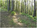 15
15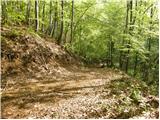 16
16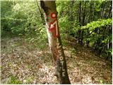 17
17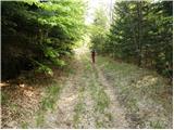 18
18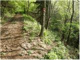 19
19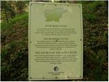 20
20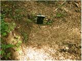 21
21 22
22 23
23 24
24 25
25 26
26 27
27 28
28 29
29 30
30 31
31 32
32 33
33 34
34
Discussion about the trip Prelaz Vrhe - Maceljska gora (via source of Sotla)
To post a comment you must log in:
If you do not yet have a username, you must first
register.