Prešnica - Grmada at Slavnik
Starting point: Prešnica (480 m)
| Latitude/Longitude: | 45,56560°N 13,94170°E |
| |
Walking time: 1 h 50 min
Difficulty: easy unmarked way
Elevation gain: 521 m
Elevation difference along the route: 550 m
Map: Primorje in Kras 1:50.000
Recommended equipment (summer):
Recommended equipment (winter):
Views: 2.710
 | 1 person like this post |
Access to starting point:
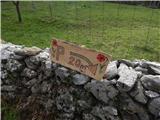
A) From the highway Ljubljana - Koper we go to the exit Kozina, and then we drive on the old road towards Koper. When on the road we get below the viaduct of the highway, we turn left in the direction of the settlement Prešnica. In Prešnica we notice the first blazes, and through the village we follow the blazes. At the smaller crossroad in the village we go right in the direction of the marked parking lot (straight marked path to Slavnik), to which we have a little less than 500 meters of driving on a narrower asphalt road.
B) From the highway Koper - Ljubljana we go to the exit Kastelec, and then we drive on the old road in the direction of Kozina. The road then leads us past the settlement Petrinje, and approximately 2 km after the settlement from the crossroad below the viaduct of the highway we continue right in the direction of the settlement Prešnica. In Prešnica we notice the first blazes, and through the village we follow the blazes. At the smaller crossroad in the village we go right in the direction of the marked parking lot (straight marked path to Slavnik), to which we have a little less than 500 meters of driving on a narrower asphalt road.
Route description:
By the parking lot we notice signs for Slavnik, which point us through the underpass under the railway track, and a little after the underpass we continue left in the direction of the mountain path to Slavnik. There follow a few more junctions, where we follow the signs for Slavnik, and a little higher a path joins from the left, which leads from the center of the village Prešnica.
We continue right and continue the ascent on the path, which then for quite some time ascends transversely towards the right. Higher, the path leads us past an interesting vantage point, from which a nice view opens up, which reaches all the way to the sea. A few minutes ahead from the viewpoint the path, which was most of the time steadily moderately ascending, flattens and crosses the macadam road (left Hrpelje, right Slavnik and Podgorje).
Next follows an easy ascent, and then we cross another road, a little after the crossing a marked path from Hrpelje also joins from the left.
We continue in the direction of Slavnik, on the path which after the sign, which marks the natural monument Slavnik, starts to ascend a little more steeply. The path quickly flattens and right before we reach the macadam road, an unmarked path branches off to the right, on which in a few minutes we ascend to the summit of Grmada, where a fire protection observatory stands.
Description and pictures refer to the condition in the year 2018 (April).

Photos:
 1
1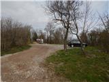 2
2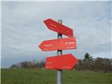 3
3 4
4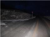 5
5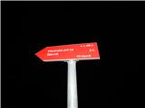 6
6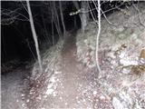 7
7 8
8 9
9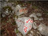 10
10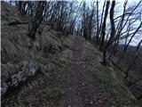 11
11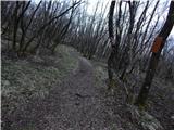 12
12 13
13 14
14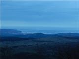 15
15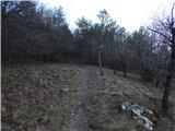 16
16 17
17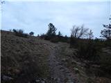 18
18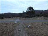 19
19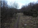 20
20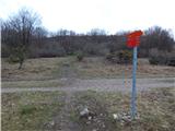 21
21 22
22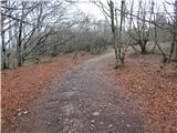 23
23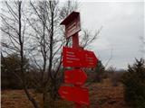 24
24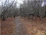 25
25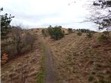 26
26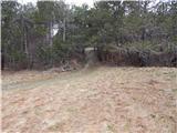 27
27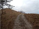 28
28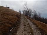 29
29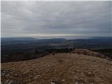 30
30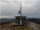 31
31 32
32
Discussion about the trip Prešnica - Grmada at Slavnik
|
| saram12. 04. 2025 18:13:32 |
Today via this path to Grmada and Slavnik. Nice path suitable for all hikers. Well marked and quite frequented. Parking lot is free, which counts for something. And in the hut they have such good tea for 1 euro.
|
|
|
To post a comment you must log in:
If you do not yet have a username, you must first
register.