Prešnica - Hrpeljska gora
Starting point: Prešnica (480 m)
| Latitude/Longitude: | 45,56560°N 13,94170°E |
| |
Walking time: 1 h 20 min
Difficulty: easy unmarked way, easy marked way
Elevation gain: 257 m
Elevation difference along the route: 290 m
Map: Primorje in Kras 1:50.000
Recommended equipment (summer):
Recommended equipment (winter):
Views: 1.230
 | 1 person like this post |
Access to starting point:
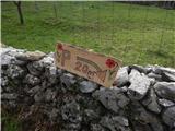
A) From the Ljubljana - Koper highway, take the Kozina exit, then drive along the old road towards Koper. When you arrive under the highway viaduct along the road, turn left towards the Prešnica settlement. In Prešnica, notice the first blazes, and through the village follow the blazes. At the smaller crossroads in the village, go right towards the marked parking lot (straight ahead marked path to Slavnik), to which there is still less than 500 m of driving on a narrower asphalt road.
B) From the Koper - Ljubljana highway, take the Kastelec exit, then drive along the old road towards Kozina. The road leads past the Petrinje settlement, and about 2 km after the settlement, at the crossroads under the highway viaduct, continue right towards the Prešnica settlement. In Prešnica, notice the first blazes, and through the village follow the blazes. At the smaller crossroads in the village, go right towards the marked parking lot (straight ahead marked path to Slavnik), to which there is still less than 500 m of driving on a narrower asphalt road.
Route description:
From the parking lot, we return to Prešnica, then from the crossroads where the path to Slavnik branches off to the right and the main road continues to the left, we continue straight uphill on the narrower road that continues past the chapel carved into the house wall. From the road that climbs to the last house, a nice view opens up on the lower part of the village with the church of St. Jedrt, and from the last house we continue on the cart track, a little further we join another cart track, on which we quickly ascend to the railway line. We carefully cross the fairly busy railway line and on the other side continue ascending on the cart track for a while. Higher we reach the macadam road, which we follow to the right, at the nearby crossroads we go left towards the hunting lodge. The road becomes somewhat steeper, and we follow it all the way to the hunting lodge below Glavica.
From the hunting lodge we walk to the nearby wider macadam road, which we follow in the direction of Slavnik and Koča pri Lipi. After a good 10 minutes we arrive at a smaller crossroads, where we continue on the lower left road (straight to Slavnik), which descends barely noticeably. A shorter steep ascent follows, then the road begins to descend, and during the descent we will come to the place where the path to Hrpeljska gora branches off to the left.
We continue the ascent on the marked path, which ascends moderately through the forest, and after another 10 minutes of walking on it we arrive at the panoramic summit.
Prešnica - hunting lodge 45 minutes, hunting lodge - Hrpeljska gora 35 minutes.

Photos:
 1
1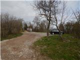 2
2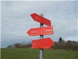 3
3 4
4 5
5 6
6 7
7 8
8 9
9 10
10 11
11 12
12 13
13 14
14 15
15 16
16 17
17 18
18 19
19 20
20 21
21 22
22 23
23 24
24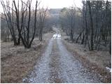 25
25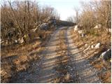 26
26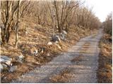 27
27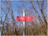 28
28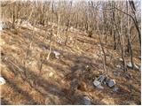 29
29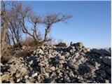 30
30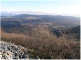 31
31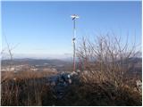 32
32
Discussion about the trip Prešnica - Hrpeljska gora
To post a comment you must log in:
If you do not yet have a username, you must first
register.