Starting point: Prešnica (480 m)
| Latitude/Longitude: | 45,56560°N 13,94170°E |
| |
Walking time: 2 h
Difficulty: easy marked way
Elevation gain: 548 m
Elevation difference along the route: 575 m
Map: Primorje in Kras 1:50.000
Recommended equipment (summer):
Recommended equipment (winter):
Views: 33.040
 | 2 people like this post |
Access to starting point:
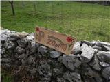
A) From the Ljubljana-Koper highway, take the Kozina exit, then drive on the old road towards Koper. When along the road we arrive under the highway viaduct, we turn left in the direction of the settlement Prešnica. In Prešnica we notice the first blazes, and through the village we follow the blazes. At the smaller intersection in the village we go right in the direction of the marked parking lot (straight marked path to Slavnik), to which we have a little less than 500 meters of driving on a narrower asphalt road.
B) From the Koper-Ljubljana highway, take the Kastelec exit, then drive on the old road in the direction of Kozina. The road then leads us past the settlement Petrinje, and approximately 2 km after the settlement at the intersection under the highway viaduct we continue right in the direction of the settlement Prešnica. In Prešnica we notice the first blazes, and through the village we follow the blazes. At the smaller intersection in the village we go right in the direction of the marked parking lot (straight marked path to Slavnik), to which we have a little less than 500 meters of driving on a narrower asphalt road.
Route description:
By the parking lot we notice signs for Slavnik, which point us through the underpass under the railway track, and a little after the underpass we continue left in the direction of the mountain path to Slavnik. There follow a few junctions, where we follow the signs for Slavnik, and a little higher from the left joins the path which leads from the center of the village Prešnica.
We go right and continue the ascent on the path which then for quite some time ascends diagonally towards the right. Higher, the path leads past an interesting vantage point, from which a nice view opens up, reaching all the way to the sea. A few minutes ahead from the viewpoint the path, which was most of the time steadily moderately ascending, flattens and crosses the macadam road (left Hrpelje, right Slavnik and Podgorje).
Next follows an easy ascent, then we cross another road, a little after the crossing from the left also joins a marked path from Hrpelje.
We continue in the direction of Slavnik, on the path which after the sign marking the natural monument Slavnik starts to ascend a little more. The path quickly flattens and right before we reach the macadam road, to the right branches an unmarked path, on which we can in a few minutes ascend to the summit of Grmada, where there is a fire observatory; we continue straight and for good 100 m continue on the road, leaving it only a little further from the spot where from the left joins the path from Skadanščina and Povžan. Next follows a pleasant walk on at first a gentle, then moderately steep grassy slope to Tumova koča on Slavnik, from which to the top of panoramic Slavnik there are only a few 10 steps.
Description and pictures refer to the condition in the year 2018 (April).

Photos:
 1
1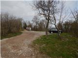 2
2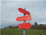 3
3 4
4 5
5 6
6 7
7 8
8 9
9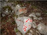 10
10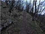 11
11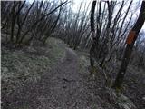 12
12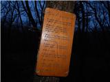 13
13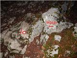 14
14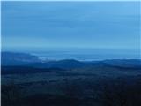 15
15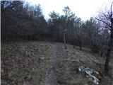 16
16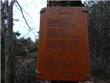 17
17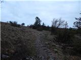 18
18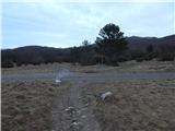 19
19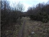 20
20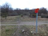 21
21 22
22 23
23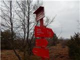 24
24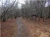 25
25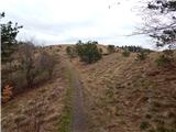 26
26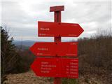 27
27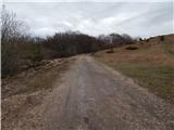 28
28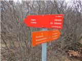 29
29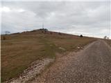 30
30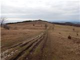 31
31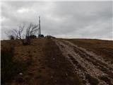 32
32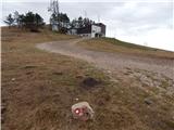 33
33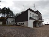 34
34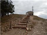 35
35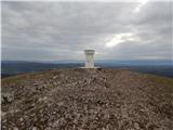 36
36 37
37
Discussion about the trip Prešnica - Slavnik
|
| zlatica18. 04. 2019 |
This is the most beautiful trail to Slavnik for me, no special steep sections, the entire time the trail leads with a gentle slope through forest and meadow sections. Particularly beautiful end of the trail along the soft flat path through pine forest from the viewpoint all the way to the exit from the forest.
|
|
|
|
| damjan8523. 04. 2019 |
Excellent Sunday hike  I made a circular route, picture 3 gave the idea I made a circular route, picture 3 gave the idea 
Prešnica - Podgorje - Slavnik - Grmada - Prešnica.
|
|
|
|
| soraya200222. 03. 2021 |
Yesterday a nice windy sunny circular....Prešnica-Grmada-Slavnik-Planina Jegno-Mišja Šoga-Lovski dom pod Glavico-Prešnica.
|
|
|
|
| TrmaD19. 05. 2024 21:21:43 |
Yesterday we did a nice "botanical" hike to Slavnik. Pleasant walking, a bit windy at the top, friendly staff at the hut. Lots of flowers along the trail.
|
|
|
|
| 11115. 05. 2025 18:00:15 |
Wonderful path...flat, mostly shaded, through a beautiful thermophilic forest, in spring scented with lilies of the valley, on the summit section plenty of flowers among which narcissi predominate. Along the path also some benches for resting. Also possibility of a circular path via Hrpelja gora. At the end of Prešnica pleasant parking without EasyPark machine.
|
|
|
To post a comment you must log in:
If you do not yet have a username, you must first
register.