Starting point: Preval (380 m)
| Latitude/Longitude: | 46,07840°N 14,43270°E |
| |
Walking time: 40 min
Difficulty: easy unmarked way
Elevation gain: 53 m
Elevation difference along the route: 100 m
Map: Ljubljana - okolica 1:50.000
Recommended equipment (summer):
Recommended equipment (winter):
Views: 6.598
 | 2 people like this post |
Access to starting point:
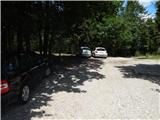
A) From the Ljubljana ring road, we head to the exit Ljubljana - Podutik, then continue driving towards Podutik. At the traffic light near the parish church in Podutik, we continue straight, then gradually start ascending towards the Preval saddle, where at the crossroads we continue right in the direction of Toško čelo (straight Dobrova). From the crossroads, we drive a few hundred meters more, then on the right side we notice a suitable parking space, where there is space for around 10 cars.
B) From the Ljubljana - Koper motorway, we head to the Brezovica exit, then continue driving towards Dobrova and Polhov Gradec. At the end of Dobrova, signs for Šentvid direct us right onto a narrower road, along which we continue driving. Further on, the road leads through Stranska vas, after which it starts ascending towards the Preval saddle. At Preval, we turn left (straight Šentvid and Podutik) and drive a few hundred meters more, then on the right side we notice a suitable parking space, where there is space for around 10 cars.
Route description:
From the starting point, on an asphalt road in a few minutes we return to Preval, where we carefully cross the main road Dobrova - Podutik, then next to the cross we continue into the forest on a marked path which leads towards the final bus stop in Podutik. From Preval the path first moderately ascends, then flattens and soon splits into two parts. The left path leads further towards Podutik while we continue slightly right on an unmarked path which leads towards Stražni vrh, Klobuk, Bokalce... Although the path further on is not marked, we can notice some unofficial marks next to it, and orientation due to the good troddenness of the "main" path is not particularly difficult.
From the fork onwards the path for a short time gently ascends, then descends to a smaller saddle, where there is a junction of several cart tracks. From the junction we continue slightly right, so that we continue the path transversely to the right, where a bit further the path leads past an intermittent spring. Soon after the spring the path splits again, and we continue straight (left Stražni vrh 5 minutes) on the path which gradually descends. The transverse descent soon ends, and along the path we notice signs for the open-door farm at Jurčk. We continue in the mentioned direction, at the next junctions we follow the signs for the hunting hut. A few minutes of moderate ascent follow and the forest path brings us without major difficulties to the Hunting Hut on Klobuk.

Along the route: Preval (369m)
Photos:
 1
1 2
2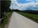 3
3 4
4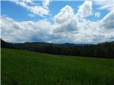 5
5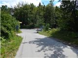 6
6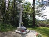 7
7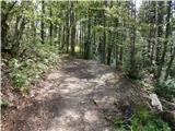 8
8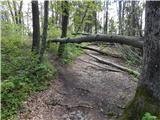 9
9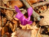 10
10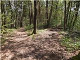 11
11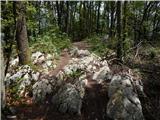 12
12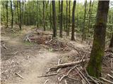 13
13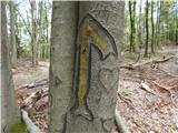 14
14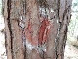 15
15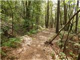 16
16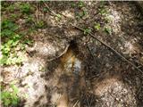 17
17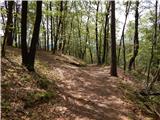 18
18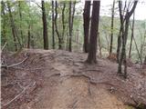 19
19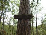 20
20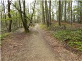 21
21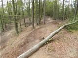 22
22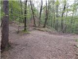 23
23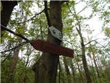 24
24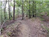 25
25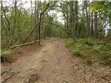 26
26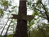 27
27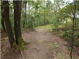 28
28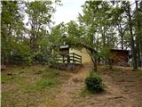 29
29 30
30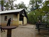 31
31
Discussion about the trip Preval - Koča Klobuk
To post a comment you must log in:
If you do not yet have a username, you must first
register.