Starting point: Preval (924 m)
| Latitude/Longitude: | 46,16960°N 14,19190°E |
| |
Walking time: 3 h 15 min
Difficulty: easy marked way
Elevation gain: 469 m
Elevation difference along the route: 800 m
Map: Škofjeloško in Cerkljansko hribovje 1:50.000
Recommended equipment (summer):
Recommended equipment (winter): ice axe, crampons
Views: 1.090
 | 1 person like this post |
Access to starting point:
A) From Škofja Loka we drive towards Železniki or vice versa, but only to the village Praprotno, where signs for Stari vrh point us to the left (from the direction of Železniki after the village Bukovica we continue sharply right) on the road which brings us to the foot of the ski center Stari vrh. We continue on the asphalt road which a little further brings us to a crossroads, where we continue sharply left in the direction of the village Zapreval. From Zapreval we continue driving towards the village Javorje, but only to a smaller pass named Preval. Here we notice signs for guesthouse Stari vrh - right, and we continue left, where we park on the parking lot by the road.
B) We drive to Poljane nad Škofjo Loko, from where at the traffic-light-controlled crossroads we continue in the direction of the settlement Javorje. When Poljane end, the road leads us through Volča, and after the mentioned settlement, the road starts to ascend more steeply. Higher, we go through Dolenčice, and then we already arrive in Javorje, where we go left in the direction of Stari vrh and Blegoš. A little further, in the settlement Murave we go right towards Stari vrh and settlement Četena Ravan (straight Blegoš and Žetina). After Četena Ravan there follow still a few crossings, and then we arrive at the crossroads at Preval, where we go left (straight Zapreval and Škofja Loka) and then park on the parking lot by the road.
Route description:
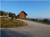
From Preval we continue in the direction of family park Stari vrh and guesthouse Stari vrh. We continue on an ascending asphalt road which leads us by the edge of the ski track, and higher also past family park Stari vrh. We continue on the asphalt road, from which soon slightly to the left branch off the circular paths "med gorami, Valentinova and hunting path". Next follows a few minutes of diagonal ascent and we arrive at the Koča na Starem vrhu.
From the hut we continue forward, bypassing the upper station of the six-seater chairlift Stari vrh on the left side, where we continue on a cart track which crosses a ski track and enters the forest. Through the forest we ascend on a cart track which makes a few hairpin turns, and at the junctions we follow the blazes. Higher, we cross the ski track once again, and then along the edge of the forest we ascend to a log cabin, where the path past the playground returns into the forest. Next follows a few more 10 steps of walking and we arrive at Stari vrh; for a nice view it is worth continuing for approximately 10 minutes to the vantage point, where there are a bench, table and registration box.
From the vantage point follows a fairly steep descent to the saddle Prehodi, where from the left the hunting path and the path from Podvrh join us.
We continue straight towards Mladi vrh, Koprivnik and Blegoš. The path ahead ascends through the forest and mostly runs along the forested southeastern ridge of Mladi vrh. Higher we follow the blazes, and the ridge turns a little to the right, so we continue walking towards the north. Next follows a few minutes of ascent and the path brings us to Mladi vrh, where there is a bench and from which some views open up.
From Mladi vrh we start descending towards the west, and the path after approximately 30 minutes of descent brings us to the saddle Brdo, where we reach the macadam road. We continue a few minutes on the macadam road, and then signs for Koprivnik direct us to the right onto a footpath which starts ascending through the forest. The path ahead leads us on cart tracks, where at the junctions we follow the blazes, and higher from a few clearings a nice view opens up on the neighbouring Mladi vrh. For some time we still walk on a relatively well-marked cart track, and then it changes into a footpath which through the last meadow brings us into the forest and a little further to the top of Koprivnik.
Preval - Koča na Starem vrhu 0:20, Koča na Starem vrhu - Stari vrh 0:30, Stari vrh - Prehodi 0:20, Prehodi - Mladi vrh 0:50, Mladi vrh - Brdo 0:30, Brdo - Koprivnik 0:45.

Along the route: Koča na Starem vrhu (1032m), Stari vrh (1217m), Prehodi (1125m), Mladi vrh (1374m), Brdo (1144m)
Photos:
 1
1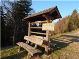 2
2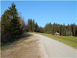 3
3 4
4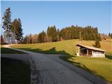 5
5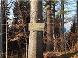 6
6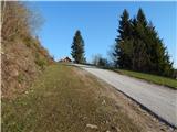 7
7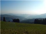 8
8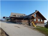 9
9 10
10 11
11 12
12 13
13 14
14 15
15 16
16 17
17 18
18 19
19 20
20 21
21 22
22 23
23 24
24 25
25 26
26 27
27 28
28 29
29 30
30 31
31 32
32 33
33 34
34 35
35 36
36 37
37 38
38 39
39 40
40 41
41 42
42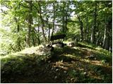 43
43 44
44 45
45 46
46 47
47 48
48 49
49 50
50 51
51 52
52 53
53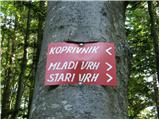 54
54 55
55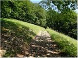 56
56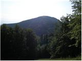 57
57 58
58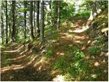 59
59 60
60 61
61 62
62 63
63 64
64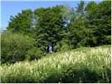 65
65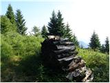 66
66 67
67 68
68 69
69
Discussion about the trip Preval - Koprivnik
To post a comment you must log in:
If you do not yet have a username, you must first
register.