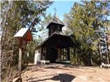
Prevalje - Brinjeva gora (above Prevalje) (south path)
Starting point: Prevalje (409 m)
Starting point Lat/Lon: 46.5489°N 14.9282°E 
Path name: south path
Time of walking: 1 h
Difficulty: easy unmarked way
Difficulty of skiing: no data
Altitude difference: 314 m
Altitude difference (by path): 320 m
Map: Koroška 1:50.000
Access to starting point:
We drive on Prevalje (to here from Mežica, border crossing Holmec or Ravne na Koroškem), where from the roundabout in the center of the settlement, we drive on exit in the direction of Retirement home Na Fari and settlement Na Fari. When we get to a bus stop in front of the inn and pizzeria Krištan-Sonjak, there is the beginning of the described path. At the starting point, there aren't any appropriate parking spots, therefore we park on an appropriate place somewhere nearby.
Path description:
From the starting point, we walk to a smaller roundabout, from which we continue "straight". The road then leads us through the underpass under the railway track, and a little higher we get to the crossroad, where we continue right in the direction of Bar pri Hanni (left farm Pušnik and settlement Rožej). Some ascending follows on an asphalt road, and then we get to the next crossroad, where we continue right (straight Bar pri Hanni). A little further, the road once again splits, this time we choose a slightly left road (slightly right a homestead Črepnik). At the next crossroad, we continue sharply left and then we go after few steps right, on the edge of a meadow, where further we are ascending by the edge of the forest. A little further, we get closer to the nearby houses, and we don't step on the road which leads to them, but we continue straight in the forest, where we continue on a cart track. The path ahead leads us on a cart track which it is moderately ascending towards the right, at the crossings we continue straight (on this part because of the fallen trees, which are consequences of strong wind, there's a little harder orientation). Past some small statues we get to a meadow, on which we continue by left upper edge, when on the left, in the forest appears a beaten footpath, we go there and we continue there to the nearby peak Brinjeva gora.
Description and pictures refer to a condition in the year 2018 (March).
Pictures:
 1
1 2
2 3
3 4
4 5
5 6
6 7
7 8
8 9
9 10
10 11
11 12
12 13
13 14
14 15
15 16
16 17
17 18
18 19
19 20
20 21
21 22
22 23
23 24
24 25
25 26
26 27
27 28
28 29
29