Pri Rupah - Brda (east path)
Starting point: Pri Rupah (1350 m)
| Latitude/Longitude: | 46,36590°N 13,93420°E |
| |
Route name: east path
Walking time: 2 h
Difficulty: easy marked way
Elevation gain: 658 m
Elevation difference along the route: 670 m
Map: TNP 1:50.000
Recommended equipment (summer):
Recommended equipment (winter): ice axe, crampons
Views: 3.450
 | 1 person like this post |
Access to starting point:
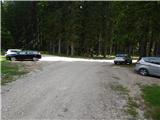
A) From Bled, Jesenice or Bohinj we drive to Pokljuka, more precisely to Mrzli studenec (Mrzli studenec is located immediately after the crossroad, where the roads from Bohinj and Bled side join). From the crossroad we continue another about 50 meters on the main road towards Rudno polje, then we go right onto the forest road in the direction of Blejska koča and Debela peč. At the next crossroads we follow the road in the direction of the mountain pasture (Za)Javornik. The road then runs past the mentioned mountain pasture and a good kilometer further brings us to the parking lot at the monument to fallen NOB soldiers Pri Rupah. From Mrzli studenec to the starting point is a little less than 6 km of macadam road.
B) From Bled, Jesenice or Bohinj we drive to Pokljuka, more precisely to Mrzli studenec (Mrzli studenec is located immediately after the crossroad, where the roads from Bohinj and Bled side join), then we continue driving towards Rudno polje. Further we drive past the turn-off for Šport hotel, then approximately 100 m after the road sign 4 km we turn right onto the forest road (at the crossroad we also notice signs for Blejska koča). At the crossroad after a little less than 2 km we go right, then after a further 600 m we arrive at the parking lot Pri Rupah, beside which the NOB monument is located. From Mrzli studenec to the starting point is approximately 6.5 km, of which 2.5 km macadam.
Route description:
From the starting point we continue in the direction of Blejska koča na Lipanci, on the path that past the NOB monument leads into the forest. Further, we first ascend gently, then moderately on Velika preseka, where the path leads us through the forest. Higher we cross a macadam road, then from the right the path from the mountain pasture (Za)Javornik joins. We continue straight, a few minutes higher we join a wider cart track, where we join the path from Medvedova konta.
We follow the cart track to the left, along which we quickly arrive at the grazing area. Here the path turns right and then ascends diagonally above the lower part of the pasture. Higher the cart track first crosses part of the pasture, then turns sharply right and brings us past the memorial to the central part of the mountain pasture Lipanca, where on the left side we notice Blejska koča na Lipanci.
From Blejska koča we continue right and proceed in the direction of Debela peč. A gentle ascent follows across the panoramic part of the mountain pasture Lipanca, then at the edge of the forest the path splits. We continue left on the marked path (right hunting cottage on mountain pasture Brda), which crosses the slopes to the left, then after a short ascent splits again.
We continue on the more visible right path (slightly left Lipanski vrh and Krma), which ascends gently for a few more minutes, then turns right and ascends diagonally across a short steep section. When the path brings us above the steep part we are already at the next junction, and we again continue in the direction of Debela peč (left Brda and Krma).
Ahead the path ascends only lightly for some time and runs through thin, mostly larch forest. Higher there are fewer and fewer trees, the path becomes somewhat steeper again, and when it levels out a nice view opens towards the mountains on the other side of Krma valley.
Here there is also a marked but less noticeable junction, where we go left in the direction of Brda, Lipanski vrh and Krma (right Debela peč). Ahead the path continues for a short time without major elevation changes, then transitions to the slopes of peak Brda, across which it mainly ascends diagonally. A little further the path brings us to the next junction, beside which there is usually a small cairn, and we continue right in the direction of Brda peak. From here follows less than 5 minutes of ascent and an increasingly panoramic path brings us to the 2008 m high peak.
Pri Rupah - Blejska koča 45 minutes, Pri Rupah - Brda 1:15.
Description and pictures refer to the condition in 2017 (June).

Photos:
 1
1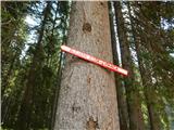 2
2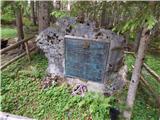 3
3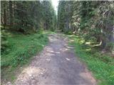 4
4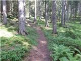 5
5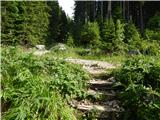 6
6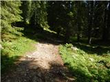 7
7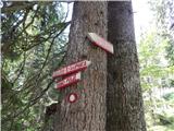 8
8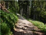 9
9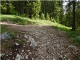 10
10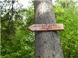 11
11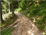 12
12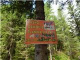 13
13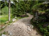 14
14 15
15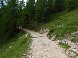 16
16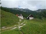 17
17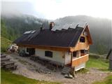 18
18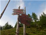 19
19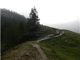 20
20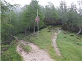 21
21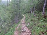 22
22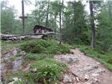 23
23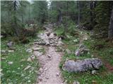 24
24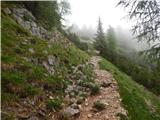 25
25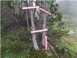 26
26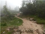 27
27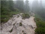 28
28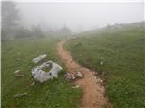 29
29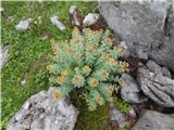 30
30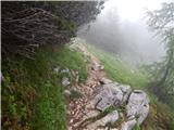 31
31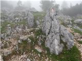 32
32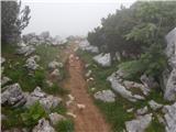 33
33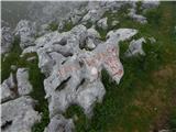 34
34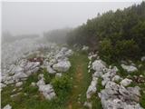 35
35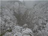 36
36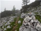 37
37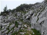 38
38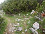 39
39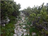 40
40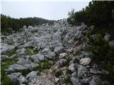 41
41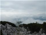 42
42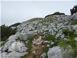 43
43 44
44
Discussion about the trip Pri Rupah - Brda (east path)
To post a comment you must log in:
If you do not yet have a username, you must first
register.