Pri Rupah - Mrežce (direct way)
Starting point: Pri Rupah (1350 m)
| Latitude/Longitude: | 46,36590°N 13,93420°E |
| |
Route name: direct way
Walking time: 1 h 40 min
Difficulty: easy marked way
Elevation gain: 615 m
Elevation difference along the route: 615 m
Map: TNP 1 : 50.000
Recommended equipment (summer):
Recommended equipment (winter): ice axe, crampons
Views: 29.383
 | 3 people like this post |
Access to starting point:
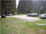
From the Ljubljana–Jesenice highway, take the Lesce exit and follow the road towards Bled; there, at the traffic-light crossroads, signs for Pokljuka direct us to the right. We follow this road, which in the lower part runs through some villages and later starts ascending more steeply, to Mrzli Studenec (mountain pasture, which is located a good 50 meters behind the crossroads, where the road to Bohinj branches off left downwards). In the middle of the mentioned mountain pasture, the road to Medvedova konta, Pri Rupah and mountain pasture Javornik branches off to the right from the main road. Here we turn right and in the next crossroads we follow the road in the direction of the mountain pasture (Za)Javornik. The road then runs past the mentioned mountain pasture and a good kilometer ahead brings us to a parking lot at the monument to fallen NOB soldiers.
Route description:
From the parking lot, we head onto the footpath towards Blejska koča on Lipanca, which past the NOB monument quickly leads us into the forest. The path, which initially ascends gently, ascends somewhat more steeply after about 10 minutes and brings us to a forest road, which we merely cross. We continue on the cart track towards Lipanca, which higher up brings us to the point where we join the path from mountain pasture Javornik. The fairly wide path, which all the time runs embraced by spruce forests, then brings us higher to the next junction, where we continue towards Lipanca (left). We continue the ascent on a very wide cart track, which in a gentle ascent brings us in a few minutes to the grazing area of mountain pasture Lipanca. Here the path turns right and leads us in a moderate ascent along the right lower edge of the mentioned mountain pasture. This is followed by crossing a grassy slope and the path, which brings us back into the forest, makes a sharp right turn at the NOB monument, after which we reach the shepherd and mountain hut on mountain pasture Lipanca.
From the hut we continue left towards Viševnik and Mrežce on the path, from which a path towards Rudno polje soon branches off left downwards. We continue straight and the moderately steep path brings us after a short ascent to the next junction, where we continue right upwards (straight: Viševnik, Debeli vrh and Mrežce gentle path) on the path, which starts to ascend steeply, first through a belt of sparse forest and higher through dwarf pines. To the increasingly panoramic path, from which a view opens onto the highest peaks of the Julian Alps, a somewhat longer gentle path joins a little below the summit. We continue right and in a few next steps step onto the summit.
Starting point - Blejska koča 45 minutes, Blejska koča - Mrežce 55 minutes.

Along the route: Blejska koča (1630m)
The trip can be extended to the following destinations: Lipanski vrh
Photos:
 1
1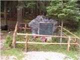 2
2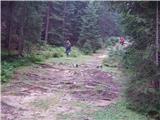 3
3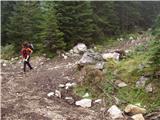 4
4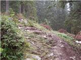 5
5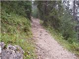 6
6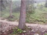 7
7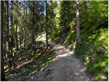 8
8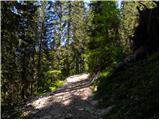 9
9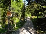 10
10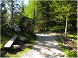 11
11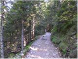 12
12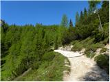 13
13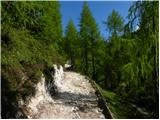 14
14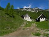 15
15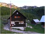 16
16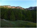 17
17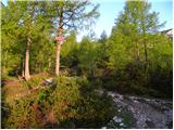 18
18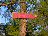 19
19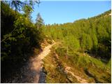 20
20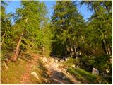 21
21 22
22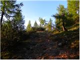 23
23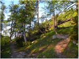 24
24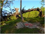 25
25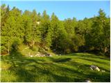 26
26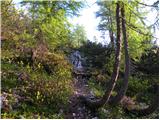 27
27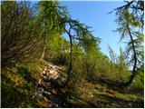 28
28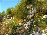 29
29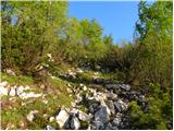 30
30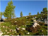 31
31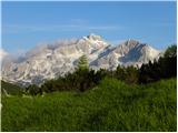 32
32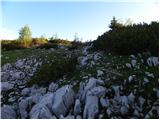 33
33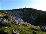 34
34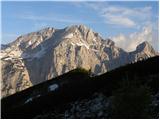 35
35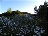 36
36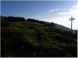 37
37 38
38
Discussion about the trip Pri Rupah - Mrežce (direct way)
|
| Branee28. 04. 2012 |
Yesterday right after "night" directly up  . .
It was a phenomenal day. From Blejska koča onwards it was sinking over the knees up to the top.
Fox
Triglav
Enter here
|
|
|
|
| grega_p29. 07. 2012 |
Invitation to this SUPER viewpoint via the path that leads past blueberries, forest strawberries, raspberries, mushrooms, spruces, larches, cows, Lipance, dwarf pines...
I suggest a circular path downhill the easier way or even a much longer detour to Viševnik and Rudno polje (best to leave the car there then).
p.s. upon looking from the top into Krma gravity might pull you
|
|
|
|
| Borut112. 09. 2020 |
What is the current condition of the road to the parking lot at Pri Rupah?
|
|
|
|
| garmont12. 09. 2020 |
I parked there last week. The road from Mrzli studenec, past Medvedova konta to Rupa is great.
The other one that branches off behind Šport hotel is also perfectly fine.
|
|
|
|
| orchigu7. 08. 2021 22:12:16 |
Walked today, 7.8.2021. The road is really okay, of course a bit more potholed in some sections, but super compared to most other such roads (no problem for an old biker, if that's a reference point for someone  ). The path is very nice everywhere, where the description says it's less visible etc. - you can't get lost either to Lipanski vrh it was a bit muddy and crumbly this time (especially on descent from Mrežce, where there is no chain), so we decided Lipanski vrh waits this time. Otherwise a fun path, also for children, offer and service at Blejska koča pleasant (and also very crowded). For hikers with moderate fitness it takes a minute or so less than described. On Pokljuka at this time lots of blueberries, great for the end of such a fun, undemanding outing ). The path is very nice everywhere, where the description says it's less visible etc. - you can't get lost either to Lipanski vrh it was a bit muddy and crumbly this time (especially on descent from Mrežce, where there is no chain), so we decided Lipanski vrh waits this time. Otherwise a fun path, also for children, offer and service at Blejska koča pleasant (and also very crowded). For hikers with moderate fitness it takes a minute or so less than described. On Pokljuka at this time lots of blueberries, great for the end of such a fun, undemanding outing
|
|
|
|
| Majdag21. 07. 2024 15:50:31 |
19.7. ....Mrežce from the monument.
The path is wonderful, all surrounded by flowers. When the first summit views appear, the meadows are full of flowers. As if the wind had scattered all that colorful beauty, wonderful. Only the summits were in clouds, but full of visitors. Mountaineer's paradise, and not far away, beautiful...
https://jelenkamenmajdag.blogspot.com/2024/07/mrezce-odete-v-cvetne-poljane.html
|
|
|
To post a comment you must log in:
If you do not yet have a username, you must first
register.