Pri Žagi (Javorniški Rovt) - Alničje
Starting point: Pri Žagi (Javorniški Rovt) (885 m)
| Latitude/Longitude: | 46,45390°N 14,09750°E |
| |
Walking time: 1 h
Difficulty: easy unmarked way
Elevation gain: 260 m
Elevation difference along the route: 260 m
Map: Karavanke - osrednji del 1:50.000
Recommended equipment (summer):
Recommended equipment (winter): ice axe, crampons
Views: 6.466
 | 3 people like this post |
Access to starting point:
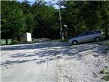
From the Ljubljana - Jesenice highway we take the Lipce exit, and turning right we drive towards Jesenice. In the settlement Javornik at the first traffic-light intersection we drive right (direction Lj.) towards Koroška Bela. At the next crossroad with a traffic light we turn left, and soon once again left towards Javorniški Rovt. After a few kilometers of driving uphill (when we have already arrived in the mentioned village), in a sharp left turn the macadam road branches off straight towards the Dom Trilobit hut (sign). Right before that spot on the right we notice a smaller parking lot, where our starting point is.
Route description:
From the starting point, we continue a few meters on macadam, whereupon we run into marked signposts with signs Valvazor and Gajškova pot. Here we go right, where we follow the blazes, which lead over the bridge on the right over the stream Javornik. We are on a marked path which leads towards Valvazor. At first, it ascends for a few meters, then descends back, and soon flattens. When after a few minutes of walking the path in parts even descends and soon starts gradually ascending, we again run into signposts on both sides of the path.
We follow the direction Valvazor and turn left (right Gajškova pot). A pleasant path through the forest after some time joins the cart track from the right, where on the trees we notice a quite worn-out metal signpost. We continue on the cart track which runs uphill and first turns a little to the left, later towards the summit also right. When the steepness decreases, we come to a cut part of the path, where it turns to the left. Here towards the southeast a view opens up on the west slope of Alničje. When after a few meters the path splits, we continue left following the blazes. Soon the steepness decreases and for some time we walk on a winding gentle path through the forest. When left above the path we notice rocks, we are by the stream, which we cross, and blazes here point us left again uphill. We leave the marked path and continue straight on an at-first muddy path, which at the right turn crosses the gully. From here further we walk in the direction of the south. When on the right side of the path we soon run into a wooden "half hovel", the path narrows and turns a little left, then crosses a shorter steeper part of the slope Debelo brdo (in snow danger of slipping), and at the end for a short time ascends towards the saddle Alničje. Here on the left below the spruce we notice a bench and inscription book, on the right a worn-out smaller cottage, a little ahead also a wooden shelter - roof, which offers shelter from storm. Here we go right on the ridge of Alničje, and in a short time (5 min) we reach the rocky peak, from where a view opens up towards Potoška planina, Potoški Stol, Mali vrh, partly Ajdna, and a little before our destination also on Golica and Krvavka. The peak does not have a stamp or inscription book (it is located on a saddle below the spruce). (Continuation on the ridge is not very safe, because towards the end (on the steepest part) it completely vanishes).

Photos:
 1
1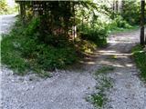 2
2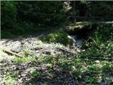 3
3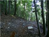 4
4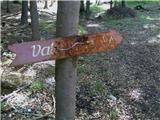 5
5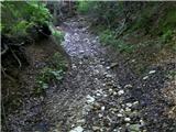 6
6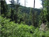 7
7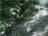 8
8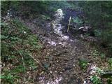 9
9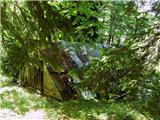 10
10 11
11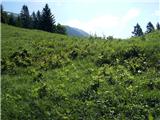 12
12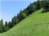 13
13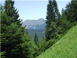 14
14 15
15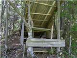 16
16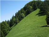 17
17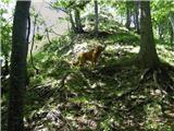 18
18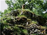 19
19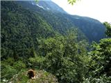 20
20
Discussion about the trip Pri Žagi (Javorniški Rovt) - Alničje
To post a comment you must log in:
If you do not yet have a username, you must first
register.