Prule - Ljubljana Castle (cart track)
Starting point: Prule (290 m)
| Latitude/Longitude: | 46,04100°N 14,50910°E |
| |
Route name: cart track
Walking time: 25 min
Difficulty: easy marked way
Elevation gain: 86 m
Elevation difference along the route: 86 m
Map: Ljubljana 1:20.000
Recommended equipment (summer):
Recommended equipment (winter):
Views: 9.329
 | 5 people like this post |
Access to starting point:
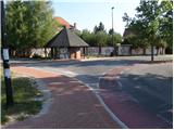
With the city bus of the Municipality of Ljubljana, we drive to the final stop of bus number 9 at Prule.
Route description:
From the bus stop we first walk to the bridge over the river Ljubljanica, then at the intersection we continue straight on the ascending road, which soon brings us to the intersection with Karlovška cesta. In the traffic-light intersection we cross the road and on the other side we continue right to the next larger intersection where we notice first an asphalted footpath that leads to the Ljubljanski grad. The wide path, which soon becomes macadam and brings us higher, takes us to a fork where we continue sharply left (the path straight joins the road to the castle). The path, which further runs through dense forest, quickly brings us to the next fork, where we continue right. The path higher brings us out of the forest onto a meadow beside which we notice a wooden cross. The path ahead slightly descends and turns slightly right, bringing us in a few minutes to a chapel. Behind the chapel the path ascends the stairs and then brings us to the parking lot on the Ljubljanski grad.
From the parking lot we walk to the castle palace from where we ascend numerous stairs to the lookout tower (ascent to the lookout tower is not free).

Photos:
 1
1 2
2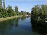 3
3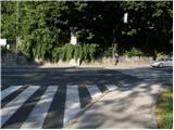 4
4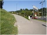 5
5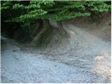 6
6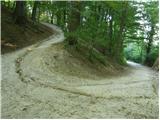 7
7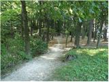 8
8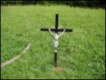 9
9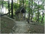 10
10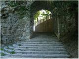 11
11 12
12 13
13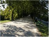 14
14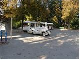 15
15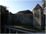 16
16
Discussion about the trip Prule - Ljubljana Castle (cart track)
To post a comment you must log in:
If you do not yet have a username, you must first
register.