Pševo - Sveti Jošt above Kranj (Sodar way)
Starting point: Pševo (530 m)
| Latitude/Longitude: | 46,23960°N 14,31900°E |
| |
Route name: Sodar way
Walking time: 45 min
Difficulty: easy marked way
Elevation gain: 315 m
Elevation difference along the route: 315 m
Map: Škofjeloško in Cerkljansko hribovje 1:50.000
Recommended equipment (summer):
Recommended equipment (winter):
Views: 103.402
 | 1 person like this post |
Access to starting point:
A) We drive to Medvode, then along the old road to Kranj, where at the first traffic light we turn left in the direction of Stražišče and Šmarjetna gora. From the roundabout, where a road towards Šmarjetna gora branches off to the right, we continue "straight" (second exit). Further on, we drive along Škofjeloška cesta, then from a somewhat larger intersection we turn right in the direction of Sv. Jošt above Kranj and Čepulj. When Kranj ends, we first drive past the starting point of the Pot prijateljev Sv. Jošta path, a little further we arrive at the starting point of Sodarjeva pot, where we park on the parking lot on the left side of the road before the beginning of the settlement Pševo.
B) From the highway Jesenice - Ljubljana we take the exit Kranj west, then along the old road towards Ljubljana. Towards the end of Kranj, at the last traffic light we turn right in the direction of Stražišče. From the roundabout, where a road towards Šmarjetna gora branches off to the right, we continue "straight" (second exit). Further on, we drive along Škofjeloška cesta, then from a somewhat larger intersection we turn right in the direction of Sv. Jošt above Kranj and Čepulj. When Kranj ends, we first drive past the starting point of the Pot prijateljev Sv. Jošta path, a little further we arrive at the starting point of Sodarjeva pot, where we park on the parking lot on the left side of the road before the beginning of the settlement Pševo.
C) From the highway Ljubljana - Jesenice we take the exit Kranj east, then we follow the signs for Škofja Loka. We leave the road towards Škofja Loka at the spot where the signs for Stražišče and Šmarjetna gora direct us right. Further on, we drive along Škofjeloška cesta, which we leave at a somewhat larger intersection and continue left in the direction of Sv. Jošt above Kranj and Čepulj (road signs are only from the opposite direction). When Kranj ends, we first drive past the starting point of the Pot prijateljev Sv. Jošta path, a little further we arrive at the starting point of Sodarjeva pot, where we park on the parking lot on the left side of the road before the beginning of the settlement Pševo.
D) We drive to Škofja Loka, then continue driving towards Kranj. When the settlement Zgornje Bitnje ends, we continue left in the direction of Stražišče and Šmarjetna gora. Further on, we drive along Škofjeloška cesta, which we leave at a somewhat larger intersection and continue left in the direction of Sv. Jošt above Kranj and Čepulj (road signs are only from the opposite direction). When Kranj ends, we first drive past the starting point of the Pot prijateljev Sv. Jošta path, a little further we arrive at the starting point of Sodarjeva pot, where we park on the parking lot on the left side of the road before the beginning of the settlement Pševo.
Route description:
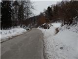
From the parking lot we first carefully cross the road, then head to Sodarjeva pot, which initially ascends parallel to the road, after a smaller meadow turns slightly right and enters a dense forest. Before we step out of the forest onto a somewhat larger meadow, the Pot prijateljev Sv. Jošta path also joins us from the right, above the meadow the path returns to the forest. In the forest the path splits, we choose the left, steeper one (straight: path past the chapel, path through the valley and Rakovica), which after a few minutes of ascent splits again.
We choose the left path again, along which there are signs "po stopnicah" (via stairs), and we begin to ascend diagonally, on a shorter section also over a few stairs.
Higher we reach a wide cart track, where most of the previously mentioned paths join us, we follow the wide path, from which nice views open a little below the summit, all the way to the top, where the Dom na Joštu hut and the church of Sv. Jošt are located.
Description and pictures refer to the condition in 2018 (February).

Photos:
 1
1 2
2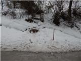 3
3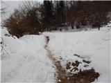 4
4 5
5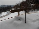 6
6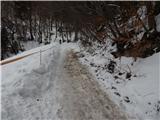 7
7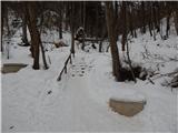 8
8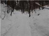 9
9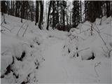 10
10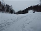 11
11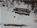 12
12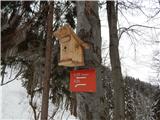 13
13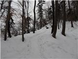 14
14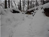 15
15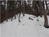 16
16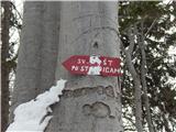 17
17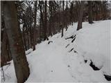 18
18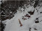 19
19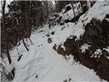 20
20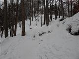 21
21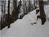 22
22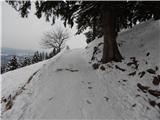 23
23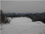 24
24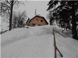 25
25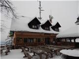 26
26 27
27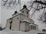 28
28 29
29
Discussion about the trip Pševo - Sveti Jošt above Kranj (Sodar way)
|
| Lucy8. 02. 2011 |
Because it was a nice warm day I went to Sveti Jošt. The path is easy and straightforward at the same time marked with blazes so you can't miss it. The food is excellent, the staff friendly and the service quick. The view from Jošt is beautiful and wonderful. I'll come again because it is a nice excursion point.
|
|
|
|
| hills11. 08. 2011 |
We decided for easier hiking  . There are many paths to Jošt, my favorite is when we leave the car right down (Tišarica) and go up... on the friends' path, "to the spring", stop at the hut, back via Sodarjeva . There are many paths to Jošt, my favorite is when we leave the car right down (Tišarica) and go up... on the friends' path, "to the spring", stop at the hut, back via Sodarjeva  ... ...
Anyway, I repeat but it's wonderful up there!!! 
|
|
|
|
| sirt19. 11. 2011 |
This path is correctly called "sodarjeva smrt". When the sodar went to Sv. Jošt, he always whined at the steepest part under Erženovo skalo: "Here will be my death!" From there the name.
The saddle between Jošt and Šmarjetno, at the foot of which you park, is called Tičnica.
No hard feelings.
|
|
|
|
| janna10. 11. 2011 |
sirt1, thanks for this info. My favorite little hill for weekdays after work.
|
|
|
|
| velkavrh12. 05. 2013 |
In the afternoon the sun came out and I used it for a pleasant short hike to Sv. Jošt. Jošt always has a lot of visitors, rain or not. Just be a bit careful on the return via the same path, as it's a bit muddy and slippery.
|
|
|
|
| KARAMELICA16. 11. 2014 |
Today we headed to Sv. Jošt nad Kranjem. We walked from Stražišče all along the asphalt to the top, I don't know it seemed to us that it would be too wet through the forest. Already soon at the beginning of the path a crowd of runners (really cool) overtook us who ran to the top. In the morning first we didn't know whether to go or not because it was raining, but we didn't regret it as it then "cleared up" after so many days of rain  , really nice weather. , really nice weather.
|
|
|
|
| Loni17. 11. 2014 |
Kranj winter running league has started, yesterday Jošt, the previous Sunday Kališče, this Sunday Krvavec, followed by Mohor and Brdo, and two more rounds of repetition. Pleasant addition to Sunday mornings.
|
|
|
To post a comment you must log in:
If you do not yet have a username, you must first
register.