Puštal (Na Dobravi) - Osolnik
Starting point: Puštal (Na Dobravi) (355 m)
| Latitude/Longitude: | 46,15700°N 14,31270°E |
| |
Walking time: 2 h
Difficulty: easy marked way
Elevation gain: 503 m
Elevation difference along the route: 510 m
Map: Škofjeloško in Cerkljansko hribovje 1:50.000
Recommended equipment (summer):
Recommended equipment (winter): ice axe, crampons
Views: 2.760
 | 2 people like this post |
Access to starting point:
A) From the road Medvode - Škofja Loka, at the beginning of Škofja Loka we drive in the direction of Poljanska dolina, and after the Sten tunnel we turn right towards Puštal. A little further, we turn right once again, and then we drive through Puštal, where we go above the Sten tunnel. Only a little further, a road branches off to the right, which crosses the Hrastnica stream. At the crossroad, where there are no arranged parking spots, the described path begins.
B) From Poljanska dolina we drive towards Škofja Loka, and then before the Sten tunnel we turn left towards Puštal, and at the next crossroad we go right. We then drive through Puštal, where we go above the Sten tunnel. Only a little further, a road branches off to the right, which crosses the Hrastnica stream. At the crossroad, where there are no arranged parking spots, the described path begins.
Route description:
From the crossroad, we continue straight (right the church of St. Andrew) and walk past the houses of the Puštal settlement, a little before the Puštal pri Dolencu bus stop we go slightly left onto a marked road which ascends parallel to the main road continuing along the Hratsnica valley (we leave the main road at the house numbered Puštal 163). During the transverse ascent we pass a few more houses, then continue along a cart track which enters the forest. Through the forest we initially ascend along a small valley where a small stream usually flows, then distance ourselves slightly to the left from the valley. A somewhat steeper ascent follows; on a small saddle we join another marked path from Puštal, but we continue right.
The path ahead leads us through dense forest for quite some time, where we follow the blazes. After a while we step out of the forest onto a panoramic hayfield, where the path temporarily fades slightly. Only a little higher we step onto a cart track and follow it right; it quickly brings us to a small wayside shrine and NOB monument, where we continue slightly left. Behind the monument the path turns slightly right and a little higher brings us into a strip of forest.
When we step out of the forest again, we will notice a solitary homestead on the left and a fenced pasture on the right. We continue straight along the path into the forest, which soon brings us to a macadam road that we follow right. A few minutes' walk along the road follows, then we reach a crossroad where we continue straight across the asphalt road onto a cart track. We continue along the marked cart track, which soon has several forks, but we always stick to the blazes. Higher up the cart track turns into a footpath, which begins to ascend steeply beside the pasture fence. A little further the path from Sora village joins from the left; we continue right and after a few dozen more steps arrive at the top of Osolnik, where the church of St. Mohor and Fortunatus stands.
The description refers to the situation in November 2019; the photos are from various periods.

Along the route: Vrh Rebra (682m)
Photos:
 1
1 2
2 3
3 4
4 5
5 6
6 7
7 8
8 9
9 10
10 11
11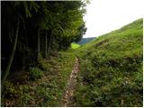 12
12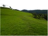 13
13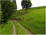 14
14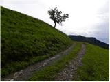 15
15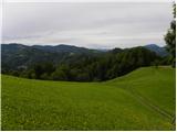 16
16 17
17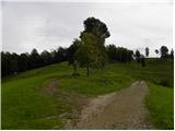 18
18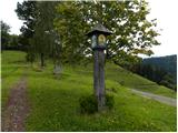 19
19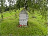 20
20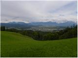 21
21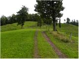 22
22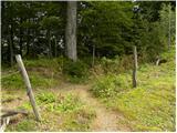 23
23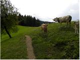 24
24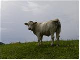 25
25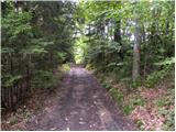 26
26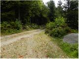 27
27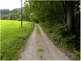 28
28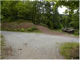 29
29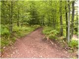 30
30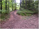 31
31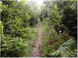 32
32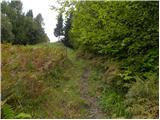 33
33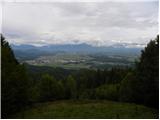 34
34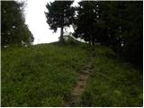 35
35 36
36 37
37
Discussion about the trip Puštal (Na Dobravi) - Osolnik
To post a comment you must log in:
If you do not yet have a username, you must first
register.