Starting point: Radlek (780 m)
| Latitude/Longitude: | 45,78340°N 14,44860°E |
| |
Walking time: 1 h 20 min
Difficulty: easy marked way
Elevation gain: 298 m
Elevation difference along the route: 340 m
Map: Snežnik 1:50.000
Recommended equipment (summer):
Recommended equipment (winter): crampons
Views: 10.307
 | 1 person like this post |
Access to starting point:
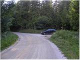
A) From the Ljubljana - Koper highway, we take the Unec exit, then continue driving towards Cerkniča and further towards Nova vas na Bloke. When we arrive at the village of Grahovo, at the crossroads by the church of St. Mary we leave the main road and continue driving left onto the local road. Further on, we first drive through the village, then the road gradually brings us into the forest, where we arrive at a smaller crossroads. We continue straight (left Martinjak) and drive on the macadam road for some time, then arrive at the sharp right turn, in the middle of which the road towards Slivnica branches off to the left. Here we continue left and then park at an appropriate place beside the road.
B) From the Ljubljana - Kočevje road at the settlement Žlebič, we head in the direction of Sodražica, then continue driving towards Bloke. At the end of Nova vas na Bloke we leave the main road which leads towards Cerkniča and continue driving right towards Velike Bloke. At the end of Velike Bloke we continue left towards Radlek, and the asphalt road quickly brings us to the mentioned village. Behind the village the asphalt ends, we continue driving on the macadam road to which soon from the left joins a worse macadam road from Bločice, and we continue straight on the road which soon enters the forest. Further, we drive past the NOB monument, after which we quickly arrive at the left turn, in the middle of which the road towards Slivnica branches off to the right. Here we turn right and then park at an appropriate place beside the road.
Route description:
From the starting point, we continue along the road beside which we have parked, which in a moderate ascent brings us to a smaller crossroads, where we continue slightly left towards Slivnica and the hunting cottage (right road leads towards Kaluže). We continue on the slightly ascending road, which we follow for approximately 30 minutes, then shortly before the nearby hunting cottage the blazes direct us left onto an initially parallel mountain path. A little further, the path from the mentioned hunting cottage also joins from the right (from the left the trail from Grahovo, the path which leads past the ruins of the church of St. Nikolaj), and we continue straight on the gradually steeper mountain path. Higher, the trail flattens and brings us out of the forest to several smaller meadows surrounded by bushes.
Further, the bushes thin out even more, and increasingly beautiful views begin to open from the path. A little further, a beautiful view also opens onto Cerkniško polje and Snežnik, and our path at this spot crosses a grassy cart track. A short ascent follows through a belt of low forest, then we join a somewhat wider cart track.
When we step onto the mentioned cart track, we continue left (right summit of Slivnica 3 minutes), and we follow it only briefly. Soon we will indeed arrive at the well-trodden path which leads from the Dom na Slivnici towards the summit of Slivnica.
Here we continue left downhill, where after a short descent we arrive at the parking lot, which we only cross. From the parking lot we continue the descent, and the path which crosses a belt of forest quickly brings us to the Dom na Slivnici.

The trip can be extended to the following destinations: Slivnica
Photos:
 1
1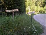 2
2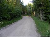 3
3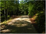 4
4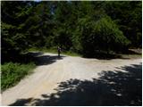 5
5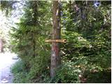 6
6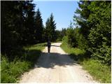 7
7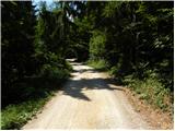 8
8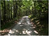 9
9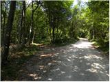 10
10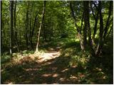 11
11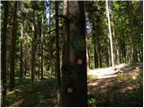 12
12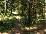 13
13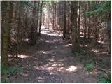 14
14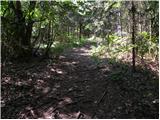 15
15 16
16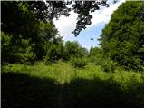 17
17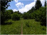 18
18 19
19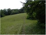 20
20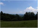 21
21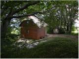 22
22 23
23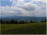 24
24 25
25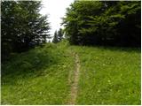 26
26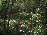 27
27 28
28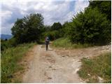 29
29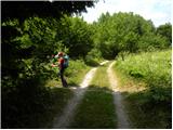 30
30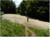 31
31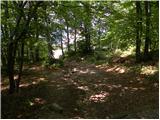 32
32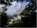 33
33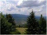 34
34
Discussion about the trip Radlek - Dom na Slivnici
|
| di9. 04. 2025 17:58:45 |
Conquered hills:
Lisec, Gladki hrib, Pogorelec, Mala Slivnica
|
|
|
To post a comment you must log in:
If you do not yet have a username, you must first
register.