Radovci (gasilski dom) - Radovci (fire station) (Graščakova pot)
Starting point: Radovci (gasilski dom) (352 m)
| Latitude/Longitude: | 46,78144°N 16,09777°E |
| |
Route name: Graščakova pot
Walking time: 4 h
Difficulty: easy marked way
Elevation gain: 0 m
Elevation difference along the route: 400 m
Map: Pomurje 1:40.000
Recommended equipment (summer):
Recommended equipment (winter):
Views: 171
 | 1 person like this post |
Access to starting point:
We drive to Murska Sobota, then follow the signs for Gederovci and Grad. In the settlement of Černelavci, we leave the road towards Gederovci and continue driving right in the direction of Grad, and also at the following intersections we follow the signs for the settlement of Grad. When we arrive at the road sign that marks the beginning of the settlements Kruplivnik and Radovci, we become attentive, as we drive along the road a bit further to the Radovci fire station, where the described trail begins. We can park 150 m before the fire station at a suitable place next to the sports field or 100 m further at the parking lot next to the cemetery.
Route description:
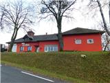
From the Radovci fire station, where the first of thirty-seven marked direction signs of the Graščak Trail is located, we continue along the road northwards, where the trail first leads past the Okrepčevalnica pri veselem Goričancu refreshment point and the Radovci cemetery. We walk along the main road for only a few minutes as the signs for the Graščak Trail direct us left onto a road that starts descending after a few steps. Lower down, the road leads past a few houses, where we follow the signs for the Graščak Trail; behind the last house in the hamlet, the trail turns onto a cart track that leads us past a beekeeper's hut into the forest. We also descend through the forest, lower down first arriving at the edge of a pasture, then the trail leads past a farmhouse, after which we descend along the access road into the valley of the Grački Stream.
Here we go right along the small stream; where the marked trail turns left, the Graščak Trail "branches". The old wooden sign for the Graščak Trail points right, the green metal one left.
The original route of the Graščak Trail went right here, but due to overgrowth it is rarely used; the left one, along which Knafelc's marks continue, leads across a meadow and joins the right one at a collapsing house.
From here onwards, the old and new signs point in the direction of the marked trail leading towards the settlement of Grad; we follow the marked trail to the point where the signs for Kripta and for the Graščak Trail direct us right up the slope. This is followed by about ten minutes of ascent through the forest, and we arrive at the castle crypt Kripta; behind it, we leave the forest and a nice view opens up over part of the Goričko landscape; with good visibility, the view extends all the way to the Alps.
Along the field, we continue to the nearby hamlet; before the hamlet, we go left onto a gravel road, along which we descend to the main road Černelavci - Grad, which we reach right at the hairpin bend.
We descend along the road for a few minutes, then carefully cross it and continue following the green signs of the Graščak Trail right into the forest, where the trail turns left. A few minutes of walking through the forest follow, and we arrive at Grad Castle on Goričko, which is considered the largest castle in Slovenia.
In front of the castle, the signs direct us left, where along the metal fence we descend to the parish church of the Assumption of Mary in the settlement of Grad. Behind the church, we reach the main road Grad - Kuzma, which we follow left, continuing along the sidewalk to the intersection below the Spar Partner store, from where we continue straight and bypass the Maxen BS Grad gas station on the right side.
From here, we continue along the road to the last house in the settlement, then go right, where after a few steps we arrive at the Marofska Chapel. Behind the chapel, we go right and begin to ascend transversely through the forest; a few minutes higher, we reach a gravel road, which we follow left, and after a few steps we reach the asphalt road, along which we begin to descend westwards. The trail further leads past a few houses; lower down, we also pass by the birthplace of Mikloš Kuzmič, who was known as a Roman Catholic priest, writer, translator, etc.
Even lower, we pass a few more houses; when we reach the main road in the valley of the Lukaj Stream, we go left (there are also some changes here compared to the original route of the Graščak Trail, which went right and then turned from the main road left across the stream and continued along the right bank of the Lukaj Stream to Pütar's Mill), and along the main road we continue past the cemetery and a few houses to a somewhat larger roundabout, where we go right in the direction of the Graščak Trail and the road sign for Murska Sobota. We do not walk long along the mentioned road as after a few minutes we arrive at Pütar's Mill, and the mill building was renovated a few years ago.
From the mill, we return back to the roundabout and continue the trail in the direction of Grad. Here the road past a small cemetery leads us into the forest, where we begin a moderate ascent; the ascent ends at the pass by the White Cross, where there is also the Okrepčevalnica pri Belem križu refreshment point.
Here the signs of the Graščak Trail direct us onto an initially still asphalted path that continues left right next to the refreshment point; lower down it becomes gravel, and we descend along the gravel road back to the Grački Stream, where we go right. For a short time further, we continue along the same route as the trail marked with Knafelc's marks, then the signs of the Graščak Trail direct us left onto an initially grassy cart track that quickly takes us into the forest. A moderate ascent follows, where we follow the signs of the Graščak Trail; higher up, the trail leads transversely to the right across a grassy section, behind which we reach a gravel road, along which we ascend to the main road Černelavci - Grad.
We reach the main road at the sports field, then go left and in a few minutes arrive at the Radovci fire station, where we started the trail.
The description and photos refer to the condition in November 2025.

Along the route: Kripta (331m),
Grad Castle in Goričko (370m), Grad (cerkev Marijinega vnebovzetja) (271m), Marofska kapela (270m), Rojstna hiša Mikloša Kuzmiča (285m), Dolnji Slaveči (239m), Pütarov mlin (233m), Beli križ (300m)
Photos:
 1
1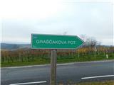 2
2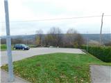 3
3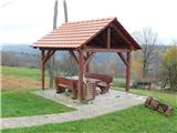 4
4 5
5 6
6 7
7 8
8 9
9 10
10 11
11 12
12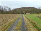 13
13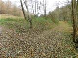 14
14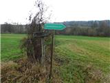 15
15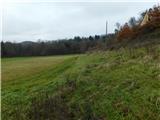 16
16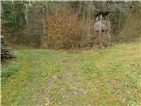 17
17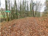 18
18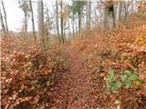 19
19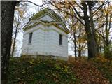 20
20 21
21 22
22 23
23 24
24 25
25 26
26 27
27 28
28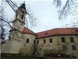 29
29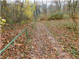 30
30 31
31 32
32 33
33 34
34 35
35 36
36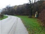 37
37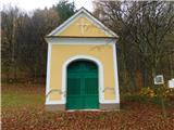 38
38 39
39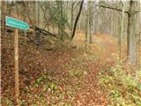 40
40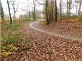 41
41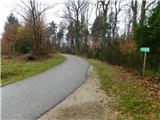 42
42 43
43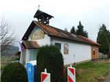 44
44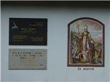 45
45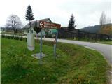 46
46 47
47 48
48 49
49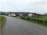 50
50 51
51 52
52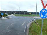 53
53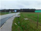 54
54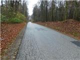 55
55 56
56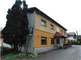 57
57 58
58 59
59 60
60 61
61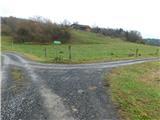 62
62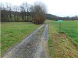 63
63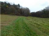 64
64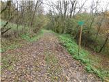 65
65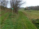 66
66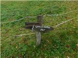 67
67 68
68 69
69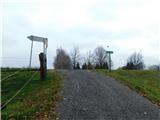 70
70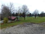 71
71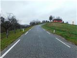 72
72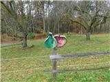 73
7374
Discussion about the trip Radovci (gasilski dom) - Radovci (fire station) (Graščakova pot)
To post a comment you must log in:
If you do not yet have a username, you must first
register.