Starting point: Radovna (695 m)
| Latitude/Longitude: | 46,42080°N 13,97720°E |
| |
Walking time: 3 h
Difficulty: easy unmarked way
Elevation gain: 926 m
Elevation difference along the route: 940 m
Map: Kranjska Gora 1:30.000
Recommended equipment (summer):
Recommended equipment (winter): ice axe, crampons
Views: 5.090
 | 2 people like this post |
Access to starting point:
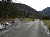
A) From the highway Ljubljana - Jesenice we take the exit Lesce and follow the road ahead towards Bled. In Bled at the traffic lights, the signs for Pokljuka direct us to the right. Ahead we drive through Spodnje and Zgornje Gorje to the village Krnica, where we leave the main road and continue driving right towards Radovna and Krnica. Through Krnica we follow the main road, then after the bridge over the river Radovna we turn left towards Mojstrana and Radovna. After a few kilometers of additional driving the asphalt ends, and we follow the macadam road over the bridge over the river Radovna. When we cross the bridge we arrive on the left side of the river (right bank), from the bridge we drive to the first turn-off of the macadam road to the left. We park on an appropriate place by the road near the junction.
B) We leave the Gorenjska highway at the exit Hrušica and follow the road ahead in the direction of Kranjska Gora. Just a little before the village Dovje, a road branches off to the left from the main road that leads to Mojstrana (Vrata, Kot and Krma). We follow the road ahead in the direction of the village Radovna and the valleys Krma and Kot. The relatively steep road then takes us past the TNP sign, behind which the road soon flattens and brings us to a junction, where a macadam road into the valley Kot branches off to the right. We continue straight on the road, which starts descending, from which quickly another road branches off to the right that leads to Krma. Here we continue straight on the main road, by which we quickly arrive at Zgornja Radovna, and at the end of the hamlet to a junction, where a second road to Krma also branches off to the right. Here we go left and continue driving on the macadam road, which we follow to the first turn-off of the road to the right. We park on an appropriate place by the road near the junction.
Route description:
From the starting point we head onto the side road, beside which there is a sign that further driving is forbidden (exceptions are landowners). Only a little further the path leads past the cottage of the Institute of Forests of Slovenia and past the green barrier, which prevents further driving (even if the barrier is open we must not continue driving, as we are warned by another traffic sign).
Further the road leads across the bare slope (consequences of the windstorm in October 2009), from which a nice view opens towards Mežakla. At the junction in the upper part of the windthrow we continue right, then gradually enter the forest. The relatively steep road higher splits again into two parts, and we again continue on the right road (the road slightly left leads towards Konavčev žleb and Zimova peč). For a short time we continue along Stresena dolina, then the road turns sharply right and ascends transversely to the next junction, where we continue sharply left on the "main" road (the right road ends in the nearby forests). Only a little above the mentioned junction we arrive at the place where the road to Frčkova planina branches off sharply to the right, and we continue straight on the gradually less steep road, which soon turns a bit more to the left. Higher the road splits again, and we continue on the right road (slightly left Pokljuka), which immediately makes a sharp right bend. Further we ascend transversely to the right, and the road higher starts turning more and more to the left, so that we gradually pass to the northern slopes of the nearby Veliki vrh (1583 m). A sharp left bend follows, then we slowly return to the eastern to southeastern slopes of Vošni vrh. We walk along the road for some more time, then, when it starts descending towards the saddle between Vošni vrh and Stresenica, we leave it and continue right on easier pathless terrain, by which in 2 minutes of further walking we arrive at the forest-covered Vošni vrh.
If from the summit we continue along the ridge towards the north we will quickly reach the northern subpeak, from which a nice view opens onto the Karawanks and Kamnik Savinja Alps.

Photos:
 1
1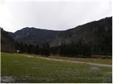 2
2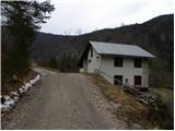 3
3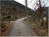 4
4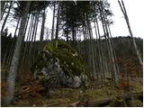 5
5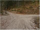 6
6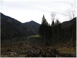 7
7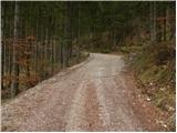 8
8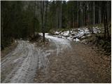 9
9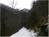 10
10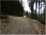 11
11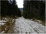 12
12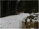 13
13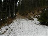 14
14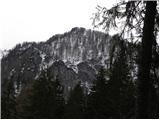 15
15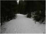 16
16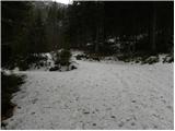 17
17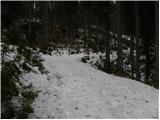 18
18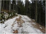 19
19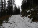 20
20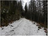 21
21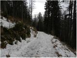 22
22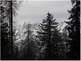 23
23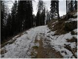 24
24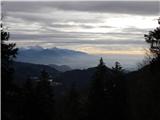 25
25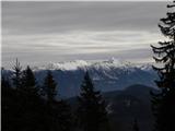 26
26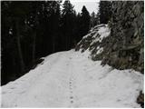 27
27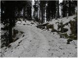 28
28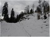 29
29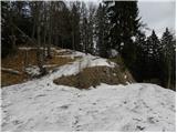 30
30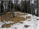 31
31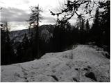 32
32 33
33 34
34
Discussion about the trip Radovna - Vošni vrh
|
| tango19. 11. 2020 |
Beautiful, warm sunny day! The trail is as described, mostly along a beautiful forest road (MTB enthusiasts would be thrilled), which occasionally offers nice views of the Karavanke. If you don't read carefully, you'll detour to the 1330 m peak along the way, which takes less than 3/4 of an hour (up and down), then continue to the overgrown summit. Really, the northern subpeak offers better views, both towards the Julijci, from Cmira to Vrtaškega Slemena, as well as towards the Karavanke and KS Alps. We could survey our previous hikes from Črna Gora to Rušnata Mlinarica and from Biščkova glava to Trta, as both ridges are clearly visible. A little snow dust from 1550 m onwards, no chamois in this area though! Otherwise, we'll have to try the variant of the Dovška priest, described in Stezicah under RKK3.
|
|
|
|
| Toni-k19. 11. 2020 |
My wife and I were up there a few years ago with MTB bikes
, it was very nice, we went all the way to the end of the road and further along the track where it no longer went anywhere.
I admit, we wanted to go to Bratova peč, but we missed the junction. But we didn't regret it, because you don't often find such beautiful forest roads
|
|
|
|
| tango26. 04. 2021 18:34:00 |
We repeated it. Forest road to the Pokljuka junction usually dry, further snowy, but since we were early it held us nicely, back we slid along fine. At the top gorgeous, a herd of chamois temporarily yielded it to us. Otherwise no living souls anywhere!
|
|
|
To post a comment you must log in:
If you do not yet have a username, you must first
register.