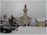
Starting point: Rakitna (789 m)
| Latitude/Longitude: | 45,89070°N 14,43970°E |
| |
Walking time: 2 h
Difficulty: easy marked way
Elevation gain: 318 m
Elevation difference along the route: 385 m
Map: Ljubljana - okolica 1:50.000
Recommended equipment (summer):
Recommended equipment (winter):
Views: 67.337
 | 1 person like this post |
Access to starting point:
From the highway Ljubljana - Koper we go to the exit Brezovica, and then we continue driving in the direction of Podpeči (to Podpeči we can also come from Črna vas or Ig). In Podpeči we continue in the direction of Borovnica, Krim and Rakitna and continue driving for a short time along the edge of the Ljubljana Moor, and then signs for Rakitna point us to the left onto a steep ascending road. The road then leads us through Preserje, where it also starts descending. After a short descent, we continue left in the direction of Krim and Rakitna, and then we follow the ascending road to the parking lot at the church on Rakitna (the road in the last part again descends a little).
Route description:
By the parking lot we notice mountain signposts for Krim and Iški Vintgar, which direct us onto an ascending road. After a short ascent, we come to an unmarked junction, where the road branches off to the left towards the nearby bar, and we continue right, where a few meters ahead we notice the blazes. After about 10 meters of additional walking we come to the next junction, where we continue on the left ascending road (right: health resort on Rakitna) and follow it for a short time to a marked junction. Here we leave the road and continue slightly right on a marked cart track in the direction of Krim (sharply right: Iški Vintgar). The path ahead ascends among meadows and in the upper part of them brings us to a junction, where we continue on the right marked cart track. We continue on the cart track, which ascends diagonally towards the right, and during the ascent we notice numerous information boards of the forest educational trail. Higher the path ascends a little steeper a few times, then it flattens and brings us to the saddle between Županov vrh and Rotovc.
Here we continue slightly left in the direction of Krim (straight: Rotovc 5 minutes) on the path which first starts gently, then moderately descends towards the nearby macadam road. When after a short descent we reach the mentioned road, we follow it to the right. We continue on the slightly ascending road, which higher brings us to the NOB monument, after which it starts descending. After a short descent, we come to the marked junction, where we continue left in the direction of Krim. We then continue along the road for some time, and then we arrive at a marked junction, where a marked path from the hunting cottage Plehanov laz joins from the left.
Here we leave the road and continue the ascent sharply right in the direction of the footpath to Krim. The path ahead steeply ascends on a wide cart track, then it flattens a little and gradually turns more and more towards the left. The path, which in the meantime has already changed from the cart track into a wide mountain path, quickly brings us to the fence of the nearby military area. We ascend along the fence, which leads us to the nearby road. When we step onto the road we follow it to the left and after a minute of additional walking we arrive at the top of Krim.

Photos:
 1
1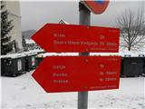 2
2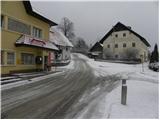 3
3 4
4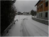 5
5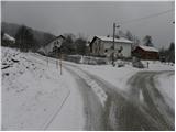 6
6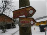 7
7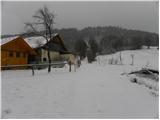 8
8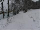 9
9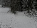 10
10 11
11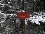 12
12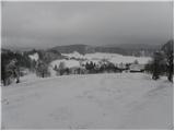 13
13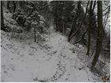 14
14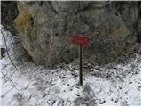 15
15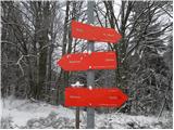 16
16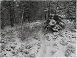 17
17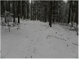 18
18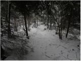 19
19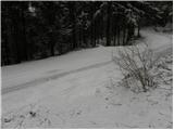 20
20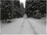 21
21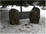 22
22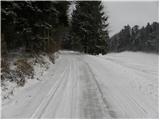 23
23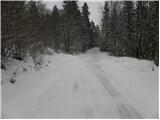 24
24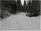 25
25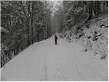 26
26 27
27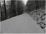 28
28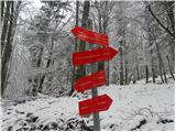 29
29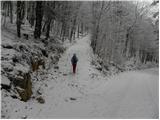 30
30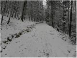 31
31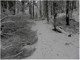 32
32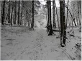 33
33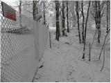 34
34 35
35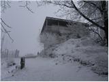 36
36 37
37
Discussion about the trip Rakitna - Krim
|
| darh19. 01. 2011 |
We climbed this trail on the first day of the year. Snow was perhaps a bit less than in these pictures, but the summit view was much better. More impressions and some trail photos here.
|
|
|
|
| VanSims27. 03. 2011 |
This path is one of the least demanding in terms of fitness approaches. The path steeply ascends only at the beginning to the saddle below Rotovec, then it's actually just a normal walk to the top (especially if at the fork just before the top we continue straight along the road).
Paths from the Iška side are much steeper and more strenuous (down went through Kramarca to Strahomer)
The disadvantage of this approach is that most of it is on gravel.
|
|
|
|
| Kokta22. 10. 2011 |
The trail to the saddle below Rotovcem and further to the road is currently bad....fallen and broken branches hinder passage...the cause is wet snow...currently the markers are less visible...otherwise it's fine 
|
|
|
|
| gmirko28. 01. 2012 |
We visited Krim today via this path, very nice, only the visibility from the summit was poor.
But the summit is quite nicely white, a bit from snow and some from frost.
|
|
|
|
| nejcf30. 09. 2018 |
Today we ascended to the summit via this path. Under the markings there was a lying figure eight all the time (infinity sign) - maybe someone knows what it means?? Otherwise, quite a few people and quite windy weather.
|
|
|
|
| Mikens23. 06. 2019 |
IMPORTANT!
I ask all hikers to keep their dogs on a leash! (bear area.)
Nice hunting regards.
Klement Mal, LD Tomišelj
|
|
|
|
| nejcf8. 03. 2021 |
taja3 thanks, I figured it out later myself, but just under two weeks ago I stamped the last stamp in the logbook.
|
|
|
To post a comment you must log in:
If you do not yet have a username, you must first
register.