Rakitna - Županov vrh (via Reber)
Starting point: Rakitna (789 m)
| Latitude/Longitude: | 45,89070°N 14,43970°E |
| |
Route name: via Reber
Walking time: 50 min
Difficulty: easy unmarked way
Elevation gain: 210 m
Elevation difference along the route: 220 m
Map: Ljubljana - okolica 1:50.000
Recommended equipment (summer):
Recommended equipment (winter):
Views: 2.341
 | 1 person like this post |
Access to starting point:
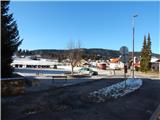
A) From the highway Ljubljana - Koper, take the Brezovica exit, then continue driving in the direction of Podpeči (to Podpeči you can also come from Črna vas or Ig). In Podpeči, continue in the direction of Borovnica, Krim and Rakitna and continue driving for a short time along the edge of the Ljubljana Moor, then the signs for Rakitna direct us to the left onto a steep ascending road. The road then leads us through Preserje, where it also starts to descend. After a short descent, continue left in the direction of Krim and Rakitna, and we then follow the mostly ascending road to Rakitna (after the turn-off for Krim the road starts descending), where we park on the parking lot by the church.
B) First, drive to Cerknica, then continue driving in the direction of Begunje; when you arrive in Begunje, follow the signs for Rakitna. When you arrive at Rakitna, park on the parking lot by the parish church at Rakitna.
Route description:
From the parking lot at the church on Rakitna we continue on the main asphalt road in the direction of Ljubljana. When we walk on the road, the path leads us past the primary school and the outdoor school playground, then we get to a smaller crossroad, where we leave the main road and continue right.
We leave the main road just before the house, on which there is an ad for the inn Gostilna pri Mari. The narrower asphalt road, on which we continue, immediately splits into two parts. We continue on the road which on the left side bypasses a bigger built chapel and which in a gentle ascent leads past a few houses. The road soon turns more to the left and at the "last" house it ends or changes into two cart tracks.
We continue on the slightly right cart track which starts ascending through gentle hayfields. After a few minutes of gentle ascent, the path past the hunting observatory brings us into the forest, through which it gradually starts ascending transversely towards the left. Higher, the path brings us out of the forest, onto panoramic slopes below the peak Reber.
Here, where from the left also joins the described path "Mesnice - Županov vrh (path over Reber)", we continue sharply right into the forest, or initially into a belt of bushes. The path, along which we further notice some blue-yellow blazes, mostly continues along the ridge, where we soon reach the indistinct and forest-covered peak Reber (923 m).
We continue on the forest ridge path, which, with the exception of the initial gentle descent, mostly ascends lightly. When the path flattens completely, it brings us out of the forest, from where a nice view opens towards the nearby Krim and Kamniško-Savinjske Alps. When the path returns to the forest, from the right another path from Rakitna joins, and we continue the path on the cart track, which a little further turns left onto the grassy slope of Županov vrh. Some gentle walking follows, then the path moderately ascends to the nearby peak, from which a nice view opens that reaches in all directions, in good weather also to Snežnik.
Description and pictures refer to the condition in 2015 (January).

Along the route: Reber (923m)
The trip can be extended to the following destinations: Rotovc
Photos:
 1
1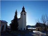 2
2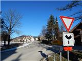 3
3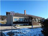 4
4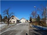 5
5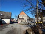 6
6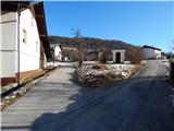 7
7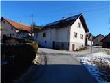 8
8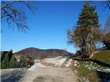 9
9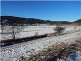 10
10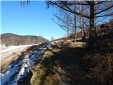 11
11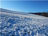 12
12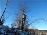 13
13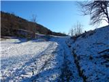 14
14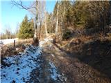 15
15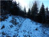 16
16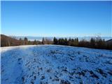 17
17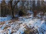 18
18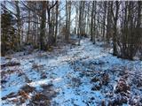 19
19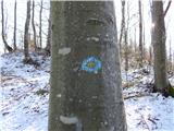 20
20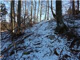 21
21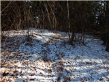 22
22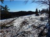 23
23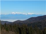 24
24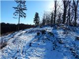 25
25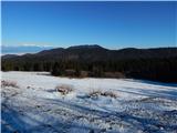 26
26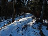 27
27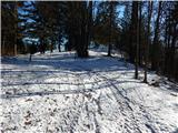 28
28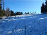 29
29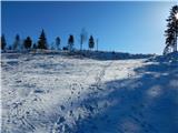 30
30 31
31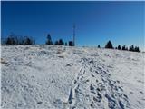 32
32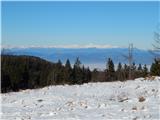 33
33 34
34 35
35
Discussion about the trip Rakitna - Županov vrh (via Reber)
To post a comment you must log in:
If you do not yet have a username, you must first
register.