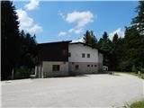
Rakov Škocjan (hotel) - Rakov Škocjan (Jamarska pot)
Starting point: Rakov Škocjan (hotel) (517 m)
| Latitude/Longitude: | 45,78840°N 14,29780°E |
| |
Route name: Jamarska pot
Walking time: 1 h 10 min
Difficulty: easy marked way
Elevation gain: 0 m
Elevation difference along the route: 75 m
Map: Snežnik 1:50.000
Recommended equipment (summer):
Recommended equipment (winter): crampons
Views: 4.500
 | 1 person like this post |
Access to starting point:
A) From the highway Ljubljana - Koper, we take the exit Unec and continue driving towards Unec. In Unec, signs for Postojna and Rakov Škocjan direct us to the right, onto the road which a little further continues directly alongside the highway. After a few kilometers from Unec, we arrive at an intersection, where signs for Rakov Škocjan direct us to the left onto a macadam road, along which we then drive to Hotel Rakov Škocjan.
B) From the highway Koper - Ljubljana, we take the exit Postojna, then continue driving on the old road towards Logatec. When Postojna ends, at the hamlet Ravbarkomanda we turn right in the direction of Unec, Rakek and Rakov Škocjan. After that, once we cross the railway track over the overpass, we continue left on the main road, then through the underpass under the highway we pass to the other side of the highway. For some time we drive alongside the highway, then signs for Rakov Škocjan direct us to the left onto a macadam road, along which we then drive to Hotel Rakov Škocjan.
C) First, we drive to Cerknica, from there we continue driving towards Unec. In the settlement Podskrajnik we continue left towards Rakov Škocjan, Zelše and the industrial zone. At the unmarked intersection in the ind. zone we continue straight, then we quickly arrive at the settlement Zelše. When the settlement ends, the asphalt soon ends too, and the road brings us to an intersection, where to the right branches off the road to the hunting lodge Lovski dom LD Cerknica, while we continue straight and continue driving to Hotel Rakov Škocjan.
Route description:
From the information board located near the hotel, we continue along the path in the direction of Veliki naravni most, bypassing the hotel on the right side. For a short time we continue through the forest alongside the hotel, then the path descends more steeply for a few steps and brings us to a marked junction, from which we continue right in the direction of Mali naravni most (left Veliki naravni most and Tkalčeva and Rakova pot). Our Jamarska pot then continues upstream along the river Rak, a little further it leads us over a small bridge to the other side of the river, where at the junction we continue right. We continue on the other side of the river, to which the path rises somewhat higher, where it continues through the forest. There follow a few junctions, where we follow the signs for Mali naravni most. Further on, the path crosses a vehicular macadam road, after which we moderately ascend and arrive at the place where, at the next information board, we make a short detour to Mali naravni most, which stands mightily above the river Rak.
From Mali naravni most we return to the last junction, then continue in the direction of Veliki naravni most. We continue along the marked path or beside the road, which descends slightly, then we quickly arrive at an intersection, from which we continue straight downhill onto the footpath, again in the direction of Veliki naravni most. After a short descent we are again by the river, where the path turns sharply to the left. For a short time we still continue along the river, then the path moves away from it somewhat to the left and in a gentle ascent brings us to the long-closed Hotel Rakov Škocjan, where we started the path.
Description and pictures refer to the condition in the year 2016 (June).

Photos:
 1
1 2
2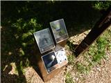 3
3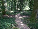 4
4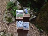 5
5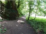 6
6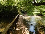 7
7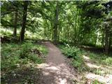 8
8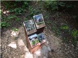 9
9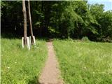 10
10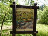 11
11 12
12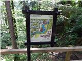 13
13 14
14 15
15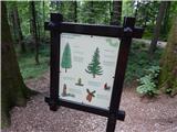 16
16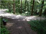 17
17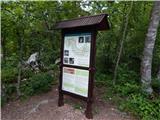 18
18 19
19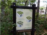 20
20 21
21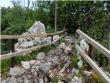 22
22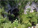 23
23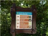 24
24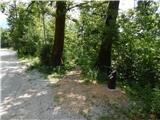 25
25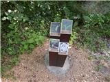 26
26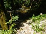 27
27 28
28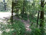 29
29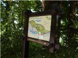 30
30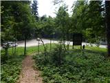 31
31 32
32
Discussion about the trip Rakov Škocjan (hotel) - Rakov Škocjan (Jamarska pot)
To post a comment you must log in:
If you do not yet have a username, you must first
register.