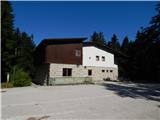
Rakov Škocjan (hotel) - Rakov Škocjan (Tkalčeva pot)
Starting point: Rakov Škocjan (hotel) (517 m)
| Latitude/Longitude: | 45,78840°N 14,29780°E |
| |
Route name: Tkalčeva pot
Walking time: 1 h 45 min
Difficulty: easy marked way
Elevation gain: 0 m
Elevation difference along the route: 100 m
Map: Snežnik 1:50.000
Recommended equipment (summer):
Recommended equipment (winter): crampons
Views: 5.510
 | 1 person like this post |
Access to starting point:
A) From the highway Ljubljana - Koper, we take the Unec exit and continue driving towards Unec. In Unec, signs for Postojna and Rakov Škocjan direct us to the right onto the road, which a little further ahead continues directly alongside the highway. After a few kilometers from Unec, we arrive at a junction, where signs for Rakov Škocjan direct us to the left onto a macadam road, along which we then drive to Hotel Rakov Škocjan.
B) From the highway Koper - Ljubljana, we take the Postojna exit, then continue driving along the old road towards Logatec. When Postojna ends, at the hamlet Ravbarkomanda we turn right in the direction of Unec, Rakek and Rakov Škocjan. After that, having crossed the railway track over the overpass, we continue left on the main road, then through the underpass under the highway we pass to the other side of the highway. For some time we drive alongside the highway, then signs for Rakov Škocjan direct us to the left onto a macadam road, along which we then drive to Hotel Rakov Škocjan.
C) First, we drive to Cerknica, from there we continue driving towards Unec. In the settlement Podskrajnik we continue left towards Rakov Škocjan, Zelše and the industrial zone. At the unmarked junction in the industrial zone we continue straight ahead, then we quickly arrive at the settlement Zelše. When the settlement ends, the asphalt soon ends too, and the road brings us to a junction, where to the right a road branches off to the hunting lodge Lovski dom LD Cerknica, while we continue straight ahead and drive on to Hotel Rakov Škocjan.
Route description:
From the hotel, by which there is an information board nicely showing Tkalčeva pot, we continue on the road which continues towards the Big natural bridge, then after some 10 steps we leave it and continue right on a cart track, on which we quickly arrive at the place where we join Rakova pot. We follow the mentioned path to the left, and it then leads us past several attractions. Behind the springs or during high waters sinkholes, Tkalčeva pot crosses to the other side of the driving road, where the path leads us past yet another attraction, by which there is an information board. We quickly return to the other side of the road, where Tkalčeva pot leads us through the forest. When we get very close to the road, the path leads us across a meadow, behind it again through the forest, where in a few minutes of further walking we arrive at the Big natural bridge, which from the marked path is located some 10 steps to the right.
At the learning board, which is located in front of the Big natural bridge, the path turns left and ascends to the macadam road, which we follow to the right. We walk on the road for a few minutes, then the path leads us left, where we quickly arrive at Tkalčeva jama, where the river Rak sinks. We can descend to the cave on a secured path, otherwise we continue ahead on the path which returns to the road. On the road we ascend to the Big natural bridge, from which a nice view opens towards the valley of the river Rak. On the bridge we once again leave the road and continue slightly left on the path, on which we quickly arrive at the ruins of the church of St. Kancijan. Some descent follows and the path returns to the road, which we follow to the left, but only to the nearby information boards.
At the boards we turn 180 degrees, then we continue the path on the road, on which we continue all the way to the hotel, by which we parked.
Description and pictures refer to the condition in 2015 (August).

Photos:
 1
1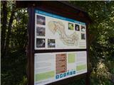 2
2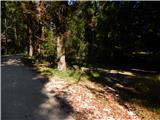 3
3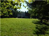 4
4 5
5 6
6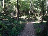 7
7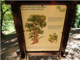 8
8 9
9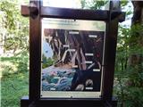 10
10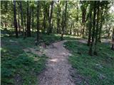 11
11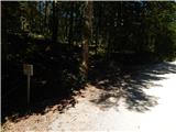 12
12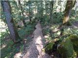 13
13 14
14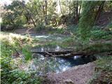 15
15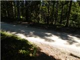 16
16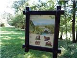 17
17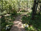 18
18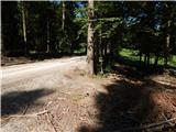 19
19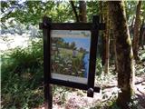 20
20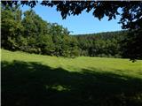 21
21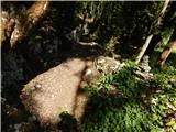 22
22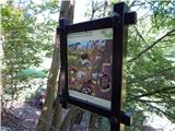 23
23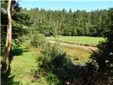 24
24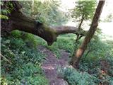 25
25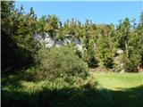 26
26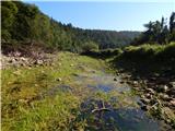 27
27 28
28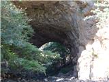 29
29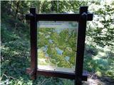 30
30 31
31 32
32 33
33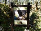 34
34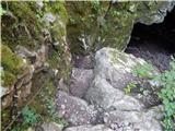 35
35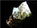 36
36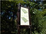 37
37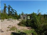 38
38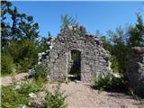 39
39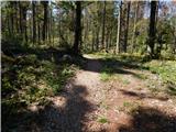 40
40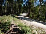 41
41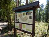 42
42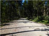 43
43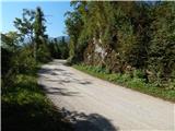 44
44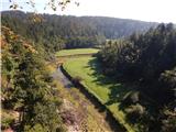 45
45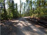 46
46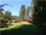 47
47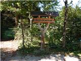 48
48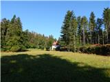 49
49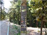 50
50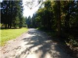 51
5152
Discussion about the trip Rakov Škocjan (hotel) - Rakov Škocjan (Tkalčeva pot)
To post a comment you must log in:
If you do not yet have a username, you must first
register.