Rašica - Rašica (Vrh Staneta Kosca) (by road)
Starting point: Rašica (400 m)
| Latitude/Longitude: | 46,13460°N 14,50430°E |
| |
Route name: by road
Walking time: 55 min
Difficulty: easy marked way
Elevation gain: 241 m
Elevation difference along the route: 241 m
Map: Ljubljana - okolica 1:50.000
Recommended equipment (summer):
Recommended equipment (winter):
Views: 38.308
 | 4 people like this post |
Access to starting point:
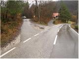
From the Trzin bypass road we go in the direction of Črnuče and follow the road ahead towards Ježica and Gameljne. Just a little before the bridge over the Sava River we turn right in the direction of the village Gameljne. We then drive through Spodnje Gameljne to the village Srednje Gameljne, where at the intersection we continue right in the direction of the village Rašica. At the beginning of the village Rašica we arrive at a smaller intersection, where a macadam road branches off to the left upwards beside which there are hiking signposts and a smaller parking lot.
Access to the starting point is possible also from Ljubljana and the Gorenjska motorway.
Route description:
From the parking lot we return to the asphalt road and ascend it to the upper part of the village, where next to the chapel we will notice signposts for the Dom na Rašici mountain hut. Here we leave the wide road and continue the ascent to the left on an ever narrower road, which soon loses its asphalt surface. The road then ascends across grassy meadows and then enters the forest, where it flattens out considerably for a short time. We follow this relatively poor and traffic-closed forest road all the way to the Dom na Rašici mountain hut.
From the hut we continue on the wide path, which after a few more steps of gentle walking brings us to the summit of Vrh Staneta Kosca, on which stands a lookout tower.
Photos:
 1
1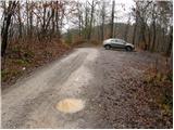 2
2 3
3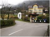 4
4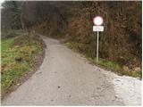 5
5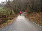 6
6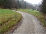 7
7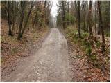 8
8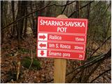 9
9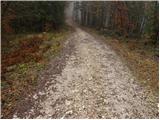 10
10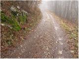 11
11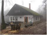 12
12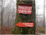 13
13 14
14
Discussion about the trip Rašica - Rašica (Vrh Staneta Kosca) (by road)
To post a comment you must log in:
If you do not yet have a username, you must first
register.