Rateče - Ofen/Peč (footpath)
Starting point: Rateče (865 m)
| Latitude/Longitude: | 46,49630°N 13,71920°E |
| |
Route name: footpath
Walking time: 1 h 40 min
Difficulty: easy marked way
Elevation gain: 643 m
Elevation difference along the route: 643 m
Map: Kranjska Gora 1:30.000
Recommended equipment (summer):
Recommended equipment (winter): ice axe, crampons
Views: 142.575
 | 3 people like this post |
Access to starting point:
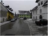
First we drive to Kranjska Gora, then we continue driving towards Rateče. At the intersection, where the road to Planica branches off to the left, and straight ahead it continues towards Italy, we turn right and drive to the center of Rateče, where we park at a suitable place.
Route description:
From the center of Rateče, we head onto the road in the direction of Tromeja. The road, which at first only gently ascends, leads us through a dense settlement, then brings us to a smaller intersection, where we continue left in the direction of Tromeja (right dead-end street). The road then leads us past a few more houses, and we quickly arrive at the next intersection, where we continue right. Here the road leads us past the yard of the nearby house, and above it the road enters the forest and changes into a somewhat steeper footpath. For some time we ascend through the forest, then we reach the forest road that leads from Rateče towards Tromeja.
We continue on the road, which becomes steeper, and we ascend along it for some time through the forest. Higher we cross a panoramic hay meadow, and the path behind it returns to the forest and brings us to a marked intersection. Here we continue straight (right Dom na Tromeji 3 minutes) and continue the path on the road, which soon makes a right bend. In the middle of the right bend a steep footpath branches off to the left, which leads to Peč - Tromeja.
Here we continue left onto the mentioned path (further on the road - Tromeja gentle path), which then begins to ascend more steeply through the forest. The path further ascends in numerous zigzags through the forest, only at numerous right turns it often brings us to the old border clearing between Slovenia and Italy.
From the clearing, from turn to turn, increasingly beautiful views open up on the Julian Alps.
Higher the trail flattens somewhat and brings us to a small hut, where there is a stamp and logbook box. Here we continue a little further and past numerous memorial markers walk to the top of Peč, which borders on three countries.

Photos:
 1
1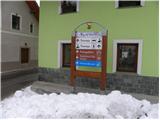 2
2 3
3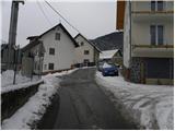 4
4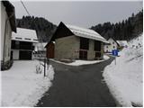 5
5 6
6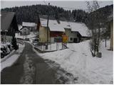 7
7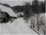 8
8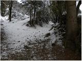 9
9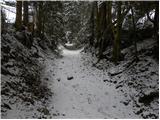 10
10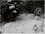 11
11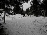 12
12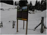 13
13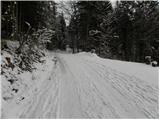 14
14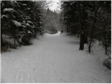 15
15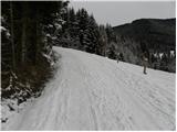 16
16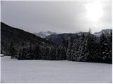 17
17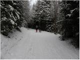 18
18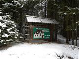 19
19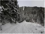 20
20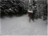 21
21 22
22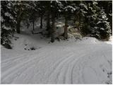 23
23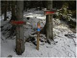 24
24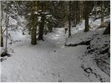 25
25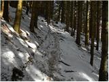 26
26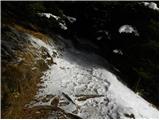 27
27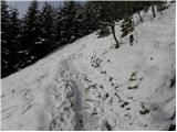 28
28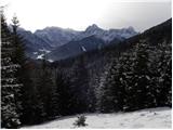 29
29 30
30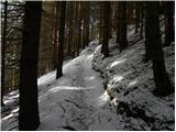 31
31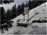 32
32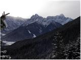 33
33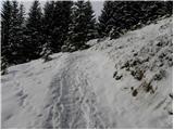 34
34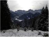 35
35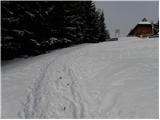 36
36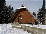 37
37 38
38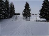 39
39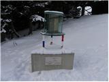 40
40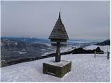 41
41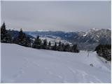 42
42
Discussion about the trip Rateče - Ofen/Peč (footpath)
|
| Gost2. 01. 2008 |
Nice hike, my friend and I treated ourselves to it on New Year's Eve night. Caution needed due to occasional ice, the midnight view from the summit of numerous fireworks on the Austrian side unforgettable! We were the only Slavs, besides a group of Romanians, no Germans. LpLj
|
|
|
|
| kris23. 01. 2010 |
or does anyone know what the path is like tomorrow, I would go?
|
|
|
|
| ajda23. 01. 2010 |
The path is well trodden and doesn't sink anywhere, not icy. I was at Tromeja yesterday, on the road though you can also sled.
|
|
|
|
| viharnik23. 01. 2010 |
The Rateče-Tromeja trail was without any issues even a week ago. Up to Dom Trilobit, a sledding track has been made along the road, and above it, it's trodden, so no problem. If you have snowshoes, the trail from Korensko sedlo is of unparalleled beauty. I tracked it not long ago and it's impossible to miss. It starts to the left (viewed from our side) at the junction of the private road to the hidden property with a house - sign on it -Mejaši-. Immediately left before the entrance to the courtyard is my track upwards. Very nice and varied trail! Read also the latest report Peč-Tromeja Karavanke.
|
|
|
|
| heinz23. 01. 2010 |
Viharnik! Dom Trilobit? ...
|
|
|
|
| viharnik24. 01. 2010 |
Yes, mixed up the name, but I think the hut in Trebiže is also called something else.
|
|
|
|
| kris24. 01. 2010 |
Today we were up there, it was nice, even though it was foggy, son really sledded down the path. Ajda, viharnik, thanks for the tip ..
|
|
|
|
| viharnik24. 01. 2010 |
No problem, I know everything!.
|
|
|
|
| ajda24. 01. 2010 |
I'm a bit happy that you enjoyed it, I liked it up there too.
|
|
|
|
| ciklama26. 11. 2011 |
With my husband we were at Tromeja (Peč) for the first time today. A bit ashamed that we've roamed the hills far and wide but hadn't been here yet. The trail is beautiful, although hard to follow to the Tromeja Hut in places due to logged trees. Otherwise wonderful day, finally sun after three weeks of fog
|
|
|
|
| janezz13. 04. 2013 |
The path really ascends gently. The views are wonderful, but there's still quite a bit of snow.
|
|
|
|
| adry18. 01. 2016 |
Yesterday sunny and cold ascent to Peč via the shorter path. Beautiful views over Planica and the Austrian and Italian side. Quite a few hikers we met. Praise to the Kranjska Gora folks for such a nicely routed forest path and good placement of benches along the path and below the summit on the sunny leeward side.
|
|
|
|
| vavtora16. 03. 2016 |
Can someone tell me if there's a lot of snow on the path and if snowshoes are needed? Thanks for the advice!
|
|
|
|
| PUHIPUHI7. 02. 2019 |
I'm wondering about the avalanche danger on this trail?
|
|
|
|
| J.P.11. 01. 2022 09:02:54 |
Over the weekend, shorter up and longer down. Lots of snow, it's soft so the path through the forest is trodden. The road path is anyway groomed with a snowcat. Plenty of sun and great views. Super tour for those conditions. LP
|
|
|
|
| Hribolazec815. 02. 2023 16:31:06 |
Today I was up there, weather for the gods, heavenly views, path super trodden, small crampons for the descent recommended, unless you go down by road or toboggan, but I can't forgive myself for not having toboggan with me, back down the road is snowcatted and everyone toboggans down, so highly recommended 
|
|
|
|
| Hrobson29. 11. 2025 15:57:29 |
Walked today, on the footpath up and down the road. Real winter fairytale with about 30 cm of snow, no cloud and good company. What could be better, best regards
|
|
|
To post a comment you must log in:
If you do not yet have a username, you must first
register.