Ravenska Kočna - Vratca (umik Žrela)
Starting point: Ravenska Kočna (1000 m)
| Latitude/Longitude: | 46,38500°N 14,53640°E |
| |
Route name: umik Žrela
Walking time: 2 h 20 min
Difficulty: difficult marked way
Elevation gain: 802 m
Elevation difference along the route: 825 m
Map: Kamniške in Savinjske Alpe 1:50.000
Recommended equipment (summer): helmet
Recommended equipment (winter): helmet, ice axe, crampons
Views: 2.520
 | 1 person like this post |
Access to starting point:
From the Ljubljana–Jesenice highway, take the Kranj–east exit and follow the road ahead towards Jezersko. At Zgornje Jezersko, just a little after the gas station, we will notice a road that branches off to the right from the main road (direction Planšarsko jezero). The road then leads us past the mentioned lake and behind it steeply ascends for a short time. Higher up, the road flattens and at the beginning of a large meadow loses the asphalt surface. We then follow the macadam road to a marked larger parking lot.
Route description:
From the parking lot, we continue on the macadam road following the signs »Češka koča, Ledine« and after approximately 15 minutes of walking, we come to a cargo cableway.
From the cargo cableway, we continue following the signs Kranjska koča na Ledinah (skozi žrelo, Slovenska pot) and Češka koča (umik žrela). At first for a short time, we walk through the forest, then the path brings us to grassy terrain which is partly covered with dwarf pines. Here the path turns slightly to the left and then ascends diagonally past sparse dwarf pines, later across scree. Such a path brings us to a junction. We head right where the inscription »Češka koča« on the rock directs us. Left leads the path to Koča na Ledinah (Slovenska pot, Skozi žrelo).
The path begins to ascend diagonally towards Češka koča (southwest). Later, the path turns slightly to the left and brings us along a slope partly covered with dwarf pines to a junction below steep walls. We continue right towards Češka koča, left leads the path through žrelo to Ledine. The path then gradually becomes a little more demanding and for most of the time with the aid of steel cable crosses a slightly exposed slope towards the west. Follows a short exposed crossing under rock overhangs, then the path becomes easier and soon brings us to Češka koča along sparse dwarf pines.
From the hut, we continue right along the path towards Kočna, Grintovec and Vratca (left Kranjska koča through Žrelo). After a short ascent, we reach flat ground marked H (intended for helicopter landing). The path ahead runs across initially gentle scree partly overgrown with dwarf pines. In the lower part of the scree, we reach a small junction where the path to Vratca branches right (slightly left Kočna and Grintovec). The path ahead ascends the scree and soon brings us to the gully below Vratca. The path through the gully is well secured but caution is needed due to falling rocks. When we exit the gully, the path turns right. From here to the top, we have only a few minutes of scenic walking. The last meters are slippery when wet.
Ravenska Kočna - Češka koča 1:35, Češka koča - Vratca 45 minutes.

Photos:
 1
1 2
2 3
3 4
4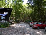 5
5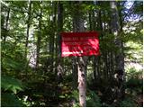 6
6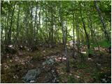 7
7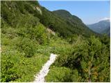 8
8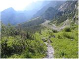 9
9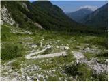 10
10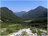 11
11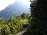 12
12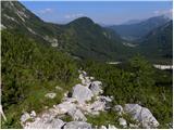 13
13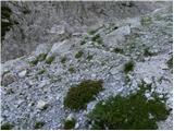 14
14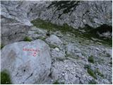 15
15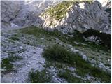 16
16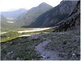 17
17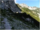 18
18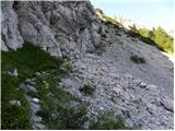 19
19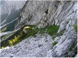 20
20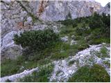 21
21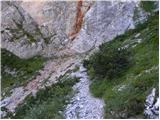 22
22 23
23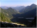 24
24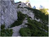 25
25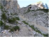 26
26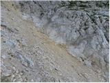 27
27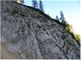 28
28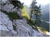 29
29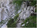 30
30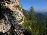 31
31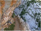 32
32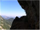 33
33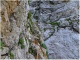 34
34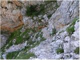 35
35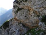 36
36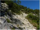 37
37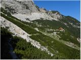 38
38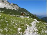 39
39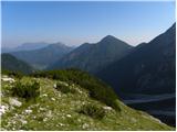 40
40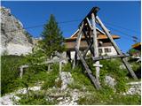 41
41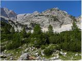 42
42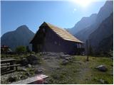 43
43 44
44 45
45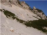 46
46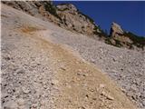 47
47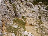 48
48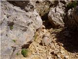 49
49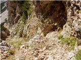 50
50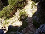 51
51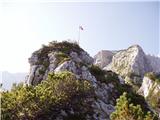 52
52 53
53
Discussion about the trip Ravenska Kočna - Vratca (umik Žrela)
|
| anica.zu1. 08. 2022 20:17:56 |
Today I went to Vratca via this path. Beautiful path, just a little repair or addition of safety gear needed in the gully right below the Vratca summit. Today it was fine because it was dry, but once I turned back due to wet rocks and insufficient safety gear.
|
|
|
To post a comment you must log in:
If you do not yet have a username, you must first
register.