Starting point: Ravne (743 m)
| Latitude/Longitude: | 45,55800°N 14,76920°E |
| |
Walking time: 1 h 30 min
Difficulty: easy marked way
Elevation gain: 449 m
Elevation difference along the route: 449 m
Map:
Recommended equipment (summer):
Recommended equipment (winter):
Views: 9.397
 | 1 person like this post |
Access to starting point:
A) First, we drive to Ribnica, and then we continue driving towards Kočevje. After Dolenja vas we continue right in the direction of Grčarice, Gotenica and Kočevska Reka. In Kočevska Reka we continue right in the direction of Borovca pri Kočevski Reki, Strma Reber pass and Osilnice. In Borovec we once again continue right, and then we get to the hamlet Ravne, we continue driving a little further, but only to a spot where by the road we notice traffic sign for 10% gradient. We park by the road, where there is enough space for that.
B) From Kočevje we drive towards the border crossing Petrina, and then at the end of the settlement Štalcerji we continue right towards Kočevska Reka. In Kočevska Reka we continue left in the direction of Borovca pri Kočevski Reki, Strma Reber pass and Osilnice. In Borovec we continue right, and then we get to the hamlet Ravne, and we continue driving a little further, but only to the spot where by the road we notice traffic sign for 10% gradient. We park by the road, where there is enough space for that.
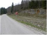
C) From Osilnica or Sel pri Osilnici we continue in the direction of settlements Žurge, Padovo pri Osilnici, Zgornji Čačič and Strma Reber pass. Further, we drive on at first slightly winding, and higher serpentine road, which after nineteen marked hairpin turns brings us to Strma Reber pass (993 m). From the pass ahead the road starts descending, and we drive to the turn-off for hunting lodge Ravne. We park near the turn-off or about 100 m ahead by the main road, where on the opposite side of the road we notice traffic sign for 10% gradient (text of course from our side is not visible), and on the right a rock with a blaze.
Route description:
On the other side of the road from the traffic sign, we notice hiking marks for Cerk, which direct us to the path that gently ascends through a meadow and in a few minutes brings us to the nearby hunting cottage (we can also start the path at the mentioned hunting cottage).
From the hunting cottage we continue slightly left on a poorly visible footpath, which quickly brings us to an animal feeding station. Further, the path enters the forest, where it continues on a moderately steep cart track. After approximately 15 minutes of walking from the starting point, the cart track splits into two parts, and we continue on the right one, along which there are initially no blazes (the left more trodden path leads to Kamniti zid and further towards Krempi). The right cart track, on which we continue the ascent, quickly brings us to the next junction, where we again notice blazes. We continue on the marked cart track, which higher changes into a poorly trodden footpath. The path further crosses a smaller torrent, then ascends to the next cart track, which we follow to the left. We continue the ascent on a rocky and leaf-covered cart track, which soon brings us to a forest road.
We continue on the forest road for some time, then marks for Cerk direct us left onto a cart track. We follow the well-marked but occasionally quite overgrown cart track all the way to a small clearing below the summit of Cerk. Here we continue slightly left, and then follow the somewhat steeper path all the way to the summit of Cerk.

Along the route: Lovski dom Ravne (760m)
Photos:
 1
1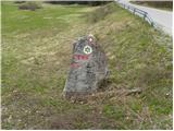 2
2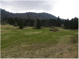 3
3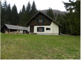 4
4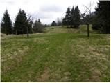 5
5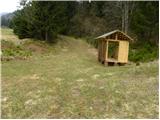 6
6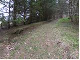 7
7 8
8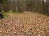 9
9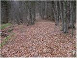 10
10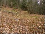 11
11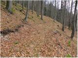 12
12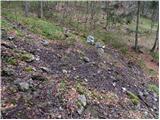 13
13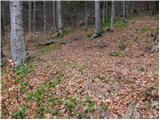 14
14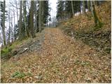 15
15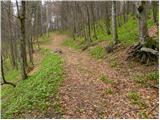 16
16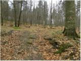 17
17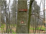 18
18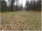 19
19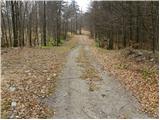 20
20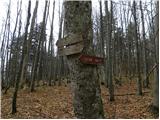 21
21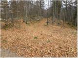 22
22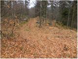 23
23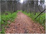 24
24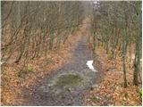 25
25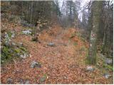 26
26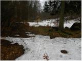 27
27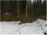 28
28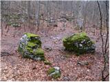 29
29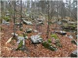 30
30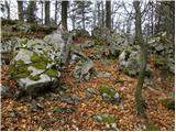 31
31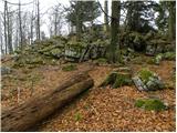 32
32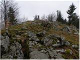 33
33 34
34 35
35
Discussion about the trip Ravne - Cerk
|
| Alenka Marinč3. 10. 2023 12:01:23 |
The path is much steeper in a considerable section than one would deduce from the photos. Appearance deceives.
|
|
|
|
| Alenka Marinč6. 02. 2025 16:11:45 |
This is not a criticism of the photographer, I want to say that the eye deceives us many times.
|
|
|
To post a comment you must log in:
If you do not yet have a username, you must first
register.