Starting point: Ravne (1177 m)
| Latitude/Longitude: | 46,42880°N 14,00550°E |
| |
Walking time: 2 h 45 min
Difficulty: easy unmarked way
Elevation gain: 416 m
Elevation difference along the route: 515 m
Map: TNP 1:50.000
Recommended equipment (summer):
Recommended equipment (winter): ice axe, crampons
Views: 9.363
 | 2 people like this post |
Access to starting point:
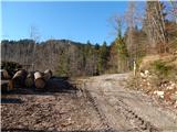
A) We leave the Gorenjska highway at the exit Jesenice east (Lipce), and then we follow the signs for Spodnje Gorje and Pokljuka. Further, we drive through the settlement Kočna, and then we already arrive in Spodnje Gorje, where we first cross the stream Rečica, and a little after the stream we go right in the direction of the settlement Zgornje Laze. Further, we drive on a narrower road which leads us through the settlement, and when the settlement Zgornje Laze ends, in a smaller valley, where the road turns semicircular to the left and where there are several crossroads, we choose the second turn-off to the right. Further, we begin to ascend towards the plateau Mežakla, when the road flattens we go past the mountain pasture Strmole and mountain pasture Ravne. At the end of the mountain pasture Ravne we continue straight (left cottage of the University of Ljubljana) and we again begin to ascend more noticeably. When we already pass onto the northwestern slopes of the peak Oblek, a cart track branches off to the left, which leads to the nearby mountain pasture Spodnji Kozjek, and we continue on a wider macadam road which a little ahead brings us to a crossroad, by which there is a marked parking lot (sign P on TNP pole), and we continue on a wider road which gradually passes into more plateau-like terrain. A few more crossroads follow, where we follow the wider road, and then at the next marked parking lot we park in an appropriate place.
B) We drive to Bled, and then we continue driving towards Pokljuka. Towards the end of the settlement Krnica we leave the main road towards Pokljuka and we continue right downwards in the direction of Radovna, Krma and Mojstrana. Some descent follows, and then over the bridge we cross the river Radovna, and after the bridge we go right in the direction of Perniki and Zgornje Laze. Further, we drive through Spodnje Laze, and when the mentioned settlement ends, in a smaller valley, the road turns semicircular to the right and where there are several crossroads, we choose the second turn-off to the left. Further, we begin to ascend towards the plateau Mežakla, when the road flattens we go past the mountain pasture Strmole and mountain pasture Ravne. At the end of the mountain pasture Ravne we continue straight (left cottage of the University of Ljubljana) and we again begin to ascend more noticeably. When we already pass onto the northwestern slopes of the peak Oblek, a cart track branches off to the left, which leads to the nearby mountain pasture Spodnji Kozjek, and we continue on a wider macadam road which a little ahead brings us to a crossroad, by which there is a marked parking lot (sign P on TNP pole), and we continue on a wider road which gradually passes into more plateau-like terrain. A few more crossroads follow, where we follow the wider road, and then at the next marked parking lot we park in an appropriate place.
Route description:
From the starting point, where the cart track branches off to the left, we continue on an ascending asphalt road which quickly brings us to a green gate and TNP pole with prohibitions and notification that we are entering the bear area. A few minutes higher we arrive at a crossroad, where we continue left (road straight semicircularly bypasses the mountain pasture Zgornji Kozjek and above it joins the road which goes left, road to the right eventually ends in the forest).
The path ahead leads us on a macadam road, from which soon a cart track branches off to the right towards the lower part of the mountain pasture Zgornji Kozjek, and a little higher also towards the upper part of the mentioned mountain pasture. In both cases we continue on the road which higher becomes quite steep, and then it joins a wider road which on the upper right side bypasses the mountain pasture.
Next follows a diagonal ascent towards the left, where we cross slopes of the peak Petelin (1448 m), and from the road occasionally nice views open up on the highest peaks of the Julian Alps. When the road passes on more western slopes it gradually starts descending and brings us to the ridge of Mežakla, where it continues with some shorter ascents and descents, and when we get closer to the northern edge of the plateau, it is worth walking to the nearby viewpoint, from which a nice view opens up on the Karawanks and settlements below us. When we leave the more plateau-like part, an ascent follows in a few hairpin turns, where occasionally still beautiful views open up, and then the road starts descending towards the mountain pasture Mežakla.
At this spot we leave it and continue left where an arrow on the TNP pole also directs us. A few minutes of ascent on a cart track follow, when it ends we continue on a worse but followable footpath which quickly brings us to the forepeak of Jerebikovec. From the forepeak an easy descent follows, and then along the northeastern ridge we reach the summit of Jerebikovec, where there is a summit logbox with a logbook and stamp and from which a nice view opens up on the Julian Alps and Karawanks; in good visibility the panorama reaches all the way to the Carnic and Gailtal Alps and High Tauern.
Description and pictures refer to the condition in 2019 (December).

Photos:
 1
1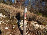 2
2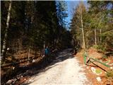 3
3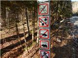 4
4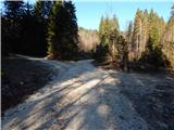 5
5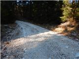 6
6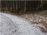 7
7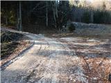 8
8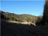 9
9 10
10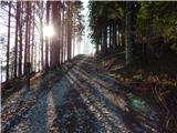 11
11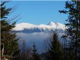 12
12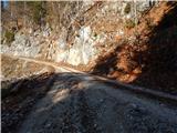 13
13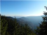 14
14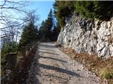 15
15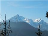 16
16 17
17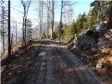 18
18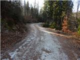 19
19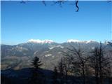 20
20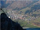 21
21 22
22 23
23 24
24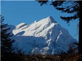 25
25 26
26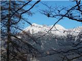 27
27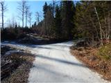 28
28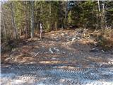 29
29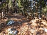 30
30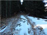 31
31 32
32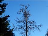 33
33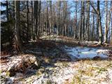 34
34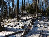 35
35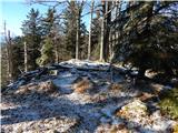 36
36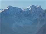 37
37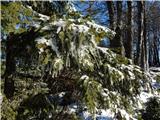 38
38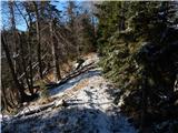 39
39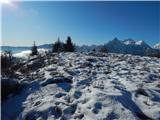 40
40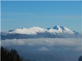 41
41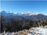 42
42
Discussion about the trip Ravne - Jerebikovec
|
| Lj23. 06. 2012 |
Here my wife and I had a small puzzle today. There is no official sign for the village of Poljane by the road, probably it's a local name for part of Spodnje Gorje. We drove from Bled - Spodnje Gorje - turnoff to Jesenice (and Blejski Vintgar) right - the turnoff to the forest road left is just under half a km before the sign marking the end of Sp. Gorje. On the forest road we drove 6 km to the mentioned partisan monument and then another 2.4 km to the second parking lot marked with a wooden post. Here we left one car and drove the other above Mojstrana and climbed up to Jerebikovec on the marked steep path. From Jerebikovec we returned to the first car on the forest road via the described direction. Interesting path where you cross a nice part of Mežakla. 
|
|
|
|
| sssr1. 05. 2018 |
Unfortunately, there are no more signs or any signposts, nor any trail markings. Thanks to Google Maps.
|
|
|
|
| Majdag9. 11. 2024 11:31:06 |
6.11... Hiking group J.Kor. Bela took the path. It was most similar to variant B of the description. Back we returned to Zgornji Kozjek along the road. Then we took it across the pasture to the road and continued to the parked cars. At the top beautiful views, the day was wonderful too. Nice, a bit different tour, elevation gain just over half a km. Nice rambling, and happy trails.
https://jelenkamenmajdag.blogspot.com/2024/11/jerebikovec-cez-pernike.html
|
|
|
To post a comment you must log in:
If you do not yet have a username, you must first
register.