Ravne - Rosenkogel/Hruški vrh (direct way)
Starting point: Ravne (1200 m)
| Latitude/Longitude: | 46,46780°N 13,99170°E |
| |
Route name: direct way
Walking time: 2 h
Difficulty: easy marked way
Elevation gain: 576 m
Elevation difference along the route: 576 m
Map: Kranjska Gora 1:30.000
Recommended equipment (summer):
Recommended equipment (winter): ice axe, crampons
Views: 13.197
 | 1 person like this post |
Access to starting point:
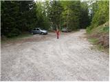
We leave the Gorenjska motorway at the Hrušica exit and follow the road ahead in the direction of Kranjska Gora, but only to the village of Dovje at Mojstrana. Here we turn right (direction Dovje) and the road quickly brings us to the mentioned village from where we continue in the direction of Dovška Baba. The road soon after the village brings us to a junction, where we continue on the right road (sharp left Kepa and Borovje). Further, we drive for quite some time to the next junction, where we turn sharply left in the direction of Dovška Baba (straight Plavški Rovt). We follow this road, which then leads us past grassy meadows named Ravne (a few holiday cottages), to a gate that prohibits further driving. We can park already a little lower on one of the parking spaces by the road (from Dovje to the starting point it is approximately 6.5 km).
Route description:
From the parking lot, we continue on the road by which we have parked. The road, which is moderately ascending and leads us past the gate, then higher flattens and brings us to a smaller saddle between Bela peč on the left and Dovška Baba on the right. We continue the ascent on the road which already after a few steps of further walking brings us to the spot where we leave it, as the blazes direct us left onto a steep footpath which further ascends through the forest. The path higher crosses a pasture fence and a short panoramic slope, then returns to the forest, where we come to a smaller unmarked junction. We continue left on the marked path (straight to the spring of the Starka well, 1 minute), which again steeply ascends, then turns a little to the right, where after a few minutes of further walking it brings us to the lower edge of the mountain pasture Dovška Rožca. Here the path turns left and after a few minutes of ascent over blooming meadows brings us to the shepherd's hut on the mountain pasture Dovška Rožca.
From the shepherd's hut, we continue right (not on the road) on a traversing footpath that gently ascends towards the east. The path soon crosses a short stretch of forest, then continues in a gentle ascent towards the saddle between Dovška Baba and Hruški vrh. This part of the path is in some places, due to crossing occasionally steep slopes, dangerous for slipping (especially when wet).
When we step onto the border ridge, we follow it to the right (east direction) and ascend along it all the way to Hruški vrh, which we reach after 10 minutes of panoramic walking.
Starting point - Dovška Rožca 1:10, Dovška Rožca - Hruški vrh 50 minutes.

Photos:
 1
1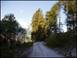 2
2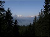 3
3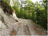 4
4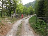 5
5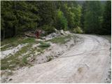 6
6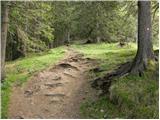 7
7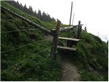 8
8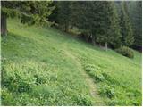 9
9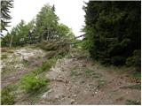 10
10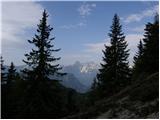 11
11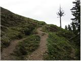 12
12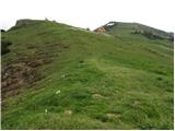 13
13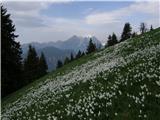 14
14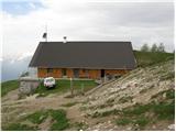 15
15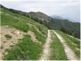 16
16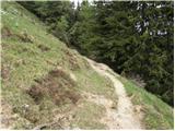 17
17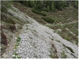 18
18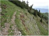 19
19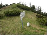 20
20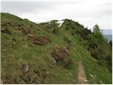 21
21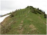 22
22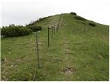 23
23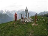 24
24 25
25
Discussion about the trip Ravne - Rosenkogel/Hruški vrh (direct way)
|
| matejd12. 06. 2010 |
I was there today, all good, nice weather and fantastic views. Walking along the border blew me away  then I extended the route to the nearby Dovška Baba, descended to the hut at Dovška Rožca and back to the parking at the ramp. I recommend it - to the top of Hruški vrh I used about 1h 10min of normal walking. then I extended the route to the nearby Dovška Baba, descended to the hut at Dovška Rožca and back to the parking at the ramp. I recommend it - to the top of Hruški vrh I used about 1h 10min of normal walking.
|
|
|
|
| lepenatka26. 05. 2023 17:09:12 |
Hello,
does anyone know what the road to Ravne is like?
Regina
|
|
|
|
| Toni-k27. 05. 2023 12:20:38 |
The road is in good condition
|
|
|
|
| lepenatka28. 05. 2023 17:08:56 |
It's true. Checked yesterday.
Thanks anyway
|
|
|
To post a comment you must log in:
If you do not yet have a username, you must first
register.