Ravne - Rušni vrh (via Planina za Črno goro)
Starting point: Ravne (730 m)
| Latitude/Longitude: | 46,25860°N 13,95920°E |
| |
Route name: via Planina za Črno goro
Walking time: 3 h 15 min
Difficulty: easy marked way, easy unmarked way
Elevation gain: 1056 m
Elevation difference along the route: 1085 m
Map: Škofjeloško in Cerkljansko hribovje 1:50.000
Recommended equipment (summer):
Recommended equipment (winter): ice axe, crampons
Views: 623
 | 2 people like this post |
Access to starting point:
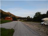
A) From the Ljubljana - Jesenice highway, we take the Lesce exit and follow the road towards Bled and further towards Bohinjska Bistrica. From Bohinjska Bistrica, we continue left in the direction of Tolmin and Soriška planina. Soon we will notice by the road the mountain signposts for Črna prst, which point to the right, but we continue straight. Only a little later we come to a crossroads, where a signpost directs us slightly to the right towards the village of Ravne. Further, we drive past a large parking lot by the former ski slope Kobla, and we follow the asphalt road, which starts to ascend steeply, to Ravne, where the road flattens. Here we continue to drive all the way to the spot where the asphalt ends. At the spot where the asphalt ends there is a larger parking lot by the inn Janez, where we park on the right side of the parking lot (the parking lot on the left side of the road is intended for guests of the inn Janez).
B) From Železniki or Petrovo Brdo we drive to Bohinjska Bistrica, where before the center of the settlement we turn left in the direction of the settlement Ravne. We follow the road, which starts to ascend steeply, to Ravne, where the road flattens. Here we continue to drive all the way to the spot where the asphalt ends. At the spot where the asphalt ends there is a larger parking lot by the inn Janez, where we park on the right side of the parking lot (the parking lot on the left side of the road is intended for guests of the inn Janez).
Route description:
From the parking lot at the inn Janez we continue in the direction of Črna prst and Orožnova koča, where at first we walk on a macadam road, from which a beautiful view opens up towards Triglav. The road after the initial ascent passes into the forest and turns a little to the left, where we quickly arrive at a marked junction.
From the junction we continue left in the direction of Črna prst, Planina za Črno goro and Orožnova koča (straight Bohinjska Bistrica and old path towards Orožnova koča). The path ahead on the right side bypasses a private house (formerly Planinski dom dr. Janeza Mencingerja), then a little further it joins a cart track, on which we continue the ascent. A little higher, at the junction we continue right, then the path continues through the forest. A little further the path leads past a log cabin and a cross, then we already arrive at a marked junction, where we continue left (right Orožnova koča).
Further on, the cart track changes into a footpath, which a little higher brings us to a forest road, which we follow to the right. We walk a few steps along the road, then the signs for Črna prst direct us left onto a steep path. We continue the ascent on an initially relatively steep path, which further leads us past artificially made channels intended for water drainage (the channel was built to prevent water ingress into the Bohinj tunnel). Higher, the path temporarily flattens completely, then moderately ascends to the Planina za Črno goro.
When we step onto the mountain pasture, the marked path turns left, then semicircularly bypasses the mountain pasture along the channel. On the other side of the mountain pasture we continue left and begin to ascend moderately through initially sparse forest. After a few minutes of further walking the path enters the forest, which brings us to a marked junction, where we continue sharply right in the direction of Črna prst (straight Kobla, Soriška planina, Porezen...).
Higher the path makes a few long serpentines, then from increasingly sparse forest or belt of bushes brings us to screes below Rušni vrh. Here the path temporarily flattens, then on the other side of the scree steeply ascends along a grassy gully below the Home ridge. On this section in late spring there is increased danger of falling rocks. Higher the gully ends, the path crosses a short steep slope, where snow can still persist until early summer. Above the steep section we join the path from Orožnova koča, a few meters higher we step onto the ridge, which we reach at the saddle Čez Suho.
At the mentioned saddle we leave the marked path and continue the ascent left along an unmarked path that ascends along the ridge of Rušni vrh. The steepness quickly eases and the increasingly panoramic path brings us after 5 minutes of walking from the place where we left the marks to the little-visited summit.
Ravne - Planina za Črno goro 1:40, Planina za Črno goro - Čez Suho 1:30, Čez Suho - Rušni vrh 5 minutes.

Photos:
 1
1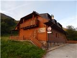 2
2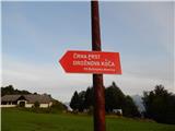 3
3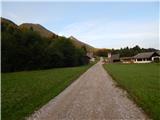 4
4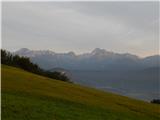 5
5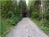 6
6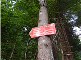 7
7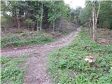 8
8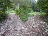 9
9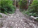 10
10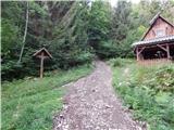 11
11 12
12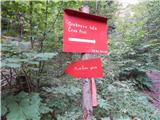 13
13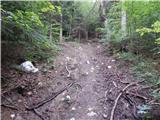 14
14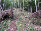 15
15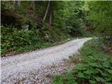 16
16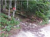 17
17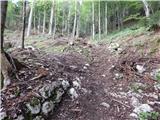 18
18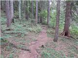 19
19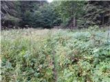 20
20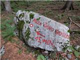 21
21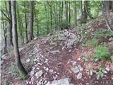 22
22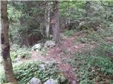 23
23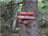 24
24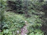 25
25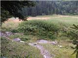 26
26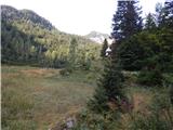 27
27 28
28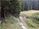 29
29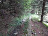 30
30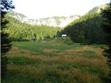 31
31 32
32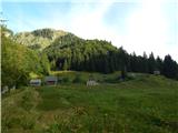 33
33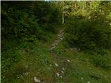 34
34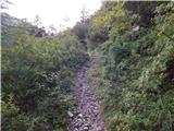 35
35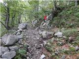 36
36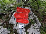 37
37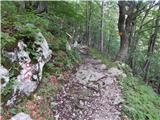 38
38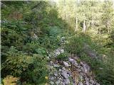 39
39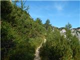 40
40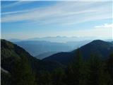 41
41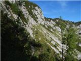 42
42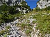 43
43 44
44 45
45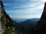 46
46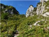 47
47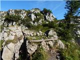 48
48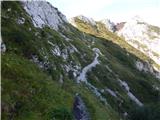 49
49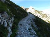 50
50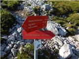 51
51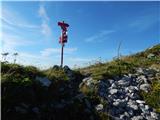 52
52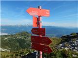 53
53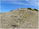 54
54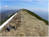 55
55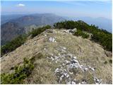 56
56 57
57
Discussion about the trip Ravne - Rušni vrh (via Planina za Črno goro)
To post a comment you must log in:
If you do not yet have a username, you must first
register.