Raxalm-Berggasthof (Rax) - Raxgmoahütte (Rax)
Starting point: Raxalm-Berggasthof (Rax) (1547 m)
| Latitude/Longitude: | 47,71497°N 15,80453°E |
| |
Walking time: 2 h 15 min
Difficulty: easy marked way
Elevation gain: 307 m
Elevation difference along the route: 420 m
Map:
Recommended equipment (summer):
Recommended equipment (winter): ice axe, crampons
Views: 105
 | 1 person like this post |
Access to starting point:
We leave the S6 highway Bruck an der Mur - Vienna / Wien at the exit Gloggnitz Süd, then follow the signs for Raxgebiet through the town. We continue driving through a few more settlements, following the road all the way to the parking lot at the lower station of the Rax-Seilbahn cable car. Then we buy a ticket (the price of a return ticket for adults was 37 euros in June 2025) and ride up to the upper station of the cable car. The current price list is available on the official website of the Rax-Seilbahn cable car operator.
Route description:
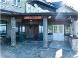
From the upper station of the cableway, we walk past the inn Raxalm-Berggasthof to a macadam road, where we notice signs for the mountain huts Ottohaus, Neue Seehütte and Karl-Ludwig-Haus. The path ahead leads us along the macadam road, or in several sections slightly beside it. We follow this path, which mostly ascends gently to moderately, all the way to the mountain hut Ottohaus, from which a beautiful view opens up.
In front of the hut we turn right towards the mountain hut Neue Seehütte along the Seeweg path (to the left of the hut the path leads over the summit of Preiner Wand) and continue along a poorer mountain road. There follow a few shorter ascents and descents, at first still through sparse forest, later through a belt of dwarf pines. Already near the mountain hut Neue Seehütte, a somewhat longer path coming over the summit of Preiner Wand joins from the left; we continue straight ahead, or slightly right, towards the mountain hut Neue Seehütte.
At the next junction, the path from the valley, or more precisely from the settlement Prein an der Rax, also joins us. Here we turn right, followed by a short descent along a wide path, and we reach the saddle Königsshutssattel, where there is a marked junction.
To the left the path continues towards the mountain hut Neue Seehütte (1 minute) and the pass Preiner Gscheid; we continue straight ahead in the direction of the mountain hut Karl-Ludwig-Haus.
An ascent follows along the mountain path through a belt of dwarf pines, after which the path forks.
We continue along the right branch, which has signs for Trinksteinsattel (both the left and right branches lead to the mountain hut Karl-Ludwig-Haus). Higher up the dwarf pines end and the path then gently turns a little more to the left, where we reach the next junction.
Here we turn left and in a few minutes ascend to the hut Raxgmoahütte.
The starting point - Ottohaus 0:30, Ottohaus - Neue Seehütte 1:10, Neue Seehütte - Raxgmoahütte 0:35.
The description and pictures refer to the condition in June 2025.

Photos:
 1
1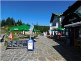 2
2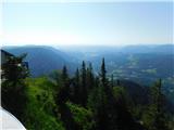 3
3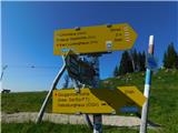 4
4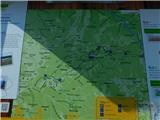 5
5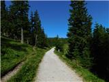 6
6 7
7 8
8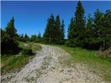 9
9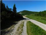 10
10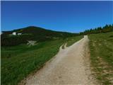 11
11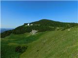 12
12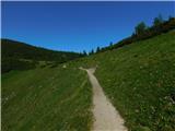 13
13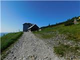 14
14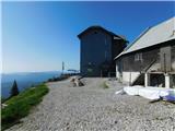 15
15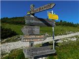 16
16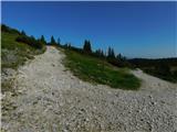 17
17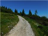 18
18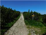 19
19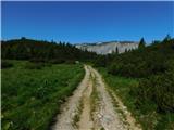 20
20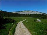 21
21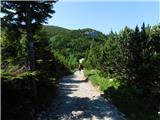 22
22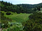 23
23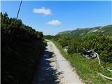 24
24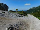 25
25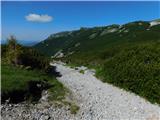 26
26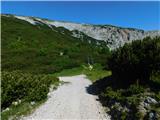 27
27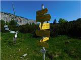 28
28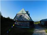 29
29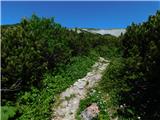 30
30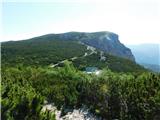 31
31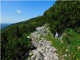 32
32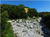 33
33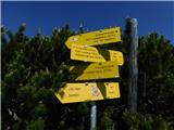 34
34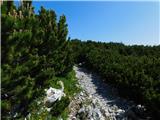 35
35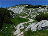 36
36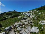 37
37 38
38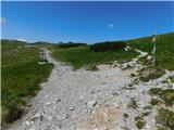 39
39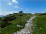 40
40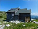 41
41
Discussion about the trip Raxalm-Berggasthof (Rax) - Raxgmoahütte (Rax)
To post a comment you must log in:
If you do not yet have a username, you must first
register.