Razpotje Vragovec - Zabreška planina
Starting point: Razpotje Vragovec (1125 m)
| Latitude/Longitude: | 46,41420°N 14,17130°E |
| |
Walking time: 20 min
Difficulty: easy unmarked way
Elevation gain: 100 m
Elevation difference along the route: 100 m
Map: Karavanke - osrednji del 1:50.000
Recommended equipment (summer):
Recommended equipment (winter):
Views: 3.860
 | 1 person like this post |
Access to starting point:
A) From the Ljubljana - Jesenice highway, take the Lesce exit, then from the roundabout continue towards Žirovnica and Vrba. Continue on the main road towards Jesenice, which first passes Vrba, then also Žirovnica. After the bridge over Završnica, at the first crossroads continue sharply right (the turn-off is not marked) towards Moste. At the next crossroads about 50 m further, go left towards Završnica. Through the Završnica valley, drive to the marked crossroads located some 10 m before Završniško jezero lake, then go left towards Valvasorjev dom pod Stolom mountain hut. Continue on the ascending (mostly) macadam road, following it for about 4 km to the marked crossroads, where you go right towards Zabreška and Doslovška planina (straight to Valvasorjev dom, Potoška planina...). From the crossroads, continue driving on the road ascending transversely to the right; at the Y (ipsilon) crossroads, continue left onto the steeper road, which you follow to a smaller crossroads where logs are usually stacked. Park near the crossroads so as not to obstruct any forestry work.
B) First drive to Bled, from where continue towards Lesce and the highway. From the roundabout near the highway, take the exit towards Vrba and Žirovnica. Continue on the main road towards Jesenice, which first passes Vrba, then also Žirovnica. After the bridge over Završnica, at the first crossroads continue sharply right (the turn-off is not marked) towards Moste. At the next crossroads about 50 m further, go left towards Završnica. Through the Završnica valley, drive to the marked crossroads located some 10 m before Završniško jezero lake, then go left towards Valvasorjev dom pod Stolom mountain hut. Continue on the ascending (mostly) macadam road, following it for about 4 km to the marked crossroads, where you go right towards Zabreška and Doslovška planina (straight to Valvasorjev dom, Potoška planina...). From the crossroads, continue driving on the road ascending transversely to the right; at the Y (ipsilon) crossroads, continue left onto the steeper road, which you follow to a smaller crossroads where logs are usually stacked. Park near the crossroads so as not to obstruct any forestry work.
C) From Jesenice, drive on the old road towards Lesce. At the 4 km road sign, also notice the sign indicating the start of Žirovnica municipality; at the first crossroads after that sign, continue slightly left towards Moste (turn-off from the main road not marked). At the next crossroads about 50 m further, go left towards Završnica. Through the Završnica valley, drive to the marked crossroads located some 10 m before Završniško jezero lake, then go left towards Valvasorjev dom pod Stolom mountain hut. Continue on the ascending (mostly) macadam road, following it for about 4 km to the marked crossroads, where you go right towards Zabreška and Doslovška planina (straight to Valvasorjev dom, Potoška planina...). From the crossroads, continue driving on the road ascending transversely to the right; at the Y (ipsilon) crossroads, continue left onto the steeper road, which you follow to a smaller crossroads where logs are usually stacked. Park near the crossroads so as not to obstruct any forestry work.
Route description:
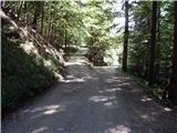
From the starting point, we continue on the left road (right Doslovška planina), which for a few minutes leads us through the forest, then past a clearing on which a wooden cottage stands, quickly bringing us to the turning point by the road closure (barrier).
Behind the fence, we step out of the forest and the path takes us to the expansive Zabreška planina, across which we quickly walk with fine views to the shepherd's hut on the said mountain pasture.
Description and pictures refer to the condition in 2015 (September).
Photos:
 1
1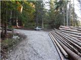 2
2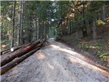 3
3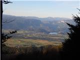 4
4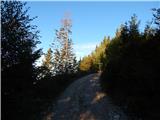 5
5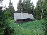 6
6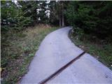 7
7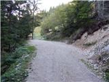 8
8 9
9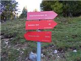 10
10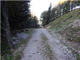 11
11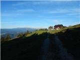 12
12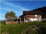 13
13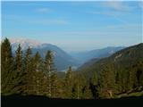 14
14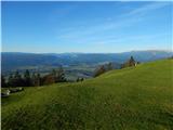 15
15
Discussion about the trip Razpotje Vragovec - Zabreška planina
To post a comment you must log in:
If you do not yet have a username, you must first
register.