Rdeči Kal - Dom Frata (by road)
Starting point: Rdeči Kal (309 m)
| Latitude/Longitude: | 45,86410°N 15,00970°E |
| |
Route name: by road
Walking time: 1 h 45 min
Difficulty: easy marked way
Elevation gain: 36 m
Elevation difference along the route: 185 m
Map: Dolenjska - Gorjanci, Kočevski Rog 1:50.000
Recommended equipment (summer):
Recommended equipment (winter):
Views: 2.030
 | 1 person like this post |
Access to starting point:
A) From the highway Ljubljana - Obrežje, we take the exit Trebnje zahod, then continue driving in the direction of Dobrnič and Žužemberk. In Dobrnič, at the church, we leave the main road which leads towards Žužemberk and continue driving straight towards Artmanja vas. At the end of Artmanja vas we go slightly left (slightly right Korita), then before we get to Vrbovec once again left, this time in the direction of Mirna Peč. The road a little further ahead ascends more steeply, then brings us to the village Rdeči Kal, where by the sign which marks the beginning of the settlement we park on a smaller parking lot by the intersection.
B) First, we drive to Trebnje, then continue driving towards Mirna Peč. After the settlement Dolenje Ponikve, we leave the main road towards Mirna Peč and continue driving right towards Dečja vas and Jordankal. In Jordankal we go right, then we drive all the way to Rdeči Kal, where we already notice signposts for Ostri vrh. From the signpost, we drive approximately 100 meters further, then park on the left side of the road, on a smaller parking lot near the sign which marks the end of the settlement.
C) From the highway Obrežje - Ljubljana, we take the exit Mirna Peč, then continue driving to the mentioned place. In Mirna Peč we reach the main road Novo mesto - Trebnje, we merely cross it and continue driving in the direction of Dobrnič. After Mirna Peč the road temporarily ascends more steeply, then brings us to a smaller intersection, where to the left branches off the road towards the settlements on Globodolsko polje, we continue straight and soon arrive at Jordankal, where we go straight. Towards Dobrnič we drive to the village Rdeči Kal, where we already notice signposts for Ostri vrh. From the signpost, we drive approximately 100 meters further, then park on the left side of the road, on a smaller parking lot near the sign which marks the end of the settlement.
D) From Novo mesto we drive to Mirna Peč, where at the intersection near the church we continue left in the direction of Dobrnič. After Mirna Peč the road temporarily ascends more steeply, then brings us to a smaller intersection, where to the left branches off the road towards the settlements on Globodolsko polje, we continue straight and soon arrive at Jordankal, where we go straight. Towards Dobrnič we drive to the village Rdeči Kal, where we already notice signposts for Ostri vrh. From the signpost, we drive approximately 100 meters further, then park on the left side of the road, on a smaller parking lot near the sign which marks the end of the settlement.
Route description:
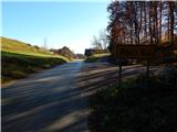
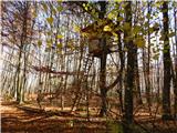
From the starting point, we head onto the macadam road in the direction of Ostri vrh and Dom LD Dobrnič. The road first leads through a strip of forest, after which we arrive at the edge of the nearby meadow. On the other side of the meadow, the road enters the forest, where it first passes a smaller cave named Jama ob cesti (unfortunately, litter is dumped into this 20 m deep and 20 m long cave), then ascends gently to moderately. Higher up, we reach a marked junction, where we continue left in the direction of Dom LD Dobrnič. After the junction, the road gradually ascends somewhat more steeply, and when a fence appears left above the road, the road gets an asphalt surface. A few minutes higher, a marked path from Dom Frata joins from the right, and we continue straight, arriving at Dom LD Dobrnič in one minute of further walking.
From the cottage, we return about a minute to the marked junction, then continue along the marked path in the direction of Frata. The path ahead leads past a hunting observatory, then enters a strip of extremely dense shrubbery, through which the path is nicely passable as it follows a clearing about a meter wide. The path soon returns to the forest and continues with a few shorter ascents and descents. There follow a few junctions where we follow the blazes, then the path begins to descend more noticeably. During the descent, some views towards Gorjanci open up temporarily, then the path gradually turns somewhat more to the right, where we reach a larger clearing. After the clearing, we step onto a macadam road, which we follow to the right, but walk on it only briefly as the signs for Frata direct us left onto a path that quickly descends to another road. This time we follow the road to the left, and in a few minutes of further walking we arrive at Dom Frata, which is located at the edge of a larger meadow.
Description and pictures refer to the condition in 2015 (November).

Photos:
 1
1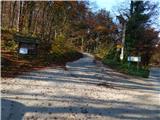 2
2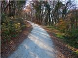 3
3 4
4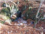 5
5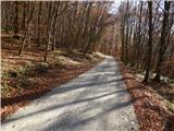 6
6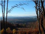 7
7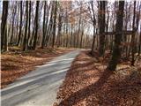 8
8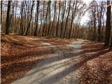 9
9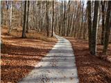 10
10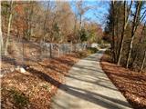 11
11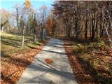 12
12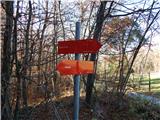 13
13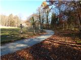 14
14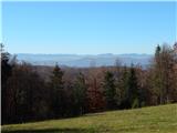 15
15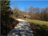 16
16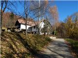 17
17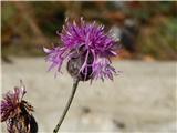 18
18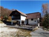 19
19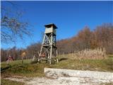 20
20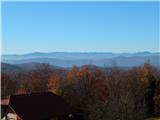 21
2122
 23
23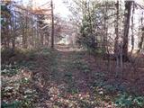 24
24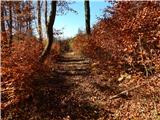 25
25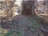 26
26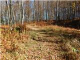 27
27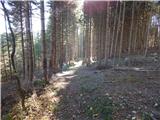 28
28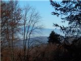 29
29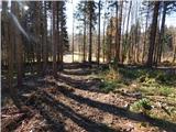 30
30 31
31 32
32 33
33 34
34 35
35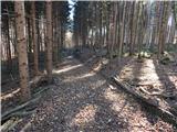 36
36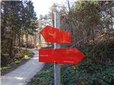 37
37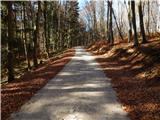 38
38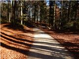 39
39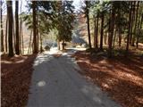 40
40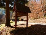 41
41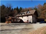 42
42
Discussion about the trip Rdeči Kal - Dom Frata (by road)
|
| smatjaz28. 01. 2018 |
the stamp is located in a wooden box on the embankment of the hut
|
|
|
To post a comment you must log in:
If you do not yet have a username, you must first
register.