Rebrca / Rechberg - Rokov vrh / Rochusberg
Starting point: Rebrca / Rechberg (602 m)
| Latitude/Longitude: | 46,52700°N 14,57720°E |
| |
Walking time: 40 min
Difficulty: easy marked way
Elevation gain: 278 m
Elevation difference along the route: 280 m
Map: Karavanke - osrednji del 1:50.000
Recommended equipment (summer):
Recommended equipment (winter): ice axe, crampons
Views: 536
 | 1 person like this post |
Access to starting point:
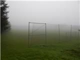
A) Via the Ljubelj border crossing we drive into Austria, then in the settlement Podljubelj / Unterloibl we turn right towards the Hofer store. When we arrive in Borovlje / Ferlach, at the intersection slightly beyond the railway track we turn left (to the right of the intersection there is the Eurospar store), at the next intersection after a few hundred meters we turn right towards Železna Kapla / Bad Eisenkappel. Towards Železna Kapla we drive to the settlement Jeriše / Jerischach, after the settlement at the intersection we turn right towards the settlement Podkraj / Unterort (left Goriče / Goritschach). At the smaller intersection in the middle of Podkraj we continue left, then we begin to ascend to a smaller saddle, beside which there is an intersection and a chapel. Here we continue straight, a little further on we arrive at the settlement Rebrca / Rechberg, where we park on the parking lot by the grassy football field.
B) Via the Jezerski vrh border crossing we drive into Austria, then past Železna Kapla we continue slightly left onto the road towards the village Rebrca / Rechberg. Along the road we then quickly ascend to the mentioned village, at the intersection in the middle of the village we continue left. We park on the parking lot by the football field.
C) We drive to Podjuna, then we follow the signs for Železna Kapla / Bad Eisenkappel. After the settlement Miklavčevo / Miklauzhof, we leave the road towards Železna Kapla and continue right towards Celovec / Klagenfurt and Borovlje / Ferlach. We then drive along the main road towards Borovlje, but we do not drive on it for long, as the signs for Podkraj / Unterort direct us left onto a somewhat narrower road. At the smaller intersection in the middle of Podkraj we continue left, then we begin to ascend to a smaller saddle, beside which there is an intersection and a chapel. Here we continue straight, a little further on we arrive at the settlement Rebrca / Rechberg, where we park on the parking lot by the grassy football field.
Route description:
At the starting point signs for Rokov vrh / Rochusberg direct us onto a side road, along which we quickly ascend to the church and cemetery in Rebrca. We bypass both on the left side, then behind the shed we continue on the footpath, which mostly continues through the forest. After a few minutes of mostly moderate ascent, the path splits, and we choose the upper right path (straight Setzhube). There follow a few minutes of steep ascent, the path flattens when we reach the cart track, along which without major changes in elevation we continue to the junction.
From the junction we go right, initially slightly downhill, then we walk on the cart track, which crosses the slopes towards the right. When the cart track ends we continue on the again steeper mountain path, to which a little below the summit the path past the homestead Bukovnik also joins.
Here we go right and in a few steps we reach the panoramic Rokov vrh.
Description and pictures refer to the condition in the year 2017 (September).

Photos:
 1
1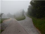 2
2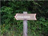 3
3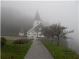 4
4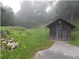 5
5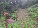 6
6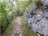 7
7 8
8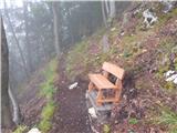 9
9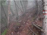 10
10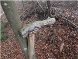 11
11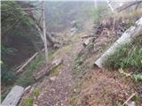 12
12 13
13 14
14 15
15 16
16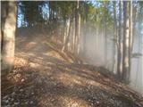 17
17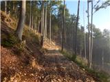 18
18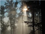 19
19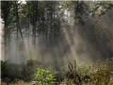 20
20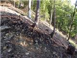 21
21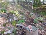 22
22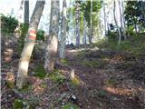 23
23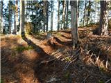 24
24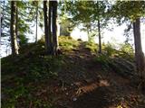 25
25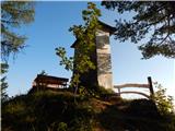 26
26 27
27
Discussion about the trip Rebrca / Rechberg - Rokov vrh / Rochusberg
To post a comment you must log in:
If you do not yet have a username, you must first
register.