Reißkofelbad - Kleiner Reißkofel
Starting point: Reißkofelbad (988 m)
| Latitude/Longitude: | 46,66590°N 13,13950°E |
| |
Walking time: 3 h 30 min
Difficulty: difficult marked way
Elevation gain: 1173 m
Elevation difference along the route: 1190 m
Map:
Recommended equipment (summer): helmet, self belay set
Recommended equipment (winter): helmet, self belay set, ice axe, crampons
Views: 2.599
 | 1 person like this post |
Access to starting point:
From Beljak/Villach we drive towards Hermagor and further towards Lienz, but only to the village Reisach. In the mentioned village, we turn right and follow the ascending road to the pension Reißkofelbad near which we park.
Route description:
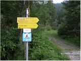
From the mountain hut, we continue on a macadam road following the signs »Reißkofel ü. Hochfleck«. At the right turn, where the road crosses a stream, signposts point us to the left into the forest. The path then runs through the forest for quite some time and occasionally ascends quite steeply. The path then crosses a cart track and through a meadow brings us back into the forest. After a short ascent, we come out of the forest again onto a somewhat overgrown cart track along which we then walk all the way to the hut Gregorihütte.
From the hut, we continue left on the mountain road following the signs »Reißkofel«. On the road we ascend for some time, then signposts direct us left into the forest. The path through the forest occasionally ascends quite steeply and then brings us to grassy slopes. The path then turns slightly to the right and brings us to a junction. We head right, while left leads the direct and somewhat more demanding path to Reißkofel. The path then crosses steep slopes below the crags of Reißkofel and at some points steel cables assist us. The slope gradually becomes less steep and the path brings us to the saddle below the summit of Kleiner Reißkofel.
On the saddle, we head right and to the summit we have only a short ascent, which is quite demanding, as we ascend with the aid of a steel cable almost vertically.

Photos:
 1
1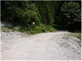 2
2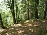 3
3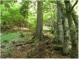 4
4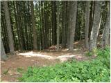 5
5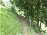 6
6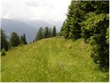 7
7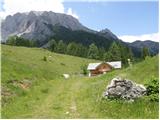 8
8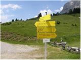 9
9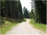 10
10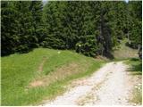 11
11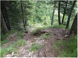 12
12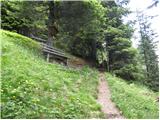 13
13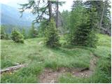 14
14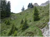 15
15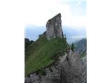 16
16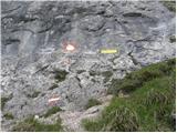 17
17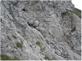 18
18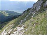 19
19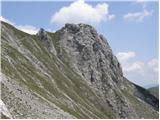 20
20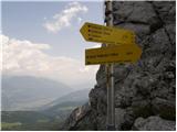 21
21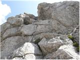 22
22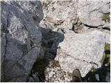 23
23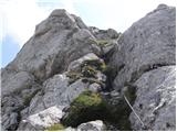 24
24 25
25
Discussion about the trip Reißkofelbad - Kleiner Reißkofel
To post a comment you must log in:
If you do not yet have a username, you must first
register.