Reißkofelbad - Reißkofel (via east ridge)
Starting point: Reißkofelbad (988 m)
| Latitude/Longitude: | 46,66590°N 13,13950°E |
| |
Route name: via east ridge
Walking time: 4 h 45 min
Difficulty: difficult marked way
Elevation gain: 1383 m
Elevation difference along the route: 1400 m
Map:
Recommended equipment (summer): helmet
Recommended equipment (winter): helmet, ice axe, crampons
Views: 7.674
 | 1 person like this post |
Access to starting point:
From Beljak/Villach we drive towards Hermagor and further towards Lienz, but only to the village Reisach. In the mentioned village, we turn right and follow the ascending road to the pension Reißkofelbad near which we park.
Route description:
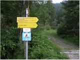
From the hut, we continue on the macadam road following the signs »Reißkofel ü. Hochfleck«. In the right bend, where the road crosses a stream, signposts direct us left into the forest. The path then runs through the forest for quite some time and occasionally ascends quite steeply. The path then crosses a cart track and brings us through a meadow back into the forest. After a short ascent, we come out of the forest again onto a somewhat overgrown cart track along which we then walk all the way to the Gregorihütte hut.
From the hut, we continue left on the mountain road following the signs »Reißkofel«. We ascend along the road for some time, then signposts direct us left into the forest. The path through the forest occasionally ascends quite steeply and brings us to grassy slopes. The path then turns slightly to the right and brings us to a junction. We go right, left leads the direct and somewhat more demanding path to Reißkofel. The path then crosses steep slopes below the walls of Reißkofel and steel cables assist us at several points. The slope gradually becomes less steep and the path brings us to the saddle below the summit Kleiner Reißkofel.
On the saddle, we go left following the signs Reißkofel, right leads the path to Kleiner Reißkofel to which it is only a few minutes' walk. From the saddle, we then begin to ascend more steeply and the path also becomes somewhat more demanding. When we reach the ridge, we go left towards the summit Reißkofel. The path along the ridge is technically not demanding, but the ridge is quite exposed and therefore some caution is required. A little below the summit, a very demanding path from the bivouac joins us from the right. From here only a short ascent to the panoramic summit follows.

Photos:
 1
1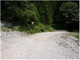 2
2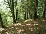 3
3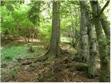 4
4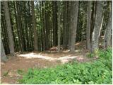 5
5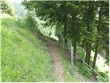 6
6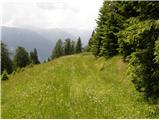 7
7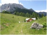 8
8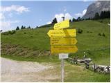 9
9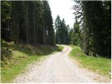 10
10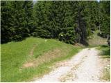 11
11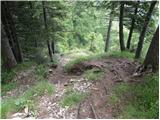 12
12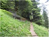 13
13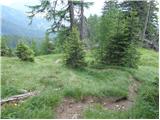 14
14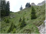 15
15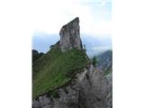 16
16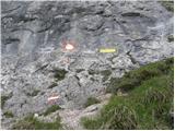 17
17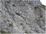 18
18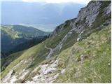 19
19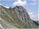 20
20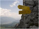 21
21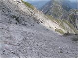 22
22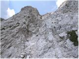 23
23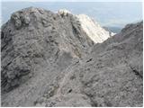 24
24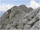 25
25 26
26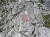 27
27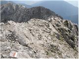 28
28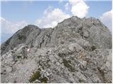 29
29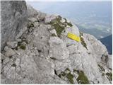 30
30 31
31
Discussion about the trip Reißkofelbad - Reißkofel (via east ridge)
|
| namor24. 03. 2013 |
From Reißkofelbad onwards there's a road, how far ahead can you go by car? Lp
|
|
|
|
| janca8. 03. 2013 |
We were on Reißkofel in July 2011, at that time we drove to the parking lot right near Gregorihütte. We were with a van and a few cars. If I remember correctly, there is only one short section in between that could be problematic and probably needs to be repaired several times (water). It was fine then.
Otherwise, according to colleagues who climbed the direct route, this one is definitely easier than the right "less demanding" route.
LP Janca
|
|
|
To post a comment you must log in:
If you do not yet have a username, you must first
register.