Starting point: Reka (253 m)
| Latitude/Longitude: | 46,11750°N 13,92140°E |
| |
Walking time: 3 h 55 min
Difficulty: easy marked way
Elevation gain: 1050 m
Elevation difference along the route: 1175 m
Map: Škofjeloško in Cerkljansko hribovje 1:50.000
Recommended equipment (summer):
Recommended equipment (winter): ice axe, crampons
Views: 5.483
 | 1 person like this post |
Access to starting point:
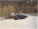
A) First, we drive to Idrija, then we continue driving towards Tolmin. After some time, the road brings us to a junction, where the road to Cerkno branches off to the right, but we still continue straight ahead here, paying attention because we will soon arrive at the settlement Reka. Immediately after the end of the settlement, we first notice signs for Kojca and a few 10 meters further also for Šebrelje. Here a narrower road branches off to the left, which brings us over a bridge across the river Idrijca to a smaller parking lot by the information boards for the Archaeological Park Divje babe.
B) From Most na Soči or Podbrdo we drive to the settlement Bača pri Modreju, then we continue driving towards Idrija. Just a few 10 meters before the settlement Reka starts, we turn right over a bridge across the river Idrijca and then park on a smaller parking lot by the information boards.
Route description:
From the parking lot, we return over the bridge, carefully cross the main road, then continue right along the main road towards Idrija. After a good 50 meters of walking along the main road, we notice signs for Kojca, which direct us slightly left onto a narrow asphalt road, along which we quickly arrive in the center of the village Reka. Here we continue straight or slightly right and walk among the houses. The dense part of the village quickly ends, and we follow the road from which a nice view opens towards the church of St. Ivan (hill above Divje babe) to a somewhat larger intersection, where we head slightly left in the direction of Kojca and Orehovška grapa. The road then begins to ascend on the left side of Orehovška grapa (viewed in the direction of ascent), and we walk along it for about 10 minutes, then arrive at a smaller intersection, where we continue sharply left in the direction of Kojca, summit Rodne and farm Močnik. Initially still asphalt road soon turns sharply to the right, then ascends transversely towards the right. Higher the asphalt ends, and the partly panoramic road quickly brings us to the already mentioned farm.
Here among the houses we turn sharply left onto a cart track, which we leave at the first right bend because the blazes direct us slightly right onto a somewhat less trodden footpath. Further we ascend across a grassy slope, and when the path enters a narrow strip of bushes, it again becomes better visible and easier to follow. Higher the path turns slightly left and joins a wide cart track. When we step onto the cart track we continue left and ascend out of the forest along it. A relatively gentle path, continuing on a panoramic cart track surrounded by meadows, gradually passes to the other side of the hill. Along the cart track, which occasionally descends, we continue to a larger hayloft, where the blazes direct us from the cart track into a nice grassy hollow. Further we ascend along the mentioned hollow, where there is no particularly visible path, then when we return to the forest we notice a blaze which directs us slightly right. Further we steeply ascend through a narrow strip of forest, then beside the stand of spring ferns we ascend to the panoramic summit Rodne.
From the summit we continue slightly right and begin descending towards the east. The path further first leads along a partly vegetated ridge, then gradually turns increasingly to the left. Lower the slope flattens, and the path gradually enters the forest. Further we briefly cross slopes on the right eastern side of the nearby ridge, then at a small saddle passes to the left western side. On the western side we continue for some time, then a wide path passes onto a partly exposed ridge. Here we continue straight and on a wide and partly fenced path "walk" to the other side of the ridge, where the path changes into a wide cart track, which after a short ascent brings us to an asphalt road. Along the road past the LD Otavnik hut we ascend to the nearby intersection, where we continue left in the direction of Kojca. The path further past the NOB monument brings us to a few houses in the village Orehek, and here we continue straight and walk to the end of the settlement.
When just a few meters ahead we arrive at the nearby chapel, we continue right onto a macadam road, along which we begin to ascend more steeply. We walk along the road for a good 10 minutes, then at the house turn right onto a marked footpath. The path further first ascends through a strip of forest, then brings us to one of numerous haylofts, where it turns sharply right. We continue the ascent on the cart track, which soon brings us to expansive hay meadows. Here signs direct us left onto a somewhat less visible footpath ascending along the edge of a smaller "avenue". At the top of the hay meadow the path turns left and then ascends transversely across occasionally steep, partly also grassy slopes. Higher the path enters the forest and begins to ascend even more steeply. A quite steep path further leads along the edge of a nearby gully, which higher it crosses, then turns right and completely flattens. Follows a relatively prolonged crossing of slopes towards the right. The crossing runs across occasionally steep grassy slopes, partly through forest. Due to the well-maintained path, the crossing does not cause major problems for us, only on one short section through the forest, due to the quite steep slope and partly destroyed path, greater caution is needed. When the approximately half-hour crossing ends, we join a better trodden path.
Here we continue left (right Zakojca, Orehek, Jesenica and pass Vrh Ravni) and continue the ascent on a relatively steep path, which first leads past a bench, then passes into a strip of sparse forest. Higher the path flattens and brings us to gentle summit grassy slopes of Kojca. Here we continue on a gentle and panoramic path, along which in less than 5 minutes of further walking we arrive at the summit, which we recognize by the famous haystack.

Photos:
 1
1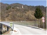 2
2 3
3 4
4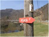 5
5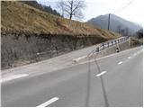 6
6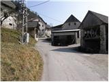 7
7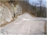 8
8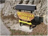 9
9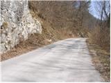 10
10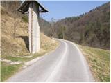 11
11 12
12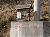 13
13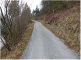 14
14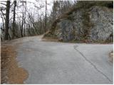 15
15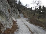 16
16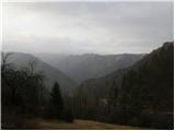 17
17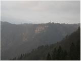 18
18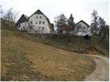 19
19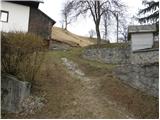 20
20 21
21 22
22 23
23 24
24 25
25 26
26 27
27 28
28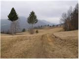 29
29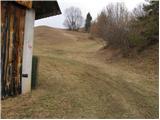 30
30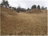 31
31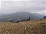 32
32 33
33 34
34 35
35 36
36 37
37 38
38 39
39 40
40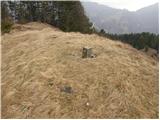 41
41 42
42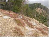 43
43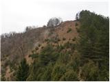 44
44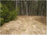 45
45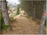 46
46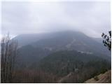 47
47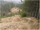 48
48 49
49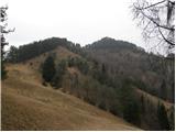 50
50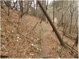 51
51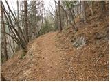 52
52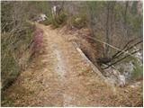 53
53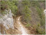 54
54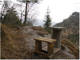 55
55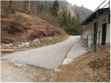 56
56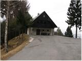 57
57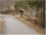 58
58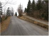 59
59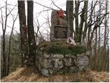 60
60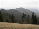 61
61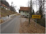 62
62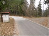 63
63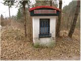 64
64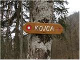 65
65 66
66 67
67 68
68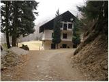 69
69 70
70 71
71 72
72 73
73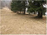 74
74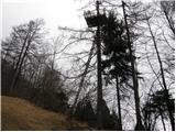 75
75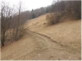 76
76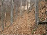 77
77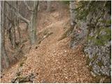 78
78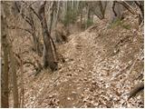 79
79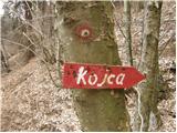 80
80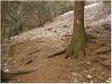 81
81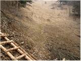 82
82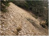 83
83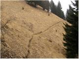 84
84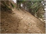 85
85 86
86 87
87 88
88 89
89 90
90 91
91 92
92 93
93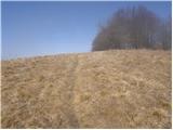 94
94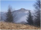 95
95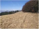 96
96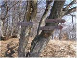 97
97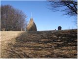 98
98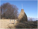 99
99 100
100
Discussion about the trip Reka - Kojca
|
| lavricr5. 05. 2012 |
The car can also be parked at the parking lot in front of the bridge over Jesenica stream.
Then we continue on foot across the bridge and immediately right along the road. We join the markings at the bend where the road from the village Reka joins. Here we see the Orehovska grapa sign (ninth picture) and continue right as described.
|
|
|
To post a comment you must log in:
If you do not yet have a username, you must first
register.